Robert
Bike
Licensed
Massage Therapy #5473
Eugene, Oregon
EFT-CC, EFT-ADV
Teaching Reiki Master
Life Coach
541-465-9486
![]()
Gift Certificates
|
Reiki
Private classes. |
|
Member
OMTA & ABMP President of the Oregon Massage Therapists Association 2008-2010 & 2012-2013 |
|
I
graduated from Freeport (Illinois) High School. |
|
Please
help keep
this site free. Buy one of my books, on sale below. All sales go to help support this website. |
|
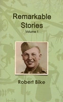
Remarkable
Stories,
Remarkable
events have happened in Freeport and Stephenson County, Illinois,
and remarkable people have lived there. These are stories gathered
about people and events from 1835 through World War II. |
|
Biblical
Aromatherapy
by Robert Bike 
The Bible mentions about 232 plants by name, or closely enough to figure out what plant is meant. Of these, 24 are aromatic plants; that is, parts of the plants can be pressed or distilled to get an essential oil. Essential oils are the lifeblood of plants and have tremendous healing capabilities. The
healing power of plants is the basis for modern medicines. Originally published in manuscript form in 1999, I completely revised the book and added illustrations. To order
Biblical Aromatherapy in paperback, List price $24.99; introductory offer $19.99 To order the pdf version and download to your computer or phone, The electronic version is only $2.99! |

Publicity!
|
Olga
Carlile, columnist for the Freeport (Illinois) Journal Standard,
featured this website in her column on January 19, 2007. |
|
Harriet
Gustason, another columnist for the Freeport Journal Standard,
has featured this website twice. Click to see pdf of articles:
June 29, 2012 November 3, 2012 |
|
"My
Life Purpose is to inspire my friends |
Robert Bike, LMT, LLC
All text and photos Copyright 2002 - present Robert L. Bike, except for photos and text from uncopyrighted material in the public domain.
In 1910 Addison Luther Fulwider published the History of Stephenson County. Much of it was a re-hashing of the Tilden 1880 History of Stephenson County. Both the Tilden and the Fulwider histories were published before copyright laws. Below is a rendering of the Fulwider book, scanned, with OCR errors, spelling errors, etc. Occasionally you will see question marks. Fulwider never proof-read his book, and places where he probably meant to go back and finish were never finished, and the question marks were left.
I am cleaning the scan up as much as possible, but errors remain. This is a work in progress. I will add to it as I can, and correct errors as I can. Fulwider wrote interminably long paragraphs, which I've broken up into many smaller paragraphs for easier reading.
Beware as you read that this is a highly racist time. Native Americans were never give their just due for how they treated the land they owned. And the language used in the Lincoln-Douglas Debates was highly racially charged.
Below is Part One - Early History.
For easier navigation, I've added a few section headings. Enjoy!
Early
History
Sucker State
Physical & Geography
The Black Hawk War
The First Settlements 1833-1837
Stephenson County 1837-1850
Newspapers
The 1850s
The Railroads
Part One - Early History
Part Two - The Migration to Stephenson County
Part Three - Townships & Towns
HISTORY OF STEPHENSON COUNTY ILLINOIS
A
RECORD OF ITS SETTLEMENT, ORGANIZATION
AND THREE-QUARTERS OF A CENTURY OF PROGRESS
By ADDISON L. FULWIDER, A. M.
"History is the accumulated experience of the race." JUDSON
VOLUME I
ILLUSTRATED
CHICAGO
THE
S. J. CLARKE PUBLISHING COMPANY
1910
HISTORY
OF STEPHENSON COUNTY ILLINOIS
UNDER FOUR FLAGS
The first people to roam over Stephenson County and
Illinois were the Mound Builders. In various parts of Illinois there are
evidences that these early people lived here in great numbers. In Winnebago
County and in Whiteside County, are yet to be found interesting mounds,
the homes and burial places of this ancient people who undoubtedly at
an early day occupied part of this County. They have gone and have left
little or nothing of value to the march of civilization.
Then came the Indian. Two hundred and fifty years ago, this state, that i now has a population of over six million people in the height of civilization, | was overrun by only a few thousand red men. They were Algonquins and Dakotas, broken up into several subordinate bands, living for the most part on wild game. The squaws engaged in a rude and primitive agriculture. The largest and best known Indian tribe was the "Illinois," a division of the Algonquin, who settled along the Illinois River, occupying the state from Joliet to Kaskaskia. To the north, and in Stephenson county, were the Winnebagoes, a branch of the Dakotas.
The state was so large and the Indian population small, that it cannot be said that to any great extent they made use of the land at all. Friendly, at first, to the French Traders and Missionaries, the Indians opposed the advance of the white settlements. The most bitter opposition came from a band of Sacs and Foxes under Black Hawk. With the defeat and almost extermination of this band in 1832, fourteen years after Illinois became a state and within the memory of men yet living here, came the Indian occupation and resistance.
The Indian had gone west from Stephenson County to await the doom of extinction that hangs over his head. He left this great, rich and beautiful state, no better than he found it. He added nothing to the storehouse of civilization. Nothing did he add to the stock of our institutions. Aside from an interesting tradition and stories of a wild romantic life, it may be safely said that the only lasting contribution of the Indian to the civilization of today, is to be found in the brave, independent and sturdy character of the pioneers, made stronger and more self-reliant by the dangers of Indian warfare in the big, frank, progressive spirit of the valley of the Mississippi, where there is growing up the genuine, distinctive American spirit.
The first flag of a civilized people to wave over the prairies of Illinois, was the flag of France. The French explorations from the mouth of the St. Lawrence, up that river, over the Great Lakes, over the portages, down the Illinois, and on the waters of the Mississippi, have no rival in the history of the world. From the discovery of the St. Lawrence in 1534 and the settlement of Champlain, in 1608, French love of romantic daring, determined patriotism and religious zeal never flagged till the whole of the Mississippi valley was made known to the civilized world.
The work of exploration was carried on to Lake Michigan. It was then taken up by these wonderful men: Marquette, Joliet, Hennepin, Allonez, Tonti and La Salle. In birch bark canoes, they went up and down the Wisconsin, Illinois, the Rock River and the Mississippi, trading with the Indians, preaching Christianity to them, establishing trading posts and planting here the flag of France. La Salle built Fort Crevecoeur near Peoria, in 1680, and in 1683, Fort St. Louis, between Ottawa and La Salle. French settlements were established at Cahokia and at Kaskaskia. French settlers came from France and from New Orleans.
In 1720, Fort Chartres
was built on the Mississippi between Kaskaskia and Cahokia. In 1750 there
were eleven hundred French in Illinois about Kaskaskia and three hundred
negroes and sixty red slaves. The negro slaves were brought into Illinois
as a result of edicts by Louis XIII and Louis XIV. The officers in Illinois
then were a commandant and a civil judge. There was no representative
government.
The European wars between France and England spread to America. England won America at the battle of Quebec, in 1759, and Illinois and Stephenson County passed from France to England by the Treaty of Paris, 1763. The dream of a great French empire was gone forever and the French flag gave away the banner of Great Britain.
Illinois was under the actual rule of England from 1763 till the conquest by Colonel Geo. Rogers Clarke in 1778-1779. The Revolutionary War came in 1776 and the Americans were aroused against the English Forts in Illinois, because they felt that the English were stirring up the Indians against the frontier settlements. Geo. Rogers Clarke, a Virginian, who knew the value of the west, secured a commission from Geo. Patrick Henry and in 1778 with about one hundred and fifty men equipped largely by his own means, marched to Pittsburg, dropped down the Ohio in flat boats, plunged through the wilds of Southern Illinois, and captured Kaskaskia and Cahokia.
In 1779, he made a desperate march across Southern Illinois and captured Vincennes. Thus the British flag went down forever in Illinois and the rule of Virginia, the "Old Dominion," began with the organization of the "County of Illinois," in 1779. The Treaty of 1763 ceded the Northwest to the thirteen United Colonies and, Virginia, after an occupation of five years ceded Illinois and the Northwest to the United States in 1784. Then over old Fort Chartres, and over Illinois, waved the Star Spangled Banner, the flag of the United States. The flags of France, of England and of Virginia had passed upon Illinois and the future of this great state was henceforth to be identified with the history of America.
The Ordinance of 1787, passed by the Old Continental Congress, organized the Northwest Territory and prohibited slavery. Illinois was organized as a separate territory in 1809, including Wisconsin and a large part of Michigan. There were, in 1810, 12,282 white people in Illinois and about 600 negro slaves and indentured servants. The governor was Ninian Edwards of Kentucky. In 1812, the people were granted a representative assembly. Like the spirit of the west, the government was liberal, giving the right to vote to all male taxpayers, and providing for the direct election of both branches of the Territorial Legislature. The first meeting of the Representative Legislature was held at Kaskaskia, Nov. 25, 1812.
In 1818, Illinois, through her delegate to Congress, Wm. Nathaniel Pope, asked admission into the Union as a state. The old Northern Boundary Line, suggested by the Ordinance of 1787, would have cut off the three northern tiers of counties and left Illinois without a foot hold on Lake Michigan. Pope was alive to the interests of his state and to the welfare of the nation. Seeing the value of Lake Michigan to the state, he secured the adoption of an amendment that fixed the boundary line at 42 30', giving the state its present frontage on the lake. This change, binding the state to the northern and middle states, Pope said, "Would afford added security to the perpetuity of the Union." Another amendment by Pope, provided that a part of the proceeds of the public lands should be given to the support of public schools.
The first state constitution was made at Kaskaskia in 1818, and Shadrach Band was elected the first governor of the state of Illinois, Dec. 3, 1818. Congress formally voted the state into the Union and Dec. 4, Illinois was represented in both houses of Congress. Thomas and Edwards were our first senators.
Several determined attempts had been made by both Indiana and Illinois to have Congress repeal that part of the ordinance that prohibited slavery in Illinois, but all had failed. However, the Anti-slavery Clause of the ordinance was flagrantly circumvented.
Most of the population was in the southern third of the state and had come from Kentucky, Virginia and North Carolina. They brought slaves with them and in 1820 there were about 1400 negroes in the state, 917 of which were counted as slaves. The total population of the state was fifty-five thousand.
From 1822 to 1824, there was fought out one of the most bitter and hotly contested campaigns known in Illinois politics. The proslavery people who were largely a majority of the population, were fighting for a new Constitutional Convention. The Anti-slavery people, led by Edward Coles, believed that the real object was to change the constitution so as to legalize slavery. The proslavery party made the mistake of putting two candidates in the field and Coles was elected governor. The legislature was pro-slavery by about two-thirds majority.
A resolution to submit the proposition of a new constitutional convention to the people was passed. After a vigorous campaign the resolution was defeated at the polls and thus was ended the attempts to make Illinois legally, a slave state.
The defeat of Tecumseh at the battle of Tippecanoe and the close of the war of 1812, opened the way to the settlement of northern Illinois. New counties were organized to the north. Peoria, Ottawa, Dixon and Chicago were established and lead mining at Galena attracted settlers to the northwest corner of the state. Kellog's Trail was blazed through Stephenson County to Galena and Black Hawk's War was fought to a successful issue before there was a single permanent settler in Stephenson County.
The second state constitutional convention in Illinois was convened June 7, 1847. It was in session eighty-four days. The new constitution was adopted by the people in March, 1848, and went into effect April 1, 1848. One important measure was the provision for a two mill tax to be kept separate to pay the state debt. The state's finances were in a bad way because of the wild-cat, internal improvements of 1837.
The new constitution
fixed the salary of the governor at $1,500 a year. The secretary of state,
state auditor and state treasurer at $800; the supreme court judges at
$1,200 and the circuit judges at $1,000. From 1818 to 1848, the governor's
salary was $1,000 and the other state officials labored for $600. The
constitution of 1848 placed the salary of members of the State Legislature
at $2 per day for 42 days and $1 per day thereafter, with 10 cents mileage
both
ways.
|
All sales go to help support this website.
Remarkable
Stories, Volume 1 Remarkable
events have happened in Freeport and Stephenson County, Illinois,
and remarkable people have lived there. These are stories gathered
about people and events from 1835 through World War II. |
SUCKER
STATE
In an address of July 4, 1876, Gen. Smith D. Atkins gave two explanations
of the sobriquet, sucker, as applied to the people of Illinois, as follows
"Many settlers in Illinois came from Virginia, Kentucky and Tennessee.
They were mostly poor people, unable to own slaves and many of them were
in sentiment opposed to slavery, and were seeking a new, country where
slavery did not exist.
Southern Illinois was principally settled by these people, who with their families penetrated the wilderness, with all their household goods on pack animals and themselves upon foot, depending on their trusty rifles and fishing rods for sustenance on the way. They were emigrants from the poorer classes of the slave states, and being unable to own slaves came to Illinois to get away from slave domination of their wealthy neighbors. The tobacco plant has many sprouts from the root and main stem which, if not stripped off, suck up the nourishment and destroy the staple. These sprouts are called suckers, and are as carefully stripped from the main plant and thrown away as the tobacco worm itself. These poor emigrants from the slave states were jeeringly and derisively called "suckers," because they were asserted to be a burden on the people of wealth; and when removed to Illinois, they were supposed to have stripped themselves from the parent stem, and gave way to perish in the wilderness like the suckers stripped from the tobacco plant.
But we wear the title proudly now, for, the stone rejected by the builders has become the chief stone of the corner, and in intelligence, morals, material prosperity and population, Illinois has far outstripped her poor old mother, Virginia, and surpassed Kentucky and Tennessee. The cognomen was misapplied. Slavery was the "sucker" from which they fled and the "subtle corps of sappers and miners," that "sucked" the life blood out of the states from which the early settlers of Illinois emigrated.
But there is another generally accepted sobriquet of "suckers," the nickname of Illinoisans. Lead was early discovered in the vicinity of Galena, and in 1824 Col. James Johnson, of Kentucky, had gone there with a party of miners and opened a lead mine about a mile above the present city of Galena. Others followed in great numbers. The southern Illinoisans ran up the Mississippi in the spring season, worked the lead mines during the warm weather, and ran down the river again to their homes in the fall, thus establishing a similitude between their migratory habits and the fishy tribe known as "suckers," that run up a stream in the spring and down the stream in the fall.
No matter how it came about, the term "sucker" will stick to the people of Illinois, while wood grows and water runs.
PHYSIOGRAPHY OF STEPHENSON COUNTY
In his book, "The Government of Illinois," Prof. E. B. Green, of the University of Illinois, says, "The first great fact in the experience of any people is the land on which they live." Certainly what people do is determined largely by the streams, the soil, the latitude and the location of the section in which they live. These conditions, in a large part, determine whether a people's life shall be devoted wholly to agriculture, wholly to manufacturing, or that it shall be a life of diversified industries.
It is no less true, that people's interests govern mainly their ideas and their ideals, and these determine their politics, their social, moral and religious principles. It is evident that long before a section of the country is occupied by the first civilized men much of that section's history has been written; written in the soil; in the streams; in the hills and valleys; in the forests and in the prairies; in its climatic conditions, and in its relation to present or future natural trade centers and transportation lines.
In its location Stephenson County is a part of northern Illinois. The great prairie state extends from latitude 37 to a latitude 42' 30”, more than 380 miles.
Illinois extends farther south than Richmond, Virginia, and farther north than Boston, Massachusetts. The state has an area of more than 56,000 square miles. The Wabash, the Ohio and the Mississippi Rivers bind the state, geographically, to the south. Lake Michigan, in a like manner, ties Illinois to the northern section of the nation.
The first explorers came by way of the St. Lawrence and the Great Lakes. The first settlers to come in numbers, came up the Mississippi from France by way of New Orleans. Illinois geographically and politically, has been regarded as the keystone state of the arch of the greater union of states. It has been said that the nation never could be divided north and south without dividing Illinois.
The southern triangle of the state between the Ohio and the Mississippi is about three hundred feet above sea level. The highest point in the state, Charles Mound, near the northern state line in Jo Daviess County, is 1,257 feet above the level of the Gulf of Mexico, and 951 feet above low water of the Mississippi at Cairo. The northern part of Stephenson County averages about 800 feet above sea level. Lake Michigan is about 600 feet above sea level.
Illinois is the lowest of the North Central States. Its average elevation is about 600 feet above tide, while that of Indiana is 700 feet; Michigan, 900 feet; Wisconsin, 1,050 feet; Iowa, 1,100 feet, and Missouri, 700 feet. The bottom of Lake Michigan opposite Racine, Wisconsin, it at sea level.
The altitude of the state decreases in a general way from north to south. Four northern counties, Jo Daviess, Stephenson, Boone and McHenry have points which rise above 1,000 feet above sea level. The lowest points are in the southernmost part of the state, near where the Ohio flows into the Mississippi, slightly below 300 feet.
In Illinois, only 125 square miles, less than four townships, have an altitude above 1,000 feet. Only 10,747 square miles, or less than one-fifth of the state, is below 500 feet. About 20,000 square miles, or one-third of the state, is 600 to 700 feet above tide. The average thickness of the drift in Illinois is between 100 and 130 feet. Deducting the drift, the average altitude of the state is about 525 feet or 50 feet below the surface of Lake Michigan.
The rock surface of Illinois is marked by a few district ridges. The most prominent ridge extends from the mouth of the Wabash to Grand Tower. This ridge is from 700 to 1047 feet above tide and 5 to 10 miles wide, and forms the southern limit to glacial action. The drift of the glacial period is found well up on the northern slope but its crest was never passed by the ice fields.
Another limestone ridge extends along the Mississippi from Grand Tower to St. Louis. This belt separates the river valley from the coal fields. It is 5 to 10 miles wide and 650 to 750 feet above tide. The ridge is cut across by two rivers, the Big Muddy and the Kaskaskia.
Another ridge extends along the Mississippi from St. Louis to the mouth of the Illinois River. Still another limestone ridge crosses from the Rock River basin into Indiana. At the Illinois-Wisconsin line, it is 400 feet above the level of Lake Michigan, while at the Indiana line it is only 100 to 200 feet above the lake. This limestone ridge is cut across by the Fox, the Kankakee and the Des Plaines Rivers. Aside from these ridges, the pre-glacial surface of Illinois is comparatively level, not marked by bold relief forms.
Stephenson County is one of the northern tier of Illinois counties, and is the second county east of the Mississippi. It is twenty-seven miles wide, east to west, and 21-1/2 miles, north to south. It contains an area of about 573 square miles or 366,720 acres. The Illinois Central Railroad surveys show that the northern part of the county averages about 1,000 feet above the level of the sea, about 723 feet above the level of the Mississippi at Cairo and about 415 feet above the level of Lake Michigan. The southern part of the county averages about 750 feet above sea level, showing a 250 foot slope to the south over the general surface of the county.
The surface of Stephenson county is made up of gently rolling prairie land, with here and there small groves and belts of timber along the streams. Flowing across the surface of the county are a number of streams which afford abundant natural water and drainage facilities.
The Pecatonica River is the largest and most important stream. It enters the county from Wisconsin about seven miles from its northern corner, follows in a direction southeast to Freeport, and then east into Winnebago county not far from the middle of the eastern boundary line of Stephenson County.
The waters of the Pecatonica are muddy and turbulent, following a wonderfully crooked and winding course. In spite of a difference of level of about 200 feet, the current is slow and tortuous, affording but little water power. The Indians named the River Pecatonica. Just what the word "Pecatonica" meant to the Indians, is not definitely known. Some claim it meant "Muddy water" and others "Crooked stream," either meaning indicating unmistakable characteristics of the stream.
The Pecatonica is in process of filling and scarcely ever runs on rock bed. This filling up is the cause of the crookedness and consequent cutting off of the so-called "oxbows" of which the island, as it is called immediately north of town, is now a peninsula and will shortly cease to be water-girt. Many of these ''sloughs" in various stages of filling are a marked feature of the valleys of both the Pecatonica and Yellow Creek. Immense opportunity for the reclamation of some of the best soils of the Pecatonica valley awaits the time when through mutual cooperation or government help and supervision the river is diked out of these so-called sloughs now occupying hundreds of acres of our most fertile soil. Some efforts are being made along this line, particularly at Ridott, but lack of cooperation very largely increases the cost and efficiency so far. Hundreds of acres of corn were lost last year, 1909, by a rise less than a foot above the danger line.
Yellow Creek enters Stephenson County near the middle of the western boundary line, flows in a direction a little south of east, into the Pecatonica about 2-1/2 miles southeast of Freeport. It is a slow flowing stream, its waters being marked by a yellowish color. The creek cuts its way through the Cincinnati Shales and this soft yellowish rock dissolving and mingling with the waters gives color to the stream. Abandoned mills along its banks are evidence that its few water powers, while they served for a time to turn the wheels in an earlier day, were not sufficient in power to compete with steam and have long since stood idle.
Cedar and Richland Creeks flow across the northeast part of the county. They unite a few miles from the Pecatonica, between Cedarville and Sciota Mills, and flow into it a few miles above Freeport. The mills still standing at Cedarville and at Sciota, one time made good use of the light water power at those places.
Rock Run enters the county four miles from its northeast corner. Running southward about twelve miles, it flows into the Pecatonica 1-1/2 miles west of the Winnebago county line. It has but few very light water powers.
Cranes Creek is a small stream or brook, that comes into Stephenson County near the middle of its southern boundary line and flows into Yellow Creek, south of Freeport. Silver Creek is a small stream that flows through Silver Creek township, into Yellow Creek. In addition to those above mentioned, there are other brooks and creeks, and taken together they afford Stephenson county an excellent natural water and drainage system.
Yellow Creek and the Pecatonica form a line east to west across the county. In a large measure, these streams served as a partial barrier against the prairie fires that swept toward the north, destroying the timbers. South of these water courses, consequently, there is little woodland. Along Yellow Creek and across from Mill Grove to Eleroy and Sciota were groves of white oak. There were white oak barrens in Loran Township. Along Cedar and Richland Creeks were belts of heavy timber. The east bank of the Pecatonica was skirted by heavy growths of timber, extending north into the township of Oneco.
The timber of Stephenson County consists, for the most part, of shell-bark and common hickory, black walnut, sugar maple, white, black and burr oak, pignut, butternut, elm and poplar. To a less degree are found the ash, the wild cherry, honey locust, basswood, cottonwood and white poplar. Sumac and hazel are found in the groves and, occasionally, red cedar, white pine and the rarer oaks.
The timber lands of the county are special features, the general characteristic of the county's surface being a rolling prairie land. The timber sections have been, and are yet, of considerable economic value and by adding variety, give the county a beautiful and interesting landscape. Everywhere in the county there are drives through the country districts that are unrivaled for the beauty of the groves and the grandeur of rich valleys and distant wooded hillsides.
GEOLOGY OF STEPHENSON COUNTY
The most casual observer cannot fail to be interested in the geological foundation upon which has grown the civilization of his time. About him is the rich soil, producing great fields of grain, and over all a wonderful natural drainage system of creeks and rivers over 365,000 acres supporting in plenty over 40,000 people, on farms, in villages, towns and the city of Freeport. Curiosity alone would lead the mind to some study of the structure of the earth underlying the surface of the county.
In almost every community in Stephenson County, are to be seen the out-cropping of the foundation framework of stone. On the country drives, along the railroad cuts, along the creeks and rivers, at Eleroy Hill and at Waddams Grove, are seen the great layers of limestone. Here and there over the country these stony ridges come to the surface. On them the soil is very thin or has been washed entirely away, leaving the barren rock. But the depressions between these ridges and above the hills are filled in with gravel, sand, clays and soils. Down through the lower levels of these depressions or valleys run the creeks and the Pecatonica River.
While the soil and clay and gravel is thin on the hills, it is found to be deeper and deeper in the valleys, in places over 150 feet in depth. All over the county wells have been dug and driven, showing everywhere the solid rock bed under the masses of gravel, clays and soils. Every hillside tells its story of how the heavy rainfall washes away the soil, cuts little gulleys through to brooks and creeks which carry much of the soil on down to the rivers and to the sea. It is not difficult to imagine all that sand and clay and soil which fills the valleys and overlays the surface of Stephenson County washed away. There would still be the 573 square miles, but no soil, no grass, no timbers, no fields of grain, no villages and towns just 573 square miles of barren rock surface. There would still be the hills, the crags, the ridges and barren plains and valleys, the massive, strong framework of the county.
The hillsides would show that the rock foundation is in layers, placed horizontally one above the other, just as they are now observed in the quarries, along the creeks and in the railroad cuts. The geologist would find different kinds of limestone at Waddams, at Eleroy, at Freeport and near Dakota. But it is all in layers or strata. At Waddams, the geologist would call the top layers of rock, the highest in the county, Niagara limestone. It is about 23 feet deep and found nowhere else in the county. At Eleroy and along Yellow Creek he would call the layers, Cincinnati limestone or Cincinnati Shales.
At Waddams he would find it just beneath the Niagara layers. Lower than the Cincinnati limestone layers, the geologist would find that part of the county not covered by Niagara and Cincinnati layers, to be covered by the three divisions of the Trenton limestone. First of these is the Galena limestone, which would make up three-quarters of the surface of the barren rocky surface of the county. On lower levels, the Galena disappears and the blue limestone covers the surface.
Still lower would be found, the Buff limestone. The blue limestone flow would be found around Rock Run; the Buff being found over a small area around Winslow. If all the gravel, sands, clays and soils were removed, the rock floor of the county would be made up of these five kinds of limestone layers Niagara, Cincinnati, Galena, Blue and Buff.
The records from an oil well bored to a depth of 608 feet near Cedarville in 1865, give an idea of the rock still deeper than the Buff limestone. After passing through 75 feet of Galena limestone, 10 feet of a gray limestone and some shales, the well passed through 207 feet of a soft, white sandstone known as St. Peter's sandstone. The bottom of St. Peter's sandstone is 375 feet below the surface at Cedarville. Below that, there are no definite records of the rocks under Stephenson County.
What is true in Stephenson County is true in a certain sense of every county in the state; for every state in the nation; and for the entire earth. If all the soil, sand, clays, gravel and water were removed from the earth, it would be a great globe of barren rock; mountains, valleys, elevated plains and depressions. There would be the layers of limestones and sandstones.
The geology of Stephenson County is then seen to be a part of the general geology of the earth. The geologists have studied the rock layers of all parts of the earth. They tell of the Potsdam sandstone still below the St. Peter's sandstone, and yet lower the Silurian and the Cambrian rocks of great thickness.
All these layers, from the Niagara down to and including the Cambrian rocks, have certain common characteristics. First, they are arranged in layers or strata; second, they all contain the remains of animal life, or the evidences of animal life, fossils. Below the Cambrian rock is the great mass of rock, not in layers or stratified form and not bearing evidences of animal life, called Archaean or "Ancient" rock. Beginning with this Archaean rock, the geologists have made a classification of all the layers of rock above it.
By studying this table or classification, the relation of Stephenson County geology to general geology can be understood.
So we may begin with the Niagara limestone on the highest point at Waddams and go down through the earth, strata after strata, layer after layer, of limestone, shale, and sandstone till we come to the original rock, the Archaean or Precambrian rock of the lifeless or Azoic age. The unstratified, lifeless, original rock seems to be the foundation on which the earth's crust is built up, layer after layer.
We may imagine the earth at a time when its surface was everywhere this barren, unstratified mass of irregular rock. It was a rough, uneven surface covered by the seas and swept by powerful winds. The rocks were broken and pulverized into sands by the forces of nature. The sands settled into layers, became hardened and are called sandstones. In these early layers of sandstone are found the forms or impressions of simple animal life, corals, worms, etc., but no back-boned animals. It required ages and ages for these first layers of sandstone to be formed. These layers, or groups of layers, are called Cambrian and Silurian by the geologists.
Sandstone is found in greater abundance on land than any other rocks. Wind and water wash the sand into great layers or strata. These layers harden and new layers are formed above them. The weight of a number of layers causes a great pressure which often presses the layers of sand into solid rock.
Mud is made up of a material finer than sand. It is carried long distances in water and covers the bottoms of seas. A sea floor may be covered several inches thick. It is subject to pressure by layers above and becomes layers of clay, shale or slate.
Limestone layers are made up of rock containing lime. If we look closely at any kind of limestone rock, we find it made up of fine pieces and occasionally small shells and fragments of shells. The sea contains many small animals with lime shells. These shells fall like a shower to the bottom of the seas. After ages and ages a great layer of shells would be found at the bottom of the sea. Other layers may be washed over this and by pressure the lime and clay is made into a hard compact layer of limestone. The corals are great limestone builders. These, together with myriads of shell animals have been making limestone for ages and ages.
In fact, the limestones form about one-sixth of the surface of the earth. Thus we see that animal life has been a great factor in building up the earth's crust. Occasionally there is found an almost perfect shell. Often a cast of a shell will be found. Ordinarily the shells and skeletons of dead animals decay and mingle with the dust and soil. Leaves and wood, bark, skins of animals, likewise, soon decay and are lost in the great mass of material that makes up the earth's crust. But under certain conditions, both vegetable and animal life may be preserved. A tree trunk falling into a pond and sinking to the bottom only partly decays. It turns black and is often preserved for thousands of years. In the swamps may be found preserved also the bones of animals.
SIMPLE CHARACTER OF STEPHENSON COUNTY GEOLOGY.
Comparing the geological formations of Stephenson County with the general geology chart, the simple character of the county's strata will be readily observed. There are just five divisions to notice. Spread over the surface of the county, we find the Quaternary deposits, the clays, sands, gravels, silt, loess, alluvium, surface soils, etc. The average depth of this superficial deposit is 32 1/3 feet, according to Mr. Hershey. Below the Quaternary deposits, are to be found in geological order
1. The Niagara limestone 23 Feet.
2. The Cincinnati limestone 40 Feet.
3. The Galena limestone 75 Feet.
4. The Blue limestone 38 Feet.
5. The Buff limestone 40 Feet.
These thicknesses are only estimates. All of the above limestone outcrop in some part of the county. Below the Buff limestone is the St. Peter's sandstone which outcrops near Winslow and comes almost to the surface at Orangeville. The St. Peter's layer of sandstone is more than two hundred feet in depth. A clear idea of the geological framework of the county may be gained from the following vertical section, made from a study of the outcroppings and deep well borings
1. Surface deposits (Inaternary) soil, clays, silts, sand, gravel, alluvium, loess, etc., average 321-3 Feet.
2. Niagara limestone 23 Feet.
3. Cincinnati limestone 40 Feet.
4. Galena limestone 75 Feet.
5. Blue limestone 38 Feet.
6. Buff limestone 40 Feet.
7. St. Peter's sandstone 207 Feet.
8. Red sandstone 109 Feet.
9. Yellow sand 3 Feet.
10. Quicksand 4 Feet.
11 . Slate sand 7 Feet.
12. Slaty snuff colored rocks 19 Feet.
13. Sharp slate colored sand 12 Feet.
14. Dark colored stone 32 Feet.
15. Bright red stone, oily, 22 Feet.
1 6. Dark reddish slate, with impy rites 22 Feet.
The above vertical section follows the outcroppings to the St. Peter's sandstone, and the remainder is taken from records of the borings of the rocky well near Cedarville. Number 16 is 586 to 608 feet below the surface. The last 100 feet, no doubt, belongs to the Potsdam sandstones.
Comparing this vertical section with the general geology chart, we find this county low down in the scale of geological formations. Below the Potsdam sandstones are the Cambrian rock layers and just below these, the Archaean rocks, known as Huronian or Laurentian. It will also be observed that the Carboniferous or coal bearing strata are above the Niagara in general geology and therefore not to be found in Stephenson County.
THE WORK OF THE ICE PERIOD.
How came this 32 feet of clays, gravels, soils, etc. to be spread over the limestones of Stephenson County? That interesting question has been answered by the geologists.
At an early period in the earth's history, great ice fields spread over the northern part of North America. Snows and ice piled up for thousands of feet about Hudson Bay, moved southward in powerful ice fields as far as the plateau that runs from the mouth of the Wabash to the Grand Tower.
From the highlands east of Hudson Bay the great sheet of ice swept towards the southwest, across the Great Lakes and over Illinois. The rock surface of the limestones, sandstones and shales had been crumbled and pulverized by freezing and thawing and this debris from the north was carried by the ice floes and spread out or piled up in Illinois. This glacial action was so powerful that it cut through and tore into fragments the great upper layers of limestone.
Geologists believe that over 400 feet of stratified rock was removed in this way from Wisconsin. The Niagara limestone which is now found only on the top of a few high ridges as at Waddams, once covered almost the whole of northwestern Illinois and Wisconsin. This massive limestone was worn away, carried southward and deposited in the form of boulders, clays, sand and gravel, over the surface regions to the south. Great streams of water followed up the receding ice fields and by the power of erosion, kept up the work of denudation, sweeping out old preglacial channels and cutting new ones, sometimes through solid rock.
The old river valleys were wide and as they narrowed with the ages, they built up the great rich, alluvial plains that now are the richest farming lands of this county. Then later the loess, the fine, gray, sandy sediment was blown into the bluffs. The ice field was deeper and carried and deposited deeper drift east and south of this county.
The margin is found over in Jo Daviess County, most of which county was not affected by glacial action. Along the margin, as about Waddams, are to be found great boulders carried to the shore and deposited.
Stephenson County, being near the shore of the ice field, was subject to more uneven action of the flow, and consequently is a varied, rolling section, with many knolls, ridges and hills alternating with stretches of level plains.
The enormous transporting power of an ice sheet is well known. It has broken up the solid rocks, reduced them to boulders and carried and distributed them over Illinois. The markings, or striation, on the boulders and the scratching and polishing of the hard rock surfaces are explained by the floating ice with imbedded fragments of harder material, that cut its way through and over whatever it came in contact with.
Dana and other geologists estimate that the glacial ice sheets were 10,000 feet deep in Canada, and several thousand feet deep as they plowed across Wisconsin and Illinois, tearing away over 400 feet of stratified limestone. It is almost impossible to conceive of the power of such a mass of moving ice and the time required to do its work.
The order of geological movements in Stephenson County, and the northern part of the United States as well, are believed to be as follows.
First, the gradual elevation of the surface above the ocean level at the close of the Carboniferous period, followed by extensive denudation of limestones and sandstones, and the cutting of extensive valleys.
Next, in order, was the partial filling of the valleys with clay, sand and gravel, and the formation of the lowest bed of ancient soil beneath the boulder clays.
This was followed by a partial submergence of the surface and the accumulation of the sands, clays, etc., which are found below the boulder clays.
The next period was a period of elevation of the surface, during which were laid down the marshy swamp soil.
Next, follows a second submergence, and the ice sheets and water currents formed the boulder clays.
After this, there was another elevation and loess was formed.
Then came the present order of things, the rivers, alluvial deposits, etc.
SUPERFICIAL DEPOSITS
Spread over the limestone stratified rocks of Stephenson County is the drift or Quaternary deposits, varying in depth from a thin layer of dust to over 100 feet, averaging, over the 573 square miles of the county, a depth of 321-3 feet. This drift, composed of clays, sands, gravel, boulders, alluvium, loess, surface soils, etc., is valuable in two ways.
First, these deposits have a great economic value because they determine the character and the productive capacity of the soil upon which all other industries are largely dependent. Mainly, soil consists of pulverized rock, mingled with such organic substances as result from the growth and decay of animal and vegetable organisms. The drift, being made up of disintegrated limestones, sandstones, shales, etc., contains the necessary mineral ingredients to make up a soil of great fertility.
Secondly, the drift deposits are the main source of our water supply and of sand, clay and gravel. Every man who builds a road, digs a ditch or cellar, drives a well or tills the soil, must deal with the drift deposits, and must be interested in knowing its possibilities and its origin.
The 573 square miles of drift in Stephenson County with an average depth of 321-3 feet is the fact of first importance in the economic and political history of the county. Rivers, railroad cuts and wells show this drift to be made up of several different masses. According to Hershey, fourteen feet of it is silt (Silveria), a finely pulverized sediment carried in suspension in water and deposited on the bottom of lakes of the ice age. Next, is the boulder clays, usually of small size, partly derived from bed rock of adjacent region and partly transported from distant localities. The boulder clays are frequently under-laid by a black peaty soil, filled occasionally with twigs and branches and sometimes with trunks of trees in a good state of preservation.
Another part of the drift is the loess deposits. This is a buff or grayish marly sand, usually capping river bluffs and terraces. Sometimes it is a brown silicious clay. Alluvial deposits are the deposits of fine mud formed by running water. They consist mainly of sand and fine silicious sediment. It forms the soil of river valleys. Along with the boulder clays are great beds and ridges of sand or gravel. On the surface is the soil, containing a large proportion of decayed animal and plant life.
Vertical sections
of drift would vary with the locality. The following vertical section
will give a fair idea of the drift material:
Black soil 1 to 2 Feet.
Yellow fine-grained clay 13 Feet.
Gravel 2 Feet.
Silt 6 Feet.
Boulder clays 15 Feet.
Blue clay 3 Feet.
Sand 11 Feet.
Clay 5 Feet.
The average thickness of drift in Illinois, including everything which overlies the rock, including glacial drift, residuary clay, loess and alluvium, must be between one hundred and one hundred and thirty feet, probably about one hundred and fifteen feet.
As a result of 1,687
borings, the following proportion of drift materials has been approximated:
Tills, including all glacial clays 69.38%
Sand, gravel and alluvium 25.25%
Loess and associated silts 4.25%
Buried soil, residuary clay, etc 1.12%
THE PECATONICA ESKER SYSTEM
An esker system is a series of gravelly ridges. They are made up largely of coarse gravel, well rounded. It contains also beds of fine gravel and sand.
Several gravelly belts or eskers in Stephenson County have been studied in detail by Mr. Oscar Hershey, and printed in the American Geologist, Vol. XIX, 1897. "The main belt follows the Pecatonica valley from eastern Stephenson County westward to the mouth of Yellow Creek about three miles east of Freeport; thence it passes up the south side of Yellow Creek to the village of Bolton. The length of this belt is over 20 miles and the ridges are in places scattered over a width of two or three miles. Sometimes there are two and sometimes three parallel ridges, traceable for a few miles. The belt is more extensive than usual at the mouth of Yellow Creek and three miles farther west and at the western end at Bolton." Mr. Hershey believes the gravelly ridges are the boundary lines of glacial fields. At the western end, the ridges are 75 to 100 feet above the surrounding plain. Beyond this there was, no doubt, a lake.
Coarse gravel and cobble were found in the upper portion of many of the ridges. Some of them are composed largely of sand and fine gravel. The pebbles are chiefly limestone and are largely derived from local rocks.
Another gravelly belt, called the Cedarville belt, begins 1-1/2 miles east of Rock City, and extends through Cedarville and Damascus to a point 3 miles northeast of Lena. Southeast of Cedarville the sharp knolls rise 80 to 90 feet in height. These ridges have so obstructed the old valley of Cedar Creek that the stream has been compelled to cut a gorge on the north side of the village. The well defined part of this belt is about 12 miles in length. It is prominent also near the junction of Cedar and Richland Creeks, two miles west of Cedarville.
The Orangeville belt is found best developed south of Orangeville and just north of Winslow. At Winslow there is a very prominent knoll and a number of parallel ridges.
Geologists believe that these gravelly ridges, or eskers, were formed during a general recession of a nearly stagnant sheet of ice. The gravelly ridges would also indicate that the drainage from the ice sheet was somewhat vigorous.
TRANSPORTED ROCK LEDGES
Leverett and Hershey report several remarkable instances of transportation of limestone ledges in Stephenson County. In some cases, they occupy an area of several acres. They have been moved westward from the crest of rock ridges without destroying their stratification. Hershey believes they were swept westward by the powerful action of great glacial ice sheets. He is confident they are not the result of landslides. He also found places where the limestone strata were folded 10 to 30 degrees by force of glacial action.
These transported masses are numerous in Dakota Township, Stephenson County. Within four miles west and southwest of the village of Dakota, Mr. Hershey found at least 30 distinct, transported masses. They are usually conical or dome shaped masses a few rods in diameter, and appeared as though embossed on the top and slope of high rock ridges. The largest transported masses are two or three miles west of Dakota and one of them, about 75 feet high, obstructs the valley in which it stands. The smaller one, about 30 feet high, is composed of Galena limestone with strata dipping steeply in every direction from the center and top. Such masses are scattered widely over Stephenson County, east of the meridian of Freeport.
Kettle holes are bowl shaped depressions, usually 30 to 50 feet deep and 100 to 500 feet in diameter. Geologists explain that the kettle hole was caused by a huge mass of ice that became detached during the melting of the ice sheets. The ice sheets piled drifts about it, after which the ice mass melted away and left the kettle hole.
In his work in Stephenson, County, Hershey found in the drift large quantities of silt, which he called Silveria Silt. This silt, it seems, was deposited by lakes formed in glacial times in the valleys. It is found in thick beds, stratified and of a nearly uniformly dark blueish-gray color, with bands often several feet in thickness which are of a lighter tint. The upper portion Is a false bedded, calcareous and ferruginous, light brown fine sand and silt, and appears to represent the shore deposits of an ancient lake in which this formation was apparently laid down. Wells show that this silt is found in nearly all the valleys of the Pecatonica drainage basin. This silt deposit has considerable bulk in Stephenson County. In a well, three miles southwest of Freeport, the silt was penetrated a depth of 150 feet without reaching the bottom. This well is in the old valley of Yellow Creek.
Mr. Hershey estimates that this silt would make a uniform layer of fourteen foot depth if spread out uniformly over the county. Since the average depth of all the superficial deposits of the county is 32-1/3 feet, it is seen at once that the Silveria silt is about one-half the total drift material. Anyone who has observed how slowly silt forms in layers on the bottom of ponds, can get some idea of the immensity of time required to build up layers of the deposit or sediment to a depth of 50 to 100 feet.
Several shells and pieces of partly decayed wood have been found in the silt. Hershey found shells in the following proportion: Succinea Avara 50; Pupa Olandi 5; Pyramidula Striatella 2. These were identified by Dr. W. H. Dall of the United States Geological Survey.
STEPHENSON COUNTY
STREAMS
The direction of valleys and streams may be determined by preglacial conditions,
glacial conditions, or both. Mr. Hershey says that that part of Illinois,
between the Rock River and the border of the driftless area of Jo Daviess
County, the drift is so thin that the streams follow in large part the
preglacial lines. Yet, there are a large number of deflections caused
by the glaciers and the drift period. In some cases, the streams have
been cut off and thrown across a divide into another preglacial valley.
These streams were forced to cut new courses through rock ledges, forming
narrow channels which, because of their high rock cliffs on their border,
are called gorges.
Mr. Hershey lists the following gorges in Stephenson County: One mile north of Freeport is a gorge of a small stream. The length of the cut is 950 feet; depth, 30 feet; breadth, 140 feet; cubic yards removed, 140,000. Another five miles northwest of Freeport, is 850 feet long, 240 feet wide, 44 feet deep and displaces 330,000 cubic yards. Three miles south of Freeport is a 2,050 foot gorge, 235 feet wide, 36 feet deep, having removed 640,000 cubic yards. Three miles west of Freeport is a gorge 950 feet long, 100 feet wide, 25 feet deep, with a displacement of 88,000 cubic yards. Four miles west of Freeport is another 1,100 feet in length, 165 feet in breadth and 30 feet deep, with cubic contents of 202,000 cubic yards. Hershey says the Cedarville gorge is the best illustration in Stephenson County. Just north of Cedarville, Cedar Creek was forced out of its preglacial valley which runs around to the south, by the sand ridges of the glacial era and was forced to cut through the Galena limestone, a gorge 3,250 feet in length, 160 feet broad, 57 feet deep, having cut out and removed 1,100,000 cubic yards of limestone. Mr. Hershey believes that these gorges were cut for the most part prior to the deposition of the loess of the time of the lowan drift sheet. Near Freeport, a gorge cut out was later abandoned by the stream because of the large amount of loess filling in, and the stream took a new course.
These gorges in Stephenson County cut through limestone by small streams, afford an excellent opportunity for the study of the tremendous power of erosion.
The power of erosion by a stream of water or a sea is very great. One authority states that Niagara Falls has cut its way back from Queenstown, seven miles, at the rate of about one foot a year. The falls of St. Anthony cut back five feet per annum. At Cape May, the coast is worn back at the rate of nine feet per year. The Church of Reculver, on the coast of Kent near the mouth of the Thames, stood at the time of Henry VIII, one mile inland. In 1804, a portion of the church yard fell into the sea and the church was abandoned. The Appalachian Mountains have lost as much by weathering as now remains.
Chamberlain and Leverett agree that in an early part of the glacial period, the Rock River flowed into the Illinois River. Then came the kettle Moraine, which filled up part of its channel and the river set to work to cut its way to the Mississippi.
SOIL
Soil is that part of the solid surface of the earth which supports plant life. The basis of soil is fragments of pulverized rock, to which are added the remains of plants and animals (organic matter) and water. The quality of any soil may be determined by the kinds of rock from which it is produced and the amount of water and organic matter it contains.
Plants affect the soil in three ways. The roots exert a mechanical force breaking up the soil. The roots also have a chemical action, taking out of the soil certain elements, thus weakening it. The plant at last dies and adds something to the soil.
Animals add to the soil by their excrements and by the decay of their bodies. Burrowing animals aid in weathering and transportation. Earth worms eat earth which when excreted contains more or less of organic matter and aids in preparing the earth for agriculture.
Decaying organic matter forms mold and is called humus. The humus gives "heart" or "life" to soil, as its body is furnished by pulverized rock, or the mineral elements. Humus provides plant food and also improves the physical condition of the soil. It lessens extremes of temperature, gives greater water holding capacity, opens up air passages and aids the chemical activity of the soil. Humus with clay, forms clay loam; with sand, a sandy loam. Exhausted soil is the result of a lack of humus, rather than a lack of mineral qualities. Humus is obtained (1) by crops grown for the purpose and plowed under; (2) by roots, stubble, sdo, refuse, etc., left on the soil; (3) by compost and stable manure directly applied.
In addition to the above elements of soil, fertile soil is infested by myriads of microscopic organisms peculiar to it and without which its various chemical purposes could not be carried on. Adametz has calculated that a single grain of fertile soil contains 50,000 germs of various kinds. These germs aid in the formation of plant foods by assisting in breaking down the soil particles and hastening the decay of organic materials. Three factors of soil life must be cared for if fertility is to be secured, (1) soil physics; (2) soil chemistry, and, (3) development of germ life and germ activity.
The soil contains a vast amount of plant food. It has been calculated by many analysis, that on average agricultural lands the surface, 8 inches on each acre, contains over 3,000 pounds of nitrogen, almost 4,000 pounds of phosphoric acid, and over 1,700 pounds of potash. The farmer considers chiefly these three elements in maintaining or increasing productivity. This plant food is developed in proportion to the excellence of the tillage.
The soil is indeed a wonderful agency, a mixture of physical and chemical forces and a full complete life within itself. As Mr. Bailey says, "It must no longer be thought of as mere dirt."
THE SOIL OF STEPHENSON COUNTY
The soil of this county has not as yet been worked by the Bureau of Soils, so our knowledge of it is not so great as in the adjoining counties of Winnebago and Jo Daviess. Its eastern half is very largely Marshall and Miami silt loam, the former being found on prairie and the latter on timber areas. In those localities where the surface soil is the product of the disintegration of the Cincinnati shale, as in the southern part of Erin Township and the immediate vicinity, we have our poorest soil. This being a locality of little glaciation, the soil is of fine granulation and inclined to "bake," as it is technically called. This soil is also quite badly exhausted of its humus, and needs large additions of organic matter.
Most of the land in Harlem, Erin, Jefferson, and the northern part of Florence Township is rolling to a marked degree and thinly covered with glacial material. Indeed, the northern slopes and the tops of the hills are in many places almost entirely denuded of soil. Here weathering is producing a soil which, if underlaid by limestone, is fairly productive, and would be exceedingly so if it had a deeper subsoil, for it is sure to be sweet, and rich in mineral plant food. Some of these residual soils are red in color, owing to the presence of oxide of iron, and loose in texture, owing to the presence of sand, for the lime has slaked away, leaving these iron silicates more abundant than in our glacial soil.
The amount of slaking resulting in the lowering of the crest of the hill can be judged by the number of flinty fragments present. These are the remains of the chirty layers between the former strata of the limestone. These spots are marked by finer crop growth in the spring, owing to their open texture and freedom from acidity, affording a favorable field for soil bacteria, but later the crop is cut short because of want of depth in the soil.
North of Freeport, largely in Harlem and to some extent in Lancaster Township, is located a strip of sandy soil three or four square miles in area, which is evidently a dump or out-wash of the glacier, composed of soil from the St. Peter's formation of Wisconsin. This soil does not retain the fertilizers applied as well as does most of Stephenson County land, and tends to leach out again quickly. In the northwestern part of the county, including West Point and Winslow, with part of Kent, is a fine fertile soil, largely prairie, and yielding fine crops of corn, oats, wheat, and hay. Although lying along the western boundary of the glacial lobe, this land is level enough to prevent heavy loss by erosion, and in consequence is blacker than the south central part of the county.
Along the Pecatonica River in Winslow, Waddams, Harlem, Lancaster, Silver Creek, and Ridott lie wide stretches of alluvial lands of great fertility, the upper benches of which yield large crops of corn, while the lower levels suffer in times of high water, both in consequence of actual overflow, and also in the attempts of owners to farm when the land has been too wet. This has resulted in great deterioration in the physical condition of the land.
Here is a great opportunity for conservation of resources, for by cooperation or by government help the water could be held out by diking, and hundreds of acres of the best land in the county reclaimed. The same is true in a lesser degree of the valley of the Yellow Creek. Where there is fall enough for proper outlet, tiling has been or is being done, to the great improvement of these lands. In the northern third of Ridott Township is a light, gray soil on ground formerly covered by oak timber, that is rather too thin and light for corn, as it tends to dry out in August and September. Moderate crops of grain and hay are raised here, but the soil washes easily and cannot be heavily manured.
As the land immediately to the north of us from which our drift material came, had but lately emerged from the Silurian seas, and had not as yet produced terrestrial life to any large extent, our glaciation was rich in marine and poor in animal remains. Hence, as shells produce the carbonate and bones the phosphate of lime, the former predominates in our soil to a greater extent than in the counties to the east of us.
So the limiting factor of our soils is phosphorus, an element which is fast being exhausted on our most productive farms. Potash we have in abundance, as the Azoic or crystalline rocks of the Lake Superior region as found in the drift are rich in potassium. Another peculiarity of our drift is that it is almost wholly composed of till or stiff clay, and not nearly so sandy and friable as farther east and north. This renders much of the mineral plant food unavailable, and leads to washing, but these soils respond to good treatment and are capable of great productiveness when skilfully handled, because owing to their heaviness large amounts of straw and other coarse organic matter can be plowed in without danger of drying out.
In the center of Lancaster and in Rock Grove Townships are bodies of silt loam that were formerly elm, walnut, and ash timber. This land when well farmed will equal the Marshall silts of Ridott or Silver Creek in corn and exceed them in small grain production, but require more skill to conserve the moisture and prevent erosion. Clover, both medium and alsike, grow readily, and offer the farmers an opportunity to replace their lost nitrogen at little expense.
Experimental tracts of alfalfa do well, and will be easier to start when the farmers understand the inoculation of the soil better. Much damage to the soil of the county has resulted from defective methods, among which may be mentioned shallow plowing, the burning of organic matter, as corn stalks, straw, and leaves, fall plowing on rolling land, working land when too wet, failure to rotate crops, failure to sow clover, hard pasturing of stubble fields, and many others. The worst of all is the penuriousness of the absent landlord who rents from year to year for money rent.
SOIL
When we trace life and all its concomitants back to their origin we come to the soil for therein grow the roots of the plants that feed the world. This soil is comprised of several elementary substances, the principles ones of which are oxygen, hydrogen, carbon, nitrogen, sulphur, iron, calcium, magnesium, sodium, phosphorus and potassium.
The first four constitute by far the larger bulk of all plant food but the others are equally essential. The limiting elements in all soil, that is those that are likely to be deficient in quantity, are nitrogen, phosphorus or potassium. The former, the farmer can buy at 15 cents per pound in nitrole of soda or raise it in clover at a nominal cost of 1 cent per pound. Owing to the great amount of feldspathic rock in our glaciation potassium will never give out in the life of this generation. This reduces the limiting element to phosphorus which element is constantly sold off the farm in a greater degree if grain is sold and to a lesser degree if animal products are marketed. Many of the soils of this county are infertile because of an acidity which presents the proper development of soil bacteria, which introduces a new feature in soil study.
Nitrogen enters into all plant food as nitrates of the other elements as sodium, potassium, etc. This nitrifying of the crude soil elements, which in the ground are generally oxides and silicates, is the work of certain minute plants so called though they very strongly resemble animals in many parts, called bacteria. These must be present in any soil in enormous number to make a soil fertile and oxygen breathing. So an open loose soil is necessary to growth, hence watering on the surface during a time of drouth without a frequent subsequent stirring of the soil is detrimental in consequence of the fact that a crust is formed, but if shallow plowing is done, ditches are allowed to form and hay and straw as well as grain are sold, then the black soil grows less and finally disappears. Then we have a soil that is unproductive and in which bacteria are helpless, and the moisture can not be retained during the period of drouth.
Some of our soils, especially along the western side, where glaciation was thin are formed of slaked limestone. These are never sour and although quite red and lacking in humus are friable and very fertile but generally fail to produce as much at harvest as they promised in the spring because of the nearness to rock and lack of a stiff subsoil. This kind of red clay with cherty flints in it is called residua and is formed by the slaking of the limestone, leaving the sand, iron (which oxidizing colors it red) and the flints that are the cherty white layers that separated the strata in the rock before its disintegration.
Soils that produced walnut, elm or maple far exceed those that bore oak and poplar in fertility. The presence of hazel on land is a good sign, while the advent of certain weeds indicate a loss of nitrogen most marked of which is the horse sorrel (Rumex Acetosella). This plant springs up in old timothy meadows when they have exhausted the nitrates.
Besides the reclamation of overflow lands, to which allusion has already been made, other things remain to be done for the conservation of our resources and the prevention of the loss of our present fertility, among which are: The purchase of rock phosphate to replace the loss of phosphorus of which mention has been made; better cultivation, to allow aeration of the soil and by means of a dust mulch to conserve the moisture until it is needed; proper rotation is also essential, as it is evident that in the selection of plant food the plant leaves in the soil something toxic to itself that is of no injury to other plants so the more perfect the rotation and the oftener the return to some leguminaceus plant, as clover, and the more thorough the cultivation before and after planting the greater will be the return in dollars and cents to the agriculturist. And the greater the prosperity of the farmer the greater that of everybody.
WELLS AND WATER SUPPLY
The rock surface of Stephenson County is for the most part covered with
glacial drift. This deposit of clays, alluvium, loess, sands, gravel and
silt has an average depth of 32-1/3 feet. The drift is not thick enough
to conceal the main preglacial valleys. In these old valleys and in ridges,
eskers and knolls, the drift is often over 100 feet in depth. In such
places the drift affords a sufficient water supply.
A large number of wells in the county reach down into Galena limestone. A few of the deeper wells pass through Galena limestone and find their water supply in the St. Peter's sandstone, which, at Freeport, is 130 feet below the Pecatonica flood plain. The Baier and Ohlendorf well is 186 feet deep, and draws its supply from St. Peter's sandstone. It passed through 86 feet of drift. The Stover Manufacturing Company has a well through 100 feet of drift into St. Peter's sandstone. A well at the vinegar works penetrated 85 feet of drift. Wells in East Freeport 30 to 50 feet in depth do not reach the Galena limestone.
The following wells
will give an idea of the depth of drift and its value as a source of water
supply in different localities:
Sec. 12 T 26 R7E depth 100 feet. Drift 98 feet.
Sec. 14 T 26 R7E depth 100 feet. Drift 100 feet.
Sec 12 T 26 R7E depth 192 feet. Drift 17 feet.
Sec. 14 T 26 R7E depth 248 feet. Drift 65 feet.
Sec. 36 T 26 R7E depth 186 feet. Drift 46 feet.
St. Peter's sandstone is a good source of water supply. The principal intake of this formation is in southern Wisconsin and southeastern Minnesota.
The principal source of our water supply is in the cranberry marshes of Wisconsin where the St. Peter's and Potsdam sandstones outcrop. There in twenty counties in large part, the water is near the surface, and is absorbed by the sandy soil.
The tilt of the sandstones is in this direction, being about 150 feet below the surface here. The water filters its way down into this county and rises through faults and crevices in the Trenton limestone, especially the Galena. The quality of the water is good, and its quantity copious.
The upper Trenton or Galena limestone is a magnesian limestone of more porous character and yields an abundance of good water, but is occasionally highly charged with hydrogen sulphide, which renders it disagreeable to the taste and limits its use as a potable water.
The Freeport Water Company gets its supply from wells in the drift along the Pecatonica and from deep wells 65 feet into St. Peter's sandstone. The wells are 201 feet deep, passing through 100 feet of the Trenton limestone, the Galena, the Blue and the Buff.
In 1895, the water of the Freeport Water Company acquired a bad taste and odor. After considerable investigation, Supt. O. T. Smith discovered that the cause was a growth of floating matter in the mains, known as well thread or Crenothix Kuhmiana. Mr. Smith also found that such growth required about 30% per million of iron solution in the water. The only remedy was to prohibit the growth by reducing the amount of iron in the water. The company then put in a filter plant, in which lime water, two to four grains of lime per gallon, was used. In an address before the 24th annual meeting of the American Water Works Association at St. Louis, June, 1904, Supt. Smith stated that the result of the filter plant was that the iron was reduced to an average of about .04 parts per million, while the carbonic acid gas was removed and the water softened 13 to 15%. In six months the growth in the mains had absolutely stopped.
FOSSILS OF STEPHENSON COUNTY
A fossil is any evidence of the former existence of a living being. Stratified rocks are sediments accumulated in ancient seas, lakes, deltas, etc. Shells were imbedded in the shore deposits. Leaves, logs and bones of land animals were swept into swamps and buried in mud. Tracks were formed on muddy shores by animals. These marks, shells logs, etc., have been preserved in stratified rocks.
In the Niagara limestones at Waddams, are found the Cyathophyllum, two or three species of Favosites and some imperfect Halysites. In the Cincinnati limestones of this county, but few fossils are found. Near Loran are found the Orthis Testitudinaria and the Orthis Occidentalis. In the Galena limestone is found the characteristic Receptaculites Oweni, commonly called "lead blossom" and "Sunflower Coral." This fossil is found in large numbers at Cedarville and Freeport. It crumbles readily and good specimens are difficult to secure. Receptaculites orbicularis is also found in the Freeport quarry. The fossils most commonly found are species of Murchisonia, Orthocera, Orthis, Plentomaria, small Bellerophons and Ambonychia. Some of the thin shaly strata of the blue limestone are full of small sized Orthis. Fragmentary stems of encrinites are found. A specimen of Receptaculites Oweni was found in the blue limestone at Rock Run bridge. Many well preserved casts of fossils are found in the Buff limestone: Pleurotomaria subconica; Orthoceras, five or six inches in diameter, and some six feet long; Oncoceras pandion; two species of Tellinomya.
Hershey collected the following loess fossils which were identified by Dr. W. H. Dall of the United States Geological Survey: Vallonia Costata Mull; Vallonia perspectiva Sterki; Zonotoides arboreus; Vitrea hammonis; Indentata; Pyramidula Alternata; Pyramidula Striatella; Helicodiscus lineatus; Polygyra hirsita; Strobilops virgo; Bifidaria Contracta; Bifidaria Corticaria; Bifidaria Armifera; Bifidaria holzingera; Vertigo tridentata; Succinea avara; Carychium exiguum; Carychium exiguum; Carychium exile. All the above are Terristial species. The following are Fluviatile species (gill bearing): Pleurocera subulate; Campeloma decisa; Bythinella termipes; Armicola Cincinnattiensis; Arnnicola porata; Somatagyrus depressus; Valvata tricarinata.
The Fluviatile bivalves (some occasionally in ponds); Pissidium compressum; Pissidium Cruciatum; Pissidium fallax; Pissidium punctatum; Pissidium Variable; Pissidium risginicum; Pissidium walkeri; Spaerium starninaeum; Sphaerium striatinum; Sphaerium simile; Sphaerium solidulum. Of the pond species, air breathing (some Fluviatile): Planobis parous; Planobis bicarinatus; Physa heterostropha; Segmentina armigera; Limnaea humilis; Ancylus tardus; Ancylus rivularis; Ancylus parallelus.
SUMMARY
Quaternary Deposits. The Quaternary deposits cover the county to an average depth of 32-1/3 feet. Along the narrow bottoms of the Pecatonica there is a strip of Alluvium proper. In places it is two miles in width. Alluvium is also noticeable along Yellow Creek and some of the smaller streams. Along some of the hills and bluffs there is to be found the loess marls. The Alluvium and the loess are found in small quantities, the main part of the superficial detritus consisting of sands, silt, clays and gravels of the drift period.
Where the rock surface is near the top of the ground, a part of the deposit is of the nature of the underlying rock. In such cases after passing through the black soil, there is a clayey subsoil, then reddish brown clay, mixed with flints and pieces of cherty limestone, then clay and limestone in regular stratification, the limestone becoming more regular, thicker and harder in the descent till solid rock is reached. The clays above the Cincinnati shales are of chocolate color, finer in texture and freer from sand. These are evidently residuary soils. The county, however, is practically overlaid by the work of the ice sheets of the drift period. The prairies north and east of Waddams Grove are marked by numberless boulders, some black, some flame colored and others combining the colors of metamorphic rock. Many of these boulders are beautiful and many colored. These boulders were torn out by the ice sheets in Wisconsin or in Canada, and carried along, being finally deposited here. Elsewhere are to be found the silt deposits, the eskers, and boulder clays above described.
NIAGARA LIMESTONE
The Niagara limestone is found only in the western and southwestern part of county. It, no doubt, at one time covered a large part of the county but was broken up and carried southward by the great ice sheets. Waddams Grove, a high tract of land two or three miles long and a mile or two wide, is capped by the Niagara formation. Here quarries have been worked twenty-five feet deep, into the Cincinnati shales. The top layers of Niagara are thick, irregular, speckled and porous, but the bottom layers are compact and solid. A slender, rotten fossil, Cyathofillum, was found in these quarries.
Niagara also outcrops in the southwestern part of the county. It is the underlying for most of that part of the county, south of Yellow Creek and west of the Illinois Central Railroad. Small streams flowing into Yellow Creek cut through Niagara into the Cincinnati shales. At Big Springs, in LaShell Hollow, considerable Niagara stone has been quarried. Quantities of some of the rougher Niagara corals are found strewn over the hills about Loran. These are Favosites and Halysites.
THE CINCINNATI LIMESTONES
The Cincinnati limestones are found just beneath the Niagara at Waddams and is about 40 feet thick. Eleroy hill is covered by the Cincinnati layers. Here a quarry outcrop is over 40 feet deep. The Catholic church is built out of the stone of this quarry. On the north side there is a bold and steep escarpment, a marked feature of the landscape. The hills about the village of Loran are covered to their tops by this formation. Many quarries are opened in the face of the hills and fair building stone is secured. Like the Niagara, a large part of the Cincinnati was eroded and carried away by the ice sheets. Just north of Baileyville, Crane's Grove, occupying several sections, is underlaid by Cincinnati. Quarries afford foundation stone. About Loran the fossils Orthis testutdinaria and Orthis Occidentalis are found.
TRENTON LIMESTONES
The Trenton limestones are the Galena, the Blue (Trenton proper) and the Buff limestones. All three of the Trentons outcrop in Stephenson County. The Galena, the upper division, is essentially a coarse grained granular, crystalline, porous dolomite which weathers into exceedingly rough, pitted, irregular forms. It is the underlying rock of about 4 of Stephenson County. It is found beneath the Cincinnati limestones at Waddams and Eleroy.
Quarries and lime kilns have been operated near Lena. A heavy section of Galena is found in Freeport, in the northwest corner of the city near the Illinois Central Railroads. Three extensive quarries have been worked, which have furnished material for lime and building purposes. The top layers are soft and crumble in the hand. The quarries are shaly towards the top but grow massive and solid as they are worked into. These quarries are worked 30 ft. or more.
Three miles southwest of Freeport, the Chicago, Milwaukee & St. Paul Railroad cuts through Galena. Three miles northwest of Freeport is a similar cut. A mile to the west is another Galena cut, 1,000 feet long and 24 feet deep. Here the rock is covered by ten feet of the usual gravelly clay.
About a mile west of Rock City, is another cut, 350 yards long and at the deepest point, 15 feet into the solid stone. Here the rock is hard, glassy and conchoidal in Fracture and approaches the Blue or Trenton proper. One-half mile further on and near Rock City is a 12 foot cut through the real Blue limestone.
East of Dakota at the railroad bridge is a 24 foot cut through Galena, and Blue limestones. Here may be seen the Yellow Galena, passing into the Blue. One-fourth of a mile east of Davis is cut through Galena, 1,000 feet long and 31 feet deep, 24 feet of which is solid limestone, slightly bluish and conchoidal in fracture.
The Pecatonica River after about five miles from the Wisconsin line, cuts into the Galena limestone. At McConnell an outcrop has been worked. Richland and Cedar Creeks expose the Galena their entire lengths, at many points heavy outcrops and escapements stand out in bold relief. At Cedarville the outcrop is 75 feet thick. A large quarry opened here furnished the stone for Adam's mill dam. There is a twenty foot quarry at Buena Vista. There are expostures and quarries also at Scioto Mills. Crane's Creek, at the west end of Crane's Grove, cuts into the Galena.
An interesting outcrop of Galena is observed near Burr Oak Grove, half way between Lena and Winslow. Several small quarries have been opened on the hilltops west of the grove. Southeast of Rock City a 24 foot exposure is operated. There are outcroppings in Ridott and Oneco townships. Stephenson County, between the Pecatonica River and Yellow Creek, except a small strip east and south of Winslow, and the Niagara at Waddams, the Cincinnati at Eleroy, Kent and along the banks of Yellow Creek, is underlaid by Galena limestone. The southeastern part of the county, nearly up to the Pecatonica and almost to the Illinois Central, is also underlaid by Galena, with the exception of a strip along the southeastern corner and a few points in the eastern part of Silver Creek township. Galena limestone fossils found in the county are, Receptaculites Oweni; Receptaculites orbicularis; Nurchisonia; Orthocera; Orthis; Pleurotomania; Bellerophon and Ambonychia.
BLUE LIMESTONE
The Blue limestone, the middle division of the Trenton group, is not found extensively in Stephenson County as surface rock. Rock run cuts into Blue limestone soon after entering the county and along its banks until within a mile or two of its mouth shows Blue outcroppings. Some of the rocky banks are over-capped with Galena. At the Milwaukee railroad bridge over Rock run the Blue is thirty-nine feet thick. The lower part is very blue. One and a half miles below is a quarry opened in a 25 foot cut.
BUFF LIMESTONE
The only place in the county where Buff limestone is the underlying rock is about Winslow. The outcrop is heavier at Martin's Mill in Wisconsin. The Winslow quarry is about 30 feet deep and the one at Martin's Mill is 38 feet. On either side of this strip are the outcroppings of Galena. The fossils are Pleurotomania subconica; a large Orthoceras, five or six inches in diameter, and some six feet long; a Cypricardites; Oncoceras pandion; two species of Tellinomya, and a few others.
ST. PETER'S SANDSTONE
This is a soft, white sandstone, at places over 200 feet thick. It is found below the buff of the Trenton series. It is 134 feet below the surface at the Freeport Water Company's plant, 168 feet below at Cedarville and comes to the surface near Winslow. It outcrops largely in Wisconsin and also in LaSalle County, Ill., where it is used as a glass sand.
ECONOMICAL GEOLOGY
The chief economic value of the geological formations of Stephenson County is in the agricultural resources of the soil. Next in value, probably, is the water supply in the drift, the Galena limestone and St. Peter's sandstone. Certain portions of the Galena, Blue and Buff limestones have been successfully burned into lime of fair quality. The reddish clays over the Galena limestones make excellent red brick. A tough, tenacious fire clay which underlies the peat marshes has been made into a light colored brick, but this industry has not been developed.
BUILDING STONE
The Niagara is quarried in several places and is a handsome colored, enduring, building material. But it is of irregular stratification which makes it unshapely and unmanageable. Barn foundations, houses and bridge abutments are made from quarries from Cincinnati rock about Eleroy and Kent. Some of the lower strata are massive and very hard.
Galena limestone is a good material for the heavier kinds of masonry. When dressed and well laid, it seasons into great hardness. Almost all the stone work in Freeport is of Galena from the Freeport quarries. It is used extensively in foundations. Several store buildings are built of it. The best example of Galena and probably the most imposing architecture in Freeport is the First Presbyterian church at the corner of Stephenson and Walnut Streets. The Blue and the Buff afford as good building stone as is to be found in this part of Illinois, but are not used extensively because of the vast amount of useless surface materials to be removed.
The day will come, no doubt, when the greatest value of Stephenson County stone will be in road-building. Crushed stone has been used extensively in making the bed for brick streets and in making macadam streets in Freeport. Out-croppings of stone are well distributed over the county and in this way nature has provided a means for making permanent hard roads.
MINERALS
There is but little mineral wealth to be found in Stephenson County. A little bog-iron ore is to be found in the swamps. Small pieces of float copper have been found in the drift, having been carried down from the Lake Superior region by the ice sheets. Small quantities of common lead ore have been taken from the ground. Considerable prospecting has developed the fact that lead mining is not a profitable business in the county because there is no lead. Years ago a lead crevice was developed without success near the mouth of Yellow Creek. Pieces as large as the fist have been taken out of quarries near Lena. A Freeport company secured several hundred pounds in Oneco township thirty years ago.
PEAT
Peat is a more or less compact mass of vegetable matter formed in swamps It is an early stage of coal formation. In Township 26, range 9, a bed of 50 acres was found by Shaw. It was 3 to 6 feet deep and underlaid by fire clay. Almost every swamp south of Yellow Creek has some peat formations. Small beds have been found about Lena and Ridott. The best peat bed is in the township of Florence, between section 25 and 26. It is 40 rods wide and over 100 rods long, and contains about 50 acres. It is from 6 to 9 feet deep. Peat may be used as fuel and as fertilizer. When mixed with ashes or lime, it becomes a good fertilizer. If peat compressing machinery is perfected, these beds may be profitably developed.
A machine has been invented which presses 50 tons of peat a day. Recent experiments show that where peat contains over 1% of nitrogen, the value of ammonia as a by-product will more than pay the expense of extracting the gas, leaving the latter as clear profit. Prof. Fernald of the Geological Survey found that Europe uses ten million tons of peat annually as fuel. In Sweden, power plants are located in the peat bogs, and electric current transferred to the cities. Prof. Dans, also of the United Geological Survey, says "The day is near at hand when American cities away from the coal fields and near peat bogs, will obtain their power and light from peat." Work has already begun in Florida on a plant for generating electric power by producer-gas engines, using air dried peat as a fuel. The value of peat in the United States is estimated at $39,000,000,000. Peat also makes incomparable coke, being nearly free from phosphorus and sulphur. It is of utmost value in metallurgical reductions iron-smelting, steel making and copper refining. Peat by-products are illuminating and lubricating oils, paraffin wax, phenol, asphalt, wood alcohol, acetic acid, ammonia sulphate, and combustible gases. In Europe, great quantities of fibrous peat are used in bedding live stock. It is superior to straw and an Indiana factory is now making a product of this kind that sells for $12.00 a ton. In Michigan, paper is made from peat; in Germany it is used for packing, insulation, etc., and in Norway is made into ethyl alcohol.
|
All sales go to help support this website.
Remarkable
Stories, Volume 1 Remarkable
events have happened in Freeport and Stephenson County, Illinois,
and remarkable people have lived there. These are stories gathered
about people and events from 1835 through World War II. |
The Black Hawk War was an inevitable conflict between the advancing tide of American civilization and a quarrelsome band of Indians. The Sacs and the Foxes had been independent tribes in Canada near Montreal. Both tribes were troublesome and like other American Indians they drifted westward before the onward moving wave of frontier settlement. In Wisconsin the remnants of Sacs and Foxes united to form a confederation. As a confederacy, they became involved in frequent wars with their neighbors. They moved southward and located finally in the valley of the Rock River, with headquarters near the present site of Rock Island.
At the close of the Revolutionary War, the settlers from the Thirteen Colonies pushed their way over the Appalachian Mountains and out into the great Mississippi Valley. The Ordinance of 1787 provided civil government for the Northwest Territory and Illinois was admitted as a state in 1818. The northern part of the state received many new settlers after the war of 1812. Small bands of Indians had occupied almost every part of the state. The United States government had bought up the claims of these Indians and had moved most of them west of the Mississippi.
The Indian lands were then open to settlement and as the scattered outposts of hardy pioneers pushed farther north and west the inevitable conflict between the Rock River Indians and the people of Illinois became evident.
The valley of the Rock River and its tributaries had long been the undisputed hunting ground of the confederacy of the Sacs and the Foxes. Part of this country was occupied by the Winnebagoes, the Kickapoos, and other small tribes, all of whom were subordinate to the power of the Sacs and Foxes.
Following the beautiful valleys of the Rock, the Pecatonica, and the Wisconsin, roamed unmolested, the hunting parties of Indians in free enjoyment of the wild life of the savage. Here and there in favored fertile spots, the squaws planted their corn and Indian villages prospered.
Occasionally, bands of braves in war paint and feathers went out to make war on the Sioux, the lowas, the Osages, or the Cherokees.
Too often murderous bands, many times inspired by British agents, went on long journeys to the south and east, robbing and killing among the defenseless outlying settlements.
Traders, trappers and adventurers had brought the Sacs and the Foxes and the Winnebagoes in touch with the skirmish line of advancing settlements. But the Indian had come to regard the country as his own.
Annually the chiefs and braves went over the old "Sauk" trail which ran from Rock Island through Joliet, to Maiden, to meet the British father from whom they received gifts and gold. But the white man crossed the trail of the surly Indian when settlements were made at Galena, and around Ottawa and Joliet. Frontier difficulties soon arose that ended only with the final defeat of Black Hawk, August 2, 1832.
The lead mines proved to be the magnet that drew the rapid advance of the frontier line to the Rock River. The Indians had already found the lead, and in a rude way, the squaws had worked the mines. In 1819, the first white settlement was made at Galena. Others came in 1820 and soon adventurers poured into the lead regions from all quarters of the world. Some came up the Mississippi River and some overland from Virginia, North Carolina, Kentucky and Tennessee, via Vincennes and Peoria, through the unbroken wilderness.
The increasing overland travel caused O. W. Kellog to break a trail from Peoria to Galena in the spring of 1827. "Kellog's trail crossed the Rock River at Dixon, passed near Polo, Ogle County, through "Kellog's Grove" now "Timms Grove," Erin Township, Stephenson County, then by way of Apple River Fort to Galena.
In 1828, Joseph Ogee established a ferry at Dixon and this same year, John Dixon made a contract with the United States government to carry the mail from Peoria to Galena. In 1830, Dixon bought the ferry from Ogee, built a house and moved his family to Dixon. He conducted the ferry, a store and a hotel.
Along Kellog's trail came two classes of settlers into northwestern Illinois: the soldiers from the Eastern States, released by the close of the War of 1812, and the men from North Carolina, Kentucky and Tennessee. They came with their families to found permanent homes. They were schooled in the hardships and dangers of the camp and the frontier, and were not likely to be over-patient with Indians who crossed their purposes.
Only the brave and the hardy dared the perils of pioneer travel and frontier life. In 1829, many settlers occupied the fertile plains about the mouth of Rock River. President Jackson ordered a government survey which included Black Hawk's village and fields. A proclamation was issued opening these lands to settlement. Frequent quarrels across between the settlers and the Indians and each in turn devastated the fields of the other.
In April, 1830, a petition signed by thirty-seven settlers was sent to Governor John Reynolds, asking protection from the Indians. Governor Reynolds took up the matter with William Clark, the Federal Indian superintendent at St. Louis, and with General Gaines, and the Indian agent at Rock Island, Felix St. Vrain.
These officials testified that every effort had been made to persuade the Indians to move across the Mississippi into Iowa. Most of the Indian chiefs including Keokuk, Wapello, head chief of the Foxes and Pash-e-pa-ho, of the Sacs, had agreed to abandon the Rock River lands peaceably. They also reported that the opposition arose from a brave, called Black Hawk, who had much influence with the quarrelsome element among the Sacs and Foxes.
At a conference with General Gaines at Rock Island, Keokuk, Wapello and other chiefs advised Black Hawk to move into Iowa and to avoid trouble with the whites. But because of his hatred for the Americans and his jealousy of Keokuk, the warning fell on deaf ears. When General Gaines asked at that conference, "Who is Black Hawk?" the old Indian replied: "I will tell you who I am. I am a Sac. I am a warrior. Ask those young men who have followed me to battle, and they will tell you who Black Hawk is; provoke our people to war and you will learn who Black Hawk is."
So, on April 6, 1832, Black Hawk, with five hundred braves with their women and children, crossed the Mississippi and took possession of their old hunting grounds and cornfields along the banks of Rock River in Illinois. Black Hawk said they had come to plant corn. That meant war, and the Americans were to know who Black Hawk was. The gauntlet was thrown down to people sure to take it up.
Black Hawk, or Ma-ka-tai-she-kia-kiak, was now sixty-five years old. He was born in a Sac village on the Rock River, three miles from the Mississippi. His father, Py-e-sa, was the medicine man of the tribe. Black Hawk was five feet, eleven inches tall and weighed one hundred and forty pounds. His features were marked by high cheek bones, a Roman nose, a sharp chin and black sparkling eyes. He was a typical Indian fighter, skilled in strategy and magnetic in leadership of his braves. Even his severest critics admit that he was an excellent husband and father and that he was honest with his own people. But he was constitutionally an "Insurgent." He was ready to command and to lead, but he was loath to obey. Fretted by restraint and envious of chiefs above him, he was quarrelsome and a seeker of trouble. He was brave in battle but as an organizer, he fell far short of Phillip of Pokanoket, Pontiac or Tecumseh.
Little is known of Black Hawk's early life except what he tells in his autobiography. He says he was permitted to wear paint and feathers at fifteen because he wounded an enemy in battle. He always possessed a warlike spirit and was never so happy as when leading a band of young Indians to battle. At sixteen, he killed an Osage in battle and thereafter was permitted to join in the scalp dances of the braves. He led frequent expeditions against the Osages, the Cherokees, the lowas, the Sioux, the Chippewas and the Kaskaskias, almost always returning with many scalps of his own taking, which seems to have been the sole object of many of his attacks.
From the Revolutionary War to 1803, Black Hawk's warlike tendencies were encouraged from two sources from his Spanish father at St. Louis and from his British father at Maiden. He received presents and money from both. From both he drank deep of the hatred of the Americans. When St. Louis passed to the Americans in 1803, Black Hawk was sorry because he would see his Spanish father no more. All this time along the extended frontier of the New Republic, British agents incited Indians to prey upon the American pioneers with scalping knife and rifle. Black Hawk earned his share of British gold in these murderous enterprises.
November 3d, 1804, under direction of President Jefferson, General William Henry Harrison met the chiefs of the Sacs and Foxes at St. Louis and made a treaty by which the confederacy ceded to the United States, all the Sac and Fox claims east of the Mississippi, amounting to over fifty million acres. In return the Indians were to receive lands in Iowa, $2,000.00 in supplies and a $1,000.00 annuity. Section 4 of the treaty binds the United States never to interrupt the Sacs and Foxes in their Iowa lands. The treaty was signed by William Henry Harrison; Layowvois, Pashepaho, the Stabber; Quashquame, the Jumping Fish; Outchequaha, the Sun Fish; Hashequavhiqua, the Bear, in the presence of witnesses and interpreters. The United States had made a treaty of friendship with the Sacs and Foxes in 1789, and this treaty of 1804 seemed to be as fair a treaty as Indian tribes of that day could expect from Americans or any other nation. Besides, frequent hunting expeditions into Iowa had already proved that that country was better fishing and hunting land than Illinois. There was no general complaint against the treaty by the chiefs of the Sacs and Foxes.
But the surly Black Hawk did not recognize the treaty of 1804. He claimed that the chiefs were made drunk before they signed the treaty. He said the American, General William Henry Harrison, said one thing and put another thing on the paper. British agents were active at this period and, no doubt, did all in their power to foster Black Hawk's discontent and antagonism for the Americans. In 1810, over one hundred Sacs visited the British agent at Huron and returned with presents, stores, rifles, powder and lead. Acting on the advice of the British, Black Hawk joined Tecumseh against General Harrison in 1811. On his return from the battle of Tippecanoe, Black Hawk attacked Fort Madison, on the Mississippi River below Rock Island. Failing to take the Fort by assault, he resorted to treachery and was foiled only by the exposure of the plot by a young woman who had formed an attachment for a soldier in the Fort.
During the War of 1812, after the surrender of Detroit by Hull, Black Hawk with two hundred braves joined the British against the Americans. He was assigned as aid to Tecumseh. Evidently he did not relish general, open war on the battlefield, for he said then that he preferred to descend the Mississippi River and make war on the settlements. He soon found, to his sorrow, that the Americans could fight although the British had told him they would not. Because the British met with poor success and because he received no "plunder," he returned to the Rock River in 1814, after the battle of the Thames, deserting in the night.
Black Hawk now satisfied his desire to slay by inciting and leading raids against defenseless frontiers. In 1814, he defeated Major Zachary Taylor and again defeated the Americans in the battle of the Sink Hole in 1815. At Black Hawk's instigation, defenseless men, women and children were murdered in their homes and their bodies horribly mutilated.
Word that General Andrew Jackson was organizing an army to move against the Sacs, brought the chiefs to terms in the Treaty Portage des Sioux in 1815. This treaty ratified the treaty of 1804. Twenty chiefs signed the treaty but Black Hawk again gave evidence of his intense bitterness toward the Americans by refusing to affix his mark. The next year, however, 1816, he signed the Treaty in St. Louis, thus ratifying the Treaty of Transfer of 1804. Later the wily old malcontent said he did not know the contents of the treaty he had signed and would not obey its terms. In 1820, he kept the British flag flying over his village. In 1822, 24 and 25, he signed other treaties all of which recognized the Cession Treaty of 1804.
In 1831, Black Hawk crossed into Illinois. General Gaines and Governor Reynolds cooperated to defend the settlements. Volunteer companies were organized and marched from Central Illinois to the Mississippi, near Rock Island. Black Hawk quickly came to terms and with twenty-seven chiefs and warriors representing the British band, some Kickapoos, Pottawattomies and Winnebagoes, and the United Sacs and Fox Nations. In this treaty Black Hawk agreed to remain west of the Mississippi in lasting friendship with the United States. His women and children were destitute and General Gaines and Gov. Reynolds supplied them with provisions to last till the next harvest.
Soon after signing the treaty of June 30, 1831, Black Hawk again showed his perfidy. He began almost at once to attempt to organize an Indian Confederacy to fight the whites. His emissaries, besides visiting nearby tribes, were sent to Canada and as far south as the Gulf of Mexico. One of his emissaries, Neapope, returning from Canada, stopped at the camp of the Prophet Wa-bo-ki-a-shiek, on Rock River, forty miles from its mouth. After going through his incantations, the prophet saw a vision and said "If Black Hawk makes war against the whites, he will be joined by the Great Spirit and by a great army of worldings, and will vanquish the whites." Thus was encouraged the spirit of resistance that would not die out in the old enemy of the advancing civilization.
Against the advice of the chiefs of both Sacs and the Foxes and in violation of treaties of his own hand, Black Hawk determined to return to Illinois in the spring of 1832. But whatever dreams he may have had of being another Phillip of Pokanoket, or Pontiac, or Tecumseh, vanished. No tribes rallied about his standard. His failure as an organizer was followed by an ill-fated error in judgment. With a few hundred of his British band, he forced the issue against overwhelming odds and led his people to starvation, defeat and annihilation.
This was Black Hawk's record when, in 1832, he recrossed the Mississippi with his five hundred men, his women and children, and took possession of lands along the Rock River. By numerous treaties, the Sacs and Foxes had agreed to retire beyond the Mississippi.
These tribes had taken up their lands in Iowa and for the most part had remained friends of the Americans. They had received $27,000.00 in supplies, Black Hawk never failing to take his share from the hated Americans. At this time, 1832, he was advised by his own chiefs not to go to war with the United States. He was not a chief, only a brave who was always able to rally to his standard the discontented warriors who were bent on plunder and murder. He was a chronic grumbler, a mercenary in the pay of the British, fought with Tecumseh at Tippecanoe, aided the British in the War of 1812, and was a free lance among the Sacs and Foxes whose hands were stained with the blood of many a defenseless frontier family.
The war he chose to begin in 1832 was not a war by the confederated Sacs and Foxes, but a personal campaign by Black Hawk and his British band. Nor is it true that he was a patriot fighting for the possession of the villages, the hunting grounds and the burial places of his people; for he, himself, says he offered to give up the Illinois land for a $10.000.00 cash payment to himself a cheap sort of patriotism.
The history of the dealings of the United States government with this Indian, taken together with his own statement, leaves no ground for emotional sympathy of Americans who laud him and flaunt his memory before us by erecting his statue in public places. It was this Black Hawk who brought about this final inevitable conflict in 1832 and struck terror to the hearts of the families of the pioneers of Northwestern Illinois.
FRONTIER LIFE IN 1832
A few illustrations will give a clear portrayal of the frontier life about the borders of Stephenson County at the opening of Black Hawk's War. The settlers who had built their homes in Southern Wisconsin, in Jo Daviess County and along the Rock River, thus bringing civilization to our doors, were not strangers to the penalty of frontier life and the havoc of Indian warfare.
The family history of most of those men and women contained many a sad chapter that told of murder of loved ones by marauding bands of stealthy red men. Life was a stern reality to these people who lived, for the most part, in close proximity to forts to which they frequently fled to escape the hatchet and the scalping knife. in the light of the history of those days, the attitude of the men of that day towards the Indians is not difficult to understand.
General A. C. Dodge gives a good illustration. In a public address he said: "In the settlement of Kentucky, five of my father's brothers fell under the Indian hatchet. I saw one of my uncles bear to the fort on horseback, the dead and bleeding body of his brother. My own brother, Henry LaFayette Dodge, was burned to death at the stake." In those days in Northwestern Illinois every home was a fort and the farmers plowed the field "with a rifle lashed to the" beam."
In describing the life of the pioneers in his "Sketches of the West," James Hall says: "They left behind them all the comforts of life. They brought but little furniture, but few farming implements and no store of provisions. At first they depended for subsistence on the game of the forest. They ate fresh meat without salt, without vegetables and often without bread; and they slept in cabins hastily erected, of green logs, exposed to much of the inclemency of the weather. They found themselves assailed, in situations where medical assistance could not be procured, by diseases of sudden development and fatal in character.
The savage was watching, with malignant vigilance, to grasp every opportunity to harass the intruder into the hunting grounds of his fathers. Sometimes he contented himself by seizing the horses or driving away the cattle, depriving the wretched family of the means of support, reserving the consummation of his vengeance to a future occasion; sometimes with a subtle refinement of cruelty, the Indian warrior crept into the settlement by stealth, and created universal dismay by stealing away a child, or robbing the family of the wife and mother; sometimes the father was the victim and the widow and the orphans were thrown on the protection of friends who were never deaf to the claims of the unfortunate, while as often the yelling band surrounded the peaceful cabin at the midnight hour, applied the fire brand to the slight fabrics and murdered the whole of its defenseless inmates."
Not far from Ottawa occurred the "Big Indian Creek Massacre," by three of Black Hawk's braves and seventy Pottawattamies and Winnebagoes. In 1830, William Davis had built a cabin and set up a blacksmith shop on the creek. Among the settlers who came later with their families, were John and J. H. Henderson, Allen Howard, William Pettigrew and William Hall. Shabona, a chief of the Winnebagoes, observed the plot of the Indians and on a perilous ride, warned every settler and hastened to the fort at Ottawa. But the warning was not heeded.
At four o'clock, May 20, 1832, the savages burst into the door yards of the settlements. Pettigrew, Hall and Norris were soon killed, Davis fought to the end, but fell at last in a determined hand to hand struggle. The women were slaughtered with spears and knives and tomahawks, the Indians laughing with fiendish glee, as they afterward said, because the women squawked like ducks when run through with a spear or stabbed with a knife. One Indian seized a four year old child by the feet and dashed its brains out on a stump. Two savages held the hands of the little Davis boy while another Indian shot him. Two boys escaped and two girls, Rachel and Sylvia Hall, aged seventeen and fifteen respectively, were carried away by the red men. Settlers at Ottawa returned with the boys the next day. They found some with their hearts cut out and others mutilated beyond description. All were buried in one grave, without coffin or box. Young Hall enlisted in a company and marched through Stephenson County in search of his sisters, camping at Kellog's Grove. After a terrible experience of eleven days, the girls were rescued on June 1st.
When Black Hawk returned in 1832, Rev. James Sample and his wife fled over the old Sauk Trail, but were overtaken by the Indians. The preacher plead in vain for them to spare his wife. Both were tied to trees, fagots were piled about them, fire was kindled and as the victims struggled in the flames, the red men danced with joy.
Near Gratiot's Grove, William Aubrey was shot from ambush by a party of Sacs. He was returning from a spring with a pail of water. On June 14th, five men Spafford, Searles, Spencer, Mcllwaine, and an Englishman were murdered and their bodies mutilated by Indians, six miles southeast of Fort Hamilton, near the border of Stephenson County, on Spafford's farm.
Mr. Franklin Reed of Pontiac wrote in 1877 about the fear of Indian depredations. His father moved to Buffalo Grove, now Polo, Ill., in 1831, built a cabin in four days, put out a garden and broke the prairie for crops. Once in 1831, the family fled to Apple River Fort in Jo Daviess County. In the spring of 1832, Black Hawk's warriors were again prowling around, more surly than usual and the family fled to Dixon.
Such was pioneer life in Northwestern Illinois, when Black Hawk's band in small parties carried pillage and murder to the scattered settlements. Their depredations extended from Rock Island to Rockford and from Ottawa to Galena and to Mineral Point, Wisconsin. The issue was sharply drawn. The United States and the government of Illinois must drive Black Hawk beyond the Mississippi or the settlers must continue to be harassed and murdered by the Indians.
When the old Indian crossed into Illinois in 1832, he sent word to General Atkinson that his heart was bad and he would not turn back. Gov. Reynolds again called for volunteers. Throughout Central Illinois, the men were aroused. Companies were speedily organized and marched to Beardstown. Some were experienced Indian fighters, but many were young men anxious as they said to kill "Injins." Many of the volunteers furnished their own horses, guns and ammunition. The companies elected their officers and marched to Dixon. They were the most independent men on earth but wholly lacking in discipline. Impetuous and headstrong, it was impossible for the Governor and the officers to organize them into an efficient fighting force, or to restrain them from a rash advance into the enemy's country. They fought their "Bull Run" and learned an expensive lesson in Stillman's Defeat at Old Man's Creek in LaSalle County, the night of the 14th of May, 1832.
Unable to hold the volunteers in check, Gov. Reynolds and Gen. Whiteside gave orders for an advance up the Rock River by a detachment under Majors Stillman and Bailey, May 12, 1832. While at supper on the 14th a few Indians appeared, and without waiting for orders, or rather in defiance of orders; the soldiers in twos and threes gave chase as fast as they could mount. The camp was soon in general disorder, the officers having lost control and the men were straggling out over two or three miles after the red skins, each volunteer anxious to shoot an "Injin." It was the same old story of Indian strategy the decoys, the ambush, and the defeat. Suddenly Black Hawk's warriors burst upon the disorganized volunteers in force and terrifying war whoops drove the stragglers pellmell back through the camp and stampeded the main body of volunteers. The detachment beat a hasty and disorderly retreat to Dixon, leaving eleven dead upon the field of battle. The Indians scalped the dead and cut off some of their heads.
From this time on, it was not a question of going on a lark to kill "Injins." After Stillman's defeat, Black Hawk's war became serious business. Gov. Reynolds called for two thousand volunteers, and General Atkinson of the United States Army took command. Three Southerners, destined to become distinguished men, entered the service and reported to Gen. Atkinson, Major Zachary Taylor, Albert Sidney Johnston and Jefferson Davis. Lieutenant Jefferson Davis marched through Stephenson County, camping at Kellog's Grove (Timm's Grove) with a detachment to aid Colonel Strode at Galena. Major Taylor and Albert Sidney Johnston served throughout the war and more than once passed through Stephenson County, camping at Kellog's Grove.
May 19, 1832, Colonel Strode started a small detachment under command of Sergeant Fred Stahl, from Galena with dispatches to General Atkinson at Dixon. They followed Kellog's Trail through this county. At Buffalo Grove, near Polo, they were attacked by Indians. The Indians were repulsed, but William Durley was left dead on the field.
On May 23d, General Atkinson sent Felix St. Vrain, the Indian agent, with dispatches to Fort Armstrong, at Rock Island. St. Vrain and his party, consisting of Aaron Hawley, Aquilla Floyd, William Hale, Thomas Kenney, John Fowler and Alexander Higginbotham, were to go via Kellog's Grove to Galena and thence down the Mississippi to Fort Armstrong.
About fourteen miles from Buffalo Grove, not far from Kellog's Grove, they met a party of Sac Indians under command of "Little Bear" who had been an intimate friend of St. Vrain. Because of this friendship, the party felt they had little to fear, but to the surprise of all the "Little Bear" and his warriors showed signs of hostility and were evidently preparing to murder the entire party. The only chance of the seven men against thirty braves lay in flight, and each white man put his spurs to his horse and made an independent daring dash for life. Fowler, Hale, Hawley and St. Vrain were killed. Floyd, Kenney and Higginbotham escaped only to meet another band of Indians soon after. From this band they also escaped, after an exciting chase for several miles.
At Brush Creek, they were attacked again, but hiding by day and moving by night, they made their way finally to Galena. Felix St. Vrain was a Frenchman, whose grandfather left France for Louisiana during the reign of terror. His father was an officer in the French navy and his brother was one time governor of Upper Louisiana. After the Louisiana purchase in 1803, Felix St. Vrain cast his lot with the United States, and was a brave, tactful and trusted Indian agent for the Sacs and Foxes at Fort Armstrong. The sullen Black Hawk had put the death mark upon him and "Little Bear" and his party had carried it into execution.
After killing the three men, the savages cut off the head, arms and feet of St. Vrain. They cut out his heart and passed it around in pieces to be eaten by the Indians who were intoxicated with joy because they had eaten the heart of one of the bravest of Americans.
General Atkinson sent out Captain lies company July 8th to keep the way clear from Dixon to Galena along Kellog's Trail. This company buried St. Vrain, Fowler, Hale and Hall near the present site of the Black Hawk monument at Timm's Grove. The company reached Galena July 10th. In this company, on this march through Stephenson County, was Abraham Lincoln, a private from Old Salem, now Petersburg, Ill. The mustering officer who mustered the company in and out of the service was Robert Anderson, who was later compelled to surrender Fort Sumter.
Kellog's Grove, or Timm's Grove in Stephenson County, was the central strategic point in this war. Located on Kellog's Trail, thirty-five miles from Galena and thirty-seven miles from Dixon, its possession meant the right of way between the leading mine settlements about Galena and Fort Hamilton, and the settlement about Dixon. It was a midway point between Fort Winnebago and Fort Armstrong.
If Black Hawk could hold the cabins at Kellog's Grove, he could send out his bands on any radius, striking terror and murder into the white settlements and getting away before the United States troops could concentrate for attack. It was a vital part of the plans of General Atkinson to hold Kellog's Grove and keep the trail open. The trail had been blazed by O. W. Kellog in 1827. He built the cabins at Kellog's Grove, the first buildings erected in Stephenson County and lived there till 1831. The cabins were built end to end, about seven feet high and covered with basswood bark.
General Atkinson decided to make Kellog's cabins a base of operations between Galena and Dixon. For this purpose, he sent out Captain Adam Snyder's company and two companies of regulars. They reached Kellog's Grove June 12th. Captain Snyder pushed on to Galena on the 13th and returned to the grove the next day. Sentinels were posted about the cabins. On the night of the 15th, during a storm, Indians approached. The night was dark and an Indian had crawled to within a few feet of a sentinel who saw the red skin by the light of a flash of lightning. The Sentinel and the Indian clinched in a hand to hand conflict. The white man was strong and was overcoming the Indian. Another flash of lightning saved the brave picket, for nearby he saw three other Indians approaching. Throwing his combatant to the ground, he ran to the cabin and shouted the alarm. All through the night, the Indians prowled around the cabins and all night long the men within were held in readiness to ward off the attack.
The next morning, the 16th of June, the Indians had withdrawn and Captain Snyder followed their trail in pursuit. After pursuing the Indians' trail several miles, Captain Snyder came upon four of them in a deep ravine about three miles from Kellog's cabins. He charged the red men, killing all four, losing one man mortally wounded, William B. Meconson, who was shot twice in this fierce hand to hand encounter.
Captain Snyder's men now started for the camp, carrying Meconson on a litter. The dying man begged for water and two detachments were sent out to search for it. One squad, composed of Dr. Richard Roman, Benjamin Scott, the drummer boy, Corporal Benjamin McDaniels, Dr. Francis Jarritt and Dr. McTy Cornelius, was attacked by a large party of Indians concealed in bushes in a ravine at the end of a ridge which the men were descending.
Benjamin Scott and Benjamin McDaniels were instantly killed and Dr. Cornelius was slightly wounded. Roman, Jarritt, and Cornelius beat a hasty retreat with over fifty savages in mad pursuit. With murderous yells, they came upon the dying Meconson and cut off his head. Snyder's men were scattered and fought at a great disadvantage. They soon closed up and engaged the Indians in a pitched battle, checking their pursuit. In this battle, the leader of the Indians mounted on a white horse exhibited great skill and courage riding to and fro among his men, directing the conflict. The aim of the pioneer soldiers was good and the red men were repulsed. A riderless white horse, wandering about the battlefield, plainly showed that the Indian leader had been killed. Without a leader, the red men retreated and Captain Snyder held his ground.
Early in this fray, Major Thomas had volunteered to ride alone to Kellog's Grove for reinforcements, an errand full of danger, one of many evidences of heroism in this campaign. Just as the battle was over, he returned with reinforcements. Night was approaching and reluctantly Captain Snyder abandoned the pursuit and returned to camp at Kellog's cabins.
The next day, the 16th, Captain Snyder made a vain attempt to find the Indians and to continue the fight. He buried the dead, and in a few days returned to Dixon where his company was mustered out. New levies had arrived to take the places of the men and keep up the war.
Captain Adam Snyder was a native of Pennsylvania. He had walked to Illinois in 1817. He was elected to congress in 1836, was presidential elector in 1840, and was nominated for governor in 1841, and would have been elected had he not died during the campaign. Governor Ford who took his place was elected.
At this stage of the war, the most effective service was rendered by small companies of "rangers," the rough riders of that day. The most distinguished of these leaders were Colonel Henry Gratiot, Colonel Dodge, Captain J. W. Stephenson, and Colonel Hamilton, son of the great Alexander Hamilton, first Secretary of the Treasury of the United States. Owing to the slow movements of the regular army and the short enlistments of the volunteers, these "rangers" alone stood between the settlements and the murderous bands sent out by Black Hawk. Located not far from Kellog's Grove, the crafty old Indian was striking in all directions at the settlements between the Rock River and the Wisconsin. Simultaneous attacks in distant parts of the war zone made effective work by a large force impossible. The marauding Indians kept the settlers well within the forts, stole their horses, burned their cabins and waiting in ambush, shot and scalped defenseless men.
The Winnebagoes too were restless. Black Hawk used threats and diplomacy to drive these more peaceable Indians into the conflict on his side. In protecting the stockade forts and the property and lives of the scattered settlements, the fearless rangers of Dodge, Hamilton, Gratiot and Stephenson were noted for the swiftness of forced marches and for prowess in Indian warfare. Combining diplomacy and daring, these men kept the Winnebagoes neutral.
On one occasion when the Winnebagoes manifested signs of flight, Colonel Dodge and Captain J. B. Gratiot walked alone into the Indian camp and took away with them the chief "White Crow" and five others as hostages. An illustration will show the rapid movement of these rough riders. On the 8th of June, Colonel Dodge left Gratiot's Grove, Wisconsin; the 9th, he was at Kellog's Grove, Stephenson County, Illinois; the 10th, he was at Dixon; the 11th, he was at Ottawa conferring with General Atkinson and General Brady; at midnight, he was in Dixon again; the 12th, he camped at Kellog's Grove and the 13th, he returned to Gratiot's Grove.
BATTLE OF THE PECATONICA
On the 16th of June, Henry Appel was waylaid and shot by a band of Indians near his cabin not far from Fort Hamilton. Colonel Dodge was soon in hot pursuit. The Indians crossed the Pecatonica, not far from the Stephenson County line, about thirty minutes ahead of Dodge and his detachment of twenty-nine men.
Colonel Dodge's own account of this battle is as follows, "After crossing the Pecatonica in the open ground, I dismounted my men, linked my horses, left four men in charge of them and sent four men in different directions to watch for the movement of the Indians, if they should attempt to swim the Pecatonica; the men were placed on high points that would give a good view of the enemy, should they attempt to retreat. I formed my men on foot at open order and at trailed arms, and we marched through the swamps to some timber and undergrowth, where I expected to find the enemy. When I found their trail, I knew they were close at hand. They had got close to the edge of a lake where the banks were about six feet high, which was a complete breastwork for them. They commenced the fire when three of my men fell, two dangerously wounded, one severely but not dangerously. I instantly ordered a charge on them by my eighteen men, which was promptly obeyed. The Indians being under the bank, our guns were brought to within ten or fifteen feet of them before we could fire upon them. Their party consisted of thirteen men. Eleven were killed on the spot and the remaining two were killed in crossing the lake, so they were left without one to carry the news to their friends."
Bouchard says there were seventeen Indians, a French trapper and Colonel Hamilton having found later the bodies of four other Indians in the swamp. This battle of the Pecatonica was a type of warfare waged by the rangers. The slow work of the muzzle loaders and the uncertainty of the flintlocks, caused many a battle to be decided by hand to hand encounters in which the determination of the white men more than matched the cunning of the Indian. If these rangers were heroic, their wives who remained in the stockades were no less so. Mrs. Dodge was urged to go to Galena for safety, but she replied: "My husband and sons are between me and the Indians. I am safe as long as they live."
Black Hawk's band made a specialty of stealing horses. If the owner pursued, he was ambushed, shot and scalped. On June 8th, the Indians got away with fourteen horses near the stockade at Apple River Fort, now Elizabeth, Illinois. A few days later, ten more were stolen. Captain J. W. Stephenson with twenty-one men went out to chastise the Indians and recover the stolen horses.
CAPTAIN STEPHENSON'S BATTLE
Captain Stephenson struck the trail the morning of June 18th and overtook the Indians on Yellow Creek about twelve miles east of Kellog's Grove in Stephenson County. The Indians were driven in a mad chase for several miles and finally secreted themselves in a dense thicket, northeast of Waddams Grove. Stephenson's men fired into the thicket, but the crafty red skins refused to expose their location by returning the fire. Stephenson left a guard for his horses and charged with his men into the thicket, each side losing one man in the encounter.
Twice more Captain Stephenson charged the hidden foe, losing a man each time. After the first volley on the third assault, the whites and the Indians fought at close range. Captain Stephenson finally withdrew, so severely wounded that he could not continue in charge of his men. Stephen P. Howard, Charles Eames and Michael Lovell were killed. The Indians lost only the one man, and he was stabbed in the neck by Thomas Sublet. "This battle," says Governor Ford, "equaled anything in modern warfare in daring and desperate courage."
Colonel Strode marched with two companies to the scene of the battle and buried the dead June 20th. This notable struggle occurred between Waddams and McConnell. The country later was settled up and the graves were on the road side. The graves were opened, and the bones of the three heroes were removed to Kellog's Grove and buried at the foot of the monument to the heroes of the Black Hawk War. This recognition was due entirely to the zeal and patriotism of Mr. J. B. Timms, the present owner of Kellog's Grove.
Hamilton, Dodge, Gratiot and Stephenson fought with the courage and effectiveness of Morgan, Wayne and Stark, and of Sumpter, Marion and Pickens of the Revolution. They were the minute men of their day. Stephenson County can well afford to erect in appropriate places statues in memory of the daring leaders of the "rangers" and to the sturdy riflemen who followed them with the old flintlock; statues that will teach generation after generation of the heroic spirits who stood between the settlers and the firebrand and scalping knife of a relentless foe, and thus made possible the safe and quiet pursuits of civil life.
June 24, 1832, about two hundred Indians attacked Apple River Fort, now Elizabeth, just over in Jo Daviess County. All the settlers got within the fort except Frederick Dickson, who found the door barred just as he arrived. The savages were close upon him and he fled into the forest at once. He abandoned his horse into the darkness, dashed past the outposts of bloodthirsty Indians safely.
The Indians were hungry and made a determined attack on the fort. Inside the fort, a brave frontier woman kept up the fighting spirit of the occupants by cheering on the men. She proved a woman's usefulness by having one squad of women mold bullets while another reloaded the rifles for the men. The Indians were repulsed with loss at every attack. But if aid did not appear from Galena, the fort must fall.
Early that night, Kirkpatrick, a boy, determined to run the gauntlet and ride to Galena for aid, for he feared Dixon had been slain. The heavy gates swung out and all alone young Kirkpatrick plunged his horse into the darkness, dashed past the outposts of blood thirsty Indians and pushed his way through twelve miles of dark wilderness to Galena a ride more daring far than that of a Paul Revere. As he arrived at Galena, he met Colonel Strode and Dixon on the march to the fort's relief. The Indians, knowing that Strode and Stephenson would soon be upon them, beat a sullen retreat and next day attacked Colonel Dement at Kellog's Grove. Once more the stealth of Black Hawk's men with scalping knife and British rifles was more than matched by the front line of pioneers with a valor that reckoned life after duty.
The great difficulty still was to keep open the line of communication between Dixon and Galena. Reports from the scouts showed that Black Hawk had moved his main army from the Rock River into Stephenson County, near Kellog's Grove. On June 23d, Major Dement's battalion was ordered by Colonel Zachary Taylor to march to Kellog's Grove. The battalion arrived that night and the following day hunted about the Grove. Colonel Dement and his men were ignorant of the fact that Black Hawk was near by, planning to capture the army supplies, which he knew were stored in the cabins.
Only great courage and a knowledge of Indian ways and wood craft, prevented a surprise and probable massacre of the party. While on a scouting trip, men from Captain Funk's fort had discovered a heavy trail leading from Apple River Fort in the direction of Kellog's Grove. Black Hawk had united his army and evidently intended to attack Kellog's Grove. But the uncertainty just where the wily old leader would strike, was always one of the hazards of the war. Captain Funk was skilled in wood craft and Indian tactics. He readily inferred that Black Hawk intended to strike unexpectedly at Kellog's Grove, massacre the garrison and capture the stores his people so much needed.
Funk's Fort was a stockade built around a double log cabin, garrisoned by about twenty-five men. It was located over the line in Wisconsin on the trail from Kellog's Grove to Mineral Point. In the fort at this time was Mr. J. B. Timms, the present owner of Kellog's Grove. He was but a child, his father and mother having sought safety in the fort after the Indians became troublesome on the Apple River. In resisting an attack on Funk's Fort, his father fought at the stockade, his mother moulded bullets and he rendered such service as a child could.
A frontiersman, Captain Funk instinctively determined that a warning must be rushed to Kellog's Grove. He called for volunteers for the perilous journey, for Black Hawk's band covered the trail. The risk and the necessity were so great that Captain Funk announced that he intended to go himself and Jake DeVall, one of his trusted scouts, stepped to his side. The pioneers of the fort cheered the men whose courage was equal to their sense of duty.
Tomorrow would not do. No time was to be lost. All the interest in the fort centered in the preparation of the couriers for the dangerous journey. Mounted on the best horses and armed in the best fashion, the two heroes rode out at sunset to carry the message to Kellog's Grove. On they rode through the wilderness into the middle of the night. Sometimes slow, sometimes fast, over the ridges, down through the valley, across ravines, through the thickets and underbrush, they pushed steadily on, always aware of the danger of ambush by a lurking foe. Or surrounded maybe by the murderous red men, they would fire the flintlocks then the hand to hand encounter, the tomahawk and the scalping knife. But though dangers multiplied as they advanced, they kept steadfastly towards the goal.
In telling of this ride with death, Captain Funk said "The first signs we had of Indians while on this midnight ride was not until we approached the cabins at Kellog's Grove, while passing a thicket one mile to the west of the grove, at about one o'clock. Here the mare I rode threw up her head and sniffed the air. She became very much excited, snorting and becoming almost unmanageable. I said to DeVall, "There are Indians in that thicket. This mare will smell one half a mile away." We lost no time in reaching the top of the hill (where Black Hawk Monument now stands), overlooking the cabins a few rods below at the foot of the slope. I called in a loud voice but received no answer. I shouted louder, and this time received a response from within, which proved to be the voice of Major Dement. Making ourselves known, we thus made it safe to approach the cabins, which we lost no time in doing. We could not know how soon the crack of a rifle might ring out, or in what proximity the foe was hiding. Everything pointed towards haste and vigilance for those who had a regard for their scalps."
Captain Funk and DeVall were met at the door by Major Dement who was at once informed of his dangerous situation. The messengers were delighted to learn that, instead of fifteen men, the detachment consisted of over two hundred with officers in charge. Although one o'clock A. M., the cabins were soon astir with military activity. The men were in a high state of tension, anxious for a clash with Black Hawk's British band. Most of the troops were fresh recruits, mustered in only eight days before. Many were short term enlistments, out on a lark fighting "Injins." Except in the minds of a few old Indian fighters, there was little seriousness in the camp of volunteers.
Black Hawk, the wily old strategist, had laid his plans to capture the entire party. He was in a surly mood because he had been repulsed the day before at Apple River Fort. His braves were stationed at every point of vantage overlooking the camp. Dement's men were surrounded by a determined foe, crouching, ready for the surprise of an unexpected assault. As Black Hawk observed the movements of Dement's men, he did not fail to notice the weakness that lost many a battle to the volunteers, the lack of discipline, over-confidence and failure to estimate correctly the fighting qualities of the Indian. Many of those lads from the farms of central Illinois, thought that they had only to march out in line of battle to see the redskins take to their heels.
When Captain Funk told Major Dement that he was surrounded by Black Hawk and outnumbered two to one, Dement called a council of war and the entire command was carefully instructed in plans for defense. At daybreak, the Major sent out a scouting party of twenty-five men to verify Funk's report. In a short time, a messenger came in at full speed with the exciting news that several Indians were in sight. As the scout in a loud voice shouted, "Fivi. Indians in sight," the whole camp was at once in commotion. About this time on the hill overlooking the camp, a group of Black Hawk's men appeared. Everywhere was pandemonium, the anxious, undisciplined volunteers saddling their horses in haste to be the first to get a shot at the Indians. As fast as they could mount, disobeying orders, they set off in twos and threes in a mad rush to get a chance at the red men before the battle was over.
It was said that Captain Funk at this point urged Dement to form his men in line of battle, as not five Indians but Black Hawk's main army was in the thicket below. A private, with rifle in hand, overheard that remark and sneeringly said "That scout thinks there is an Indian for every tree and stump in the grove." Captain Funk replied, "My good fellow, I am afraid you will think so too before night." The prophet was soon to be honored in his own country. Kellog's Grove was a characteristic frontier battlefield. The ridge swerves to the south about two miles west of the cabins. At that point is a ravine running to the southeast. Between the ridge and the ravine was a dense thicket, V shaped, the point to the west.
In this V shaped thicket, Black Hawk concealed the main body of his braves, hidden by the dense underbrush. The sixty-five year old Indian gave final directions to his aids, and riding here and there among his men, personally directed the strategy by which he hoped to destroy Dement's troops. The Indian warriors, bedaubed with paint and smeared with grease, with feathers in their scalp-locks, were stirred into a feverish valor, ready to spring uwm. the unsuspecting battalions. It was the same old plan, Stillman's defeat over again. The crafty old enemy of the Americans had set his trap had then sent out the five Indians on swift ponies, as a decoy to lure the troops of Major Dement into the skillfully planned ambuscade.
Captain Funk says, that after he had advised Major Dement, he went to the top of the hill where he could watch the progress of the battle. The Major soon found that he could not keep his forces in order. In a few moments, a large part of his men were strung out over the ridge, riding as swiftly as possible in pursuit of the decoys and into the trap. The only rule of battle was that they who had the swiftest horses were in the lead, the others following in small groups.
As soon as the first of Dement's men approached, the Indian scouts had wheeled their ponies and riding like the wind trailed the inexperienced volunteers into the ambuscade. Dement's men had followed in close pursuit and when they were well within the enemy's lines, a heavy volley of shot blazed from the thickets, and from every side Indians sprang upon them with murderous yells.
Two men were killed and almost in an instant Dement's horsemen wheeled about and began a fierce race for life. The foremost rider ran his horse through the ambuscade and back again with only a bullet through his thigh. The rout was complete, the fun of fighting "Injins" was over and the disorganized condition of the forces of Dement presented a sad spectacle. Along the ridge, some of Dement's men were riding swiftly to battle, not knowing what had happened, while the first arrivals were riding desperately in the other direction, back to camp. The red warriors, flushed with victory, painted and stripped to the waist, whipped their ponies in swift pursuit. As the Indians rode over the dead and wounded, they stopped to scalp and mutilate the bodies of the victims.
Major Dement and Zadock Casey had tried in vain to caution the men and form them in military order. That they had failed, was no fault of theirs. Major Dement did the next best thing. A short distance to the west of the Kellog cabin, he succeeded in halting a part of his command and formed them in a line of battle across the ridge to await the attack he was sure would follow. Following the rout, the Indians swept down on Dement flanking his position on both sides and pouring upon his men a gallinng fire from safe places behind trees and bushes.
Dement fought bravely at the head of his men until he was outnumbered and almost surrounded. Seeing that he could not hold his position with disorganized troops, he slowly withdrew with the men who stood by him, covering the retreat of the panic-stricken volunteers who had made the first attack. At this point, the Indians turned aside to attack three men who had gone out early in the morning in search of their horses that had wandered away. The three men were killed and scalped, but not until five red men bit the dust beside them.
This gave Dement time to form his men for another stand. But he could not hold his ground. When the yelling savages once more charged upon him, his men abandoned him and fled to the cabins. Dement saw the folly of attempting to stop the Indians in the open field and at the last moment escaped to the cabins to make a final stand. Governor Casey's horse had been shot and he narrowly escaped after furious fighting.
The followers of old Black Hawk now surrounded the cabins, confident of a complete victory. From behind trees, the red men fired upon the cabins and Dement's men returned the fire through the cracks of the log buildings. The best marksmen were detailed to pick off the Indians who dared to show themselves. Although the flintlocks were in bad order, Dement's men made the Indians respect their marksmanship. The Indians shot about two dozen horses that huddled in fright about the buildings.
The men were packed in Kellog's cabins in great confusion. It was a time that demanded fast thinking. Dement could keep the Indians back for a time, but unless General Posey at Dixon was notified and sent up reinforcements, the detachment would be massacred. Dement, who was the coolest man in the lot, saw at once that dispatches must be carried to Posey and he called for volunteers. It was almost a hopeless task.
It was hardihood, to mount swift horses, to dash through the enemy's lines, to escape to the Yellow Creek Valley and to carry the message to Posey. But there is no limit to courage on the frontier. The higher the dangers and perils rose, the higher yet rose the valor of heroes. Never in American history when there has gone out the call for volunteers to risk their owns lives to save others, has that call failed to be promptly answered. It was answered by Nathan Hale in the Revolution; by Captain Hobson at Santiago; by Kirkpatrick at Apple River and by Funk and DeVall in carrying the warning to Dement. But no situation carried less chance of life and success than this.
No sooner was Dement's call for volunteers past his lips, than Lieutenant Tramrnell Ewing limped to the front with his bandaged leg and said, "Major, I'll go." As another stepped to his side, he asked, "What horses shall we take?" "Any ones you please," replied Dement, his voice filled with emotion as he observed the heroism of the men. Lieutenant Ewing had been the foremost rider in the morning's attack, and had ridden through the ambuscade and back again with a bullet in his thigh.
The two scouts were not strangers to a race with death on the frontier. Slipping quietly from the cabins, they rescued two of the best horses known for their speed, one of them the little black mare belonging to Major Dement. They mounted quickly, and with bodies swung low over the horses' necks, they dashed down the slope, through the enemy's lines. With a roar of yells, the Indians turned to stop the scouts with flying tomahawks and a terrific fire from the rifles. But on they rode with charmed lives until they appeared into the valley below.
Black Hawk, the foxy old strategist, was rejoicing at the prospect of a complete victory with its harvest of stores and scalps, when the scouts made the dash towards Dixon. The old Indian shouted his orders in frantic desperation for if the men escaped, Posey's army would soon be upon him and that meant certain defeat. But he was too late. The swift surefooted horses of the scouts soon left the Indian ponies far behind. Two hundred lives rested on the success of that ride. Through the cracks of the cabin logs, the lookouts kept a close watch on a certain spot on the side of a distant hill across the valley. After minutes that seemed hours, they saw two horsemen ride into view. They turned and waved a signal of triumph to their besieged comrades. The look-out shouted that the riders were safe through Black Hawk's lines and the men huddled in the cabins gave hurrahs that rang defiantly against the yi-yi-yip- yah's of the redskins.
The tide of battle had turned in a few moments. The two scouts brought hope to Dement and despair to old Black Hawk. The stakes were high for the old Indian and he lost. This battle at Kellog's (Timms') Grove, in Stephenson County, broke his power and ever afterward, instead of assuming the aggressive against the Americans, he bent all his energies to beat a safe retreat across the Mississippi into Iowa.
When Black Hawk faced Dement at Kellog's Grove, his four hundred braves and his women and children were without food. His braves fought without supper or breakfast, hoping to dine sumptuously on the stores in the cabins. His fierce onslaughts on the cabins had been repulsed and he knew that Posey would be upon him before he could reduce the garrison. Sullen and in despair, the old leader almost immediately ordered a retreat. Captain Funk said that within fifteen minutes there was not a sign of an Indian about the grove. Black Hawk's women and children were not far away and as he was compelled to take them with him, his movement was necessarily slow. He acted quickly and in a short time was displaying his troops on the plain below, which Captain Funk said was one of the prettiest sights he ever saw, the drill and maneuvering being perfect.
When the Indians had apparently abandoned the scene, Major Dement and another man ventured outside at the west end of the cabins. At the same time, two Indians appeared on the hill and both fired. The balls struck the logs immediately behind Dement and his companion. One of the balls pierced the Major's plug hat, cutting his commission which he had placed in his hat for safekeeping. For years, it was a great pleasure for Mr. J. B. Timms, the owner of the cabins, to point out these bullet marks to visitors at Kellog's Grove.'
When the roll was called at the cabins, it was found that Dement had five men killed and two wounded. Captain Funk says five were buried. Some writers say only four were killed. Four of the killed were William Allen, James Black, Abner Bradford and James P. Band. The last named was the man who had jested about Funk's alarm. He was cut off and killed near where Dement made his first stand. The wounded were Aaron Payne and Marcus Randolph. According to Funk and Mr. J. B. Timms, the messengers were Aaron Payne and Stephen R. Hicks. They also say that Payne is the man who was foremost in the morning's ride into the ambuscade. Stevens in his history of the Black Hawk War, substitutes the name of Lieutenant Trammell Ewing for that of Payne. Some writers say that five scouts were sent out, but Captain Funk insists that there were but two.
General Posey arrived just as the sun went down that day, June 25, 1832. The burden of the evidence indicates that Posey had already begun his march from Dixon and that the scouts met him at Buffalo Grove (Polo).
After breakfast on the 26th, the dead were buried with military honors. This sad duty performed, General Posey started out with part of his command on Black Hawk's trail. The Indians had crossed Yellow Creek at a ford on the farm owned by Ed Schienburg. After crossing the creek, the trail broke into dozens of directions, baffling pursuit. As his commissary wagons had not arrived, General Posey returned to Kellog's Grove. The next day his wagons arrived and he set out for Fort Hamilton on the Pecatonica River.
Black Hawk's band of soldiers, women and children were almost destitute. W. S. Harney, in an article in The Galenian, July 15, 1832, writes: "I followed Black Hawk and his band thirty miles, passing four encampments and found many signs of their want of provisions. I found where they had killed and butchered horses, dug for roots and scraped the trees for bark."
Black Hawk had been forced from the Rock River Valley by the approaching lines of Atkinson and Posey. He had taken refuge in Yellow Creek Valley and had hoped there to win a decisive victory. But he was outplayed and outnumbered and was forced to move into Wisconsin.
July 21, 1832, General James D. Henry, with his brigade of Illinois volunteers, overtook Black Hawk's band on the Wisconsin River and defeated it with great loss to the Indians. The Indians had retreated so precipitately, that for several miles the trail was marked by camp kettles and baggage cast aside. General Henry fought this battle without orders from General Atkinson, his superior, and the victory for the Illinois militia was resented by the regular army officers. The battle of July 21st proved that the volunteers, under a capable leader and under rigid discipline, are as efficient soldiers as ever went to battle.
After July 21st, Black Hawk was not an aggressive fighter. His power was broken and his aim was to cross the Mississippi into Iowa. General Atkinson collected his forces and gave pursuit. He brought Black Hawk to his last stand on the banks of the Mississippi, just below the mouth of the Bad Axe River on August 2, 1832. General Atkinson prepared for battle and assigned General Henry and the Illinois volunteers to protect the baggage in the rear. It was not desired that the volunteers should win any more glory in this campaign. But another opportunity was offered the Illinois soldiers to atone for the mistakes at Stillman's defeat and Kellog's Grove.
In order to draw
off General Atkinson's army so that his people might cross the Mississippi,
Black Hawk picked out about twenty Indians and attacked Atkinson's forces.
Atkinson charged the Indians and followed them as they retreated, thinking
he was in pursuit of Black Hawk's main army. General Henry soon observed
that the main trail followed to the south to the river.
As he was left without orders, he led his brigade over the trail and was
soon engaged in a pitched battle with Black Hawk's main army of over three
hundred braves. General Henry's men charged the Indians and, killing and
wounding many, drove the remainder into the river, many to drown and others
to low, willow covered islands.
General Atkinson heard the heavy firing of General Henry's brigade and returned in time to order his men to charge the island, killing or capturing the remnant of Black Hawk's British band.
Black Hawk and a few of his men escaped to the north. They were captured by friendly Sioux and Winnebagoes and turned over to Colonel Zachary Taylor.
General Winfield Scott, who had been sent to take command of the forces in the war against Black Hawk, arrived in Galena August 3d, the next day after the final defeat of the Indians. General Scott came to Galena over the Kellog Trail through Stephenson County. September 21, 1832, he made a treaty with the Sacs and Foxes again affirming the treaty of 1804.
Black Hawk was taken on a trip through the large cities of the east to Washington City. In 1833, he returned to his people in Iowa and died at the age of eighty, October 3, 1840.
Black Hawk's War has a many-fold significance in the history of Stephenson County, though there was not at that time a single settler in the county. Kellog's Trail was the main line of communication between the settlements about Dixon and the lead mines about Galena and Fort Hamilton. Three frontier battles were fought in the county: Captain Snyder's Battle, the Battle of Kellog's Grove and Captain J. W. Stephenson's Battle near Waddams. Up and down Kellog's Trail rode these rough riders: Gratiot, Hamilton, Stephenson and Dodge.
Many of the men who
served as regulars or as volunteers, as officers or as privates; men who
were destined to become distinguished in the nation's history crossed
Stephenson County, camping on her soil at Kellog's cabins. Two of these
men, Colonel Zachary Taylor and Captain Abraham Lincoln, were to become
presidents of the United States. Albert Sidney Johnston, who kept an accurate
journal throughout the war, was to be a leading general in the
Southern Confederacy of which Lieutenant Jefferson Davis was to be president.
Besides, there were Joseph E. Johnston, Major Robert Anderson, General
Winfield Scott and many others destined to become famous in the subsequent
history of the state and nation.
The greatest significance lay in the fact that the defeat of Black Hawk opened Stephenson County to peaceable settlement. Almost immediately, permanent settlements were made. Strong men had conquered the Indian and now strong men, the first generation, began a struggle equally heroic the conquest of the wild and native soil to the pursuits of a civilized people.
In his address at Pearl City, Hon. Henry D. Dement, speaking of the independent rangers said: "It required men like these, with iron nerve, incapable of fatigue, yielding to no hardship, to pave the way for the civilization that was to follow."
THE ORIGINAL MUSTER ROLL
General Robert Anderson, of Fort Sumter fame, was the United States enrolling officer of the Black Hawk War. He kept the original muster roll of the Illinois regiments, battalions and companies in the war. General Anderson's widow carefully preserved the roll, and a few years ago, after a conference with Congressman Hitt of this district, the original roll was sent to Governor John P. Altgeld, to be placed in the archives of the State of Illinois. Early in the list of independent companies are the companies of Captain Jacob M. Early and Captain Elijah lies. On the former roll, the name of A. Lincoln appears as No. 4 in the list of privates.
In a letter to Samuel Dodds, General Geo. W. Jones, who took part in the Black Hawk War, says that during the war, Jefferson Davis visited at his home, at Sinsinawa, frequently, and often escorted to his house a young lady of this section. General Jones was with General Dodge when the Hall girls were taken from the Indians. In another letter, General Jones says, "It was I who found the body of Felix St Vrain, the Indian agent, who was slain by the Indians. General Jones was later a United States senator from Iowa.
Colonel Hitt, while engaged in a government survey in Stephenson County, discovered a charred stake and human bones, at West Point, where, it is believed, one of the men who escaped at the time of St Vrain's murder, was captured and burned at the stake.
BLACK HAWK WAR MONUMENT
On the site of the battle of Kellog's Grove, stands a monument erected in 1886. A marble slab on the north side of the monument bears the following inscription: "Black Hawk War. This monument is reared by Stephenson County, A. D., 1886, in grateful remembrance of the heroic dead who died that we might live."
This monument stands on one of the highest points in Illinois and overlooks the beautiful valley of Yellow Creek. It can be seen for miles and miles in all directions. It is built of yellowish, flinty limestone, taken from the quarry nearby on the farm of Mr. J. B. Timms. The monument was built by Mr. William Ascher and is eight feet square at the base, three feet square at the top and is thirty-four feet high, surmounted by imitation cannon balls.
The credit for this monument is due to Mr. J. B. Timms, who has lived on the site of the battlefield of Kellog's Grove since 1835. Mr. Timms' father was a soldier in the Black Hawk War and Mr. Timms, himself, was born in Fort Funk, and as a child witnessed the attack on the fort at Apple River by Black Hawk in 1832. Mr. Timms has always, maintained an extreme interest in the stirring events of the war, and it was he who presented the monument proposition to the county commissioners of Stephenson County, 1886.
In March, 1886, Mr. J. B. Timms appeared before the county commissioners of Stephenson County and addressed them on the events of the Black Hawk War, about Kellog's Grove, urging the commissioners to make an appropriation to build a monument there. The commissioners looked upon the proposition and appointed a special committee to investigate the matter, consisting of H. W. Stocks, H. S. Keck and Isaac Bogenrief, of the board, and Mr. J. B. Timms.
At the April meeting the committee reported and the commissioners voted that a site be secured and the monument built. D. W. Hays, Wm. Dively, Isaac Bogenrief and H. S. Keck, with Mr. Timms, were appointed a committee to draft a plan and secure estimates. At the July meeting, plans were adopted and the committee was instructed to proceed with the work. The contract for the monument complete was let to Mr. Wm. Ascher for $535.
A contract for an iron fence was let to Flachtemeier & Bros, for $144. Incidental expenses, exhuming and reburying the remains of the soldiers brought the total costs to the county almost to $1,000. The supervisors who voted the funds were William Ascher, W. H. Barnds, Isaac Bogenrief, W. H. Bolender, W. I. Brady, J. C. Briggs, Ira Crippen, William Dively, T. J. Foley, D. W. Hays, Jacob Jeager, Joseph Kachelhoffer, Henry S. Keck, G. S. Kleckner, J. T. Lease, James Musser, J. M. Reese, S. F. Rezner, D. F. Thompson, J. W. Stocks and T. B. Young.
The monument is the idea of Mr. J. B. Timms, who prosecuted it to its completion. As a boy he had walked over the battlefield and had kept in mind the unmarked burial places of the men who fell in battle. In 1886 he pointed out these places, the bodies were taken up and buried at the foot of the monument. Fifty-four years after the war, the remains of these men who stood between the Indian and the frontier settlements were decently buried and the place was marked by a suitable monument. On the east side is inscribed on a tablet: "Battlefield of Kellog's Grove, where was fought, June 25, 1832, the decisive battle between the forces of the United States and the great Indian Chief, Black Hawk."
The tablet on the west side bears the following: "Killed on the field of battle names as far as known Benj. Scott, the drummer boy; William B. Makenson and Benj. McDaniels of St. Clair County; Wm. Durley, Charles Eames, Stephen P. Howard and Michael Lovell, of Jo Daviess County; Felix St. Vrain, the Indian agent; Messrs. Hale and Fowler, escort to St. Vrain; Wm. Allen, James P. Band, James Black and Abner Bradford of Jefferson County, and Wm. Hecklewad of Jo Daviess County."
The remains of the soldiers who were killed in Captain Stephenson's battle at Prairie Grove between Lena and McConnell, were taken up and interred with the bodies of the men who fell about Kellog's Grove. The committee and Mr. J. B. Timms, accompanied by W. H. Crotzer, Geo. Roush, S. J. Dodds, Ed. Shoesmith, A. Jones, Wm. Dively and sons, C. Shippy and Levi Robey, found the bodies of the three men, about eighteen inches underground. One of the skeletons was almost intact. The soles and heels of the shoes were well preserved. Pieces of blankets and blue coats were found. With one skeleton was found a bullet mould, a jack knife, part of a wooden ramrod, about thirty bullets, the handle of a camp knife, several rifle flints, etc. Under another body were found several bullets. One of the men killed here, Charles Eames, was a brother-in-law of James Mitchel, of Freeport. There is a tradition that after the battle, a white man and an Indian were found so tightly clasped in each others arms that they could be separated only by severing the head of the Indian. These men were Charles Eames, Stephen P. Howard, and Michael Lovell.
The bones of the men exhumed at Kellog's Grove were fairly well preserved. In one grave, a shattered hip and a flattened bullet were found. The bones of fourteen victims of the Black Hawk War, scattered over the county, in some cases a dozen miles apart, were exhumed and reburied at the base of the monument. Although fifty years had passed, some were in a good state of preservation. The lonely grave of Bennie Scott, the drummer boy, was marked by his initials, B. S., cut on trees near his burial place.
The monument was publicly dedicated September 30, 1886. The services were conducted by the William R. Goddard Post, No. 258, G. A. R. of Lena, G. S. Roush commanding.
DEDICATION
Two thousand people attended the dedication of the monument, September 30, 1886. At 10:30 A. M. the W. R. Goddard Post and other G. A. R. members present fell into line at command of Commander Roush. The remains of the fourteen men as they lay in a rough box were viewed for the last time. The pallbearers, Messrs. Peter Yeager, A. S. Crotzer, W. W. Lowis, Isaac Bogenrief, Henry Bryman and John Winters lifted the box and, followed by the G. A. R. marched with solemn step, following John Van Sickle, fifer, and F. J. Harris, snare drummer, playing a military dirge.
The coffin was lowered into its resting place and three volleys were fired over the open grave by a squad of eight from the Lena G. A. R. Post. The post then formed a half circle on the north side of the monument and after music by the Kent and Ward's Grove band, the president of the day delivered over the monument irv the following brief words "Commander of William R. Goddard Post, No. 258, G. A. R., Department of Illinois. I have been authorized by the people of Stephenson County, through their legal representatives, to invite your post to dedicate this memorial shaft to the noble purpose for which it had been erected. I present it to you for dedication."
A guard was then placed at the four corners of the monument by Captain Sherry, the flag was raised by the color bearer, Mr. Sisson, the army symbol consisting of a musket and accoutrements were placed against the shaft and the beautiful dedicatory service of the Grand Army of the Republic, appropriately revised for the occasion, was read by Commander Roush, assisted by Mr. Charles Waite, representing the) navy, and Captain W. S. Barnes, representing the army, Captain Geo. Sherry and Chaplain John M. Rees.
At the close of the prayer, Commander Roush closed the services as follows "In the name of the Grand Army of the Republic and of the people of Stephenson County, I dedicate this monument to the memory of the brave men and true, who suffered death but not defeat, at the hands of the red men. I dedicate it to the memory of the pioneer soldiers who fell while valiantly serving their country in the Black Hawk War." The guard of honor with drum, the symbols and the flag was removed; the salute was given and the dedication of the Black Hawk War monument was complete.
At 130 after the basket picnic, the people assembled in the grove just across the road, north of the monument. A stand had been erected and seats provided. A stirring air was played by the band and Dr. Naramore, of Lena, called the meeting to order. "America" was rendered by the Yellow Creek Quartette, composed of J. P. Betts, Mr. and Mrs. Wm. Goodrich and Mr. John Seabold, with Mrs. Hart at the organ.
Mr. S. J. Dodds, of Lena, explained that not all of the fourteen bodies were those of soldiers. Two were bodies of drivers; one, Rogers, dying of illness in the cabin and the other, Hallett, being slain in a quarrel by a companion, east of the grove, while St. Vrain was an Indian agent of the government.
Mr. J. B. Timms has frequently advocated that the State of Illinois should buy a part, or all, of the site of the battlefield and convert it into a state park. The people of Stephenson County, and especially the young people, may well afford to make the trip to the battlefield and at the foot of the monument, give serious thought to the lives of the men and women of the pioneer days, and especially to the sacrifice of those men who drove back Black Hawk's British band with flintlock guns, and gave up their lives on the battlefields, about Kellog's Grove, now Timms' Grove.
REUNIONS OF SURVIVORS OF BLACK HAWK WAR
The first reunion of the survivors of the Black Hawk War was held at Lena, on the M. E. camp grounds, August 28, 1891, and an association was formed. Mr. J. B. Timms, of Kent, was chairman of the committee on arrangements and presided at the meeting. The following officers were elected: President, Mr. J. B. Timms, Kent; vice president, H. S. Townsend, Warren; secretary, Samuel J. Dodds, Lena; treasurer, Wm. Lawhorn, Lena.
The Lena Star Band furnished, the music. Judge Andrew Hinds gave the address of welcome. Dr. Monroe, of Monroe, Wisconsin, made a brief response. In the afternoon, the principal address was delivered by Mr. S. J. Dodds. Other speakers were, Hon. Peter Parkinson, of Fayette, Wisconsin, and Hon. Robert R. Hitt, member of Congress from this district. A photograph was taken of seventeen survivors of Black Hawk's War.
Mrs. Wm. Lawhorn, who was in Apple River Fort at the time of the Indian attack, gave an interesting account of the event. D. S. Hawley, of Evansville, Wisconsin, sang an Indian song and startled the audience with an Indian war-whoop.
The second annual meeting of the survivors of the Black Hawk War was held in Lena, June 24, 1892. The day was stormy and the exercises in the afternoon were held in the Opera House. President J. B. Timms called the meeting to order and a welcome address was given by S. J. Dodds. The officers were elected as follows: President, Henry Dodge Dement, Joliet, Illinois; vice presidents, J. B. Timms, Kent, and H. S. Townsend, Warren, Illinois; secretary, S. J. Dodds, Lena; treasurer, Wm. Lawhorn, Lena.
Hon. Henry Dodge Dement, of Joliet, delivered eloquently the annual address on the battle of Kellog's Grove. A stirring address was given by Rev. B. H. Cartright, Oregon, Illinois.
The third annual reunion was held in a grove near Pearl City, Illinois, June 26 and 27, 1893. The Shannon Cornet Band, and the Pearl City Drum Corps furnished the music. The address of the day was made by General Geo. W. Jones, of Dubuque, who was an officer in the Black Hawk War. General Jones was once senator from Iowa and at this meeting was eighty-nine years old. An address was also given by Mr. Henry Mann, of Darlington, Wisconsin, who was seven years old at the time of the war. He explained that St. Vrains correct name was Savery. An interesting address was given by General Smith D. Atkins, of Freeport, and another by Hon. R. R. Hitt.
Officers were elected as follows: President, Hon. Peter Parkinson, Fayette, Wisconsin; first vice president, J. B. Timms, Kent; second vice president, Hon. H. S. Townsend, Warren; secretary, S. J. Dodds, Lena; treasurer, Henry Mann, Darlington, Wisconsin.
The following survivors
attended the reunions of the Black Hawk War Survivors Association in 1891,
1892, or 1893: W. G. Nevitt, L. B. Skeel, J. M. Rees, Jacob Burbridge,
Peter Parkinson,
Cyrus Lichtenberger, Geo. W. Williams, H. S. Townsend, Samuel Hathaway,
Henson Ireton, W. D. Monroe, D. S. Hawley, Mrs. Sarah Lawhorn, Mrs. Eliza
Rice, Mrs. Jacob Burbridge, Mrs. L. B. Skeel, J. B. Timms, Fred Cheltain,
Robert Hawley, Wm. Lawhorn, Henry Mann, General Geo. W. Jones, Samuel
L. Dark, D. W. C. Mallory, Samuel Paisley, M. B. Pearsons, W. H. Lee,
Colonel Daniel F. Hitt.
BLACK HAWK AN HISTORIC PLAY
During the spring of 1910, Miss Alice Bidwell, head of the department of English in the Freeport High School, wrote an historical play based on the Black Hawk War. The play was given by the senior class 1910, of the high school to crowded houses two nights.
THE FIRST SETTLEMENTS 1833-1837
The first permanent settlement in Stephenson County was made by William Waddams, in West Point Township, at Waddams Grove, in the summer of 1833. Brewster's Ferry was established in the spring of 1834 by Lyman Brewster, near Winslow. In the spring of 1835, James Timms and family settled in the cabins at Kellog's Grove. In 1835, Miller Preston, who had evidently prospected in the county in 1833, brought a drove of cattle through from Galliopolis, Ohio, and settled in what is now Harlem Township, on section 22 near the old Galena stage road. Benjamin Goddard and family settled between Freeport and Cedarville in December, 1835, and December 19, that year, William Baker came to the present site of Freeport and built a cabin before the close of the year on the Pecatonica near the present location of the Illinois Central Railroad station.
The first settlers came from the west. The attraction of lead mining was too strong for the time for the simple agricultural and trading life that might be offered in Stephenson County. The tide of settler pioneers swept around or through this county, and went on to Apple River, Galena, Gratiot Grove or Mineral Point.
The first man to build a cabin in Stephenson County was a man named Kirker. It appears that he left St. Louis in 1826 and went to the lead mine regions about Galena. Here he was in the employment of Colonel Gratiot for a year. Then in 1827, he came into Stephenson County and built a cabin at Buffalo Grove. His idea was to establish a trading station there. Nothing is known of Kirker after that. He remained in his cabin less than a year and it is very probable that he left because of impending trouble with the Indians.
As far as the definite records go, the first white man to cross Stephenson County was Colonel E. H. Gratiot. His father had come to the lead mine district soon after the discovery of lead there. In the fall of 1827, Colonel Gratiot with a single companion, traveled on horseback from Jacksonville, Illinois, to Gratiot's Grove in Wisconsin. After leaving Peoria, Colonel Gratiot and his camp did not see a white man until they reached the Apple River district. There was no ferry at Dixon, and they forded the Rock River at that place. They rode on through Stephenson County by way of Kellog's Grove.
The outlying settlements of advancing civilization were approaching Stephenson County in all directions from 1825 to 1830. Peoria and Ottawa were settled and the lead mine regions were overflowed from 1824 to 1832. It is believed that there were from seven to ten thousand people in that district in the summer of 1827. Dixon was settled in 1827; Polo in 1831; Rockford in 1835; and Chicago in 1830.
In 1827 several men, including William Baker and the Prestons, came into the county. Their stay was only temporary, but Baker in passing what is now Freeport, was impressed with the value of the point as an Indian trading station. From the discovery of lead about Galena, no doubt, many traders and adventurers crossed the county.
It is no more than likely that at times the county was visited by those traders and trappers, a kind of Courier de bois, which formed the skirmish line of advancing civilization. They took no permanent possession of the land. They lived in simple log cabins and only to a very small extent engaged in agriculture. They depended mainly on fish and game and the Indians for a living.
These were men of a peculiar type; men who were here to enjoy the solitude of the prairie and the forest, and were not cordial to the first permanent settlers who came near their cabins. In fact, they were more antagonistic to the advance of civilization than the Indians themselves. They were silent men, anti-social, by nature constituted in such a way that they preferred life just beyond the frontier settlements, between the Indian and civilization. As the line of permanent settlements closed about him, he became restless and suspicious and suddenly and quietly, he gathered together his few simple household effects and moved out into the wilds, away from what was to him the monotonous life of permanent civilization. The rule with them was, "When you hear the shot of your neighbor's gun, it is time to move on west."
George Flower, in his "History of the English Settlements in Edwards County, Illinois," gives us the best description of the home of one of these men who was blazing the way for the advance guard of permanent settlements. "Following a trail through a dense grove, I came suddenly on a worm fence enclosing a small field of fine corn, but I could see no dwelling. Looking closely I observed between two rows of corn a narrow path. In twenty steps, I came in sight of a cabin. Looking in the direction of a voice calling back a savage dog about to attack me, I saw a naked man fanning himself with a branch of a tree. What surprised me as I approached him was the calm, self-possession of the man. There was no surprise, no flutter, no hasty movements. He quietly said, he had just come from mill 35 miles away and was cooling himself.
His cabin was 14 feet long, 12 feet wide and 7 feet high. The floor was of earth. There was a bedstead made by driving four posts in the ground. The posts were sprouting and had buds, branches and leaves growing upon them. A small three-legged stool and a rickety clapboard table were the only other furniture. Two heavy puncheons made up the door.
The culinary apparatus for this family of seven, consisted of a rim of an old wire sieve furnished with a piece of buckskin, with holes punched through it for sifting the corn meal, a skillet and a coffee pot. There was an axe at the door and a rifle leaned against the wall. The man and his boys wore suits of buckskin and the wife and her three daughters wore dresses of flimsy calico, sufficiently soiled and not without rents. The wife was a dame of some thirty years, square built and squat, sallow and smoke-dried, with bare legs and feet. Her pride was in her two long braids of shining black hair which hung far down her back. Two or three slices of half dried haunch and a few corn pones made us a relishing supper. As night advanced, my host, Captain Birk, reached up among the clapboards and pulled down a dried hogskin for my especial comfort and repose. The entire family of seven slept in the one bed and I lay my hogskin upon the floor and myself upon it."
Such was the type of home life among these peculiar men who lived always just beyond the borders of our civilization. Yet they served a purpose. They broke out the trails. They were experts with the axe and aided the settlers to build their cabins. Then, when the settlements crowded about them, they moved on to live alone, without neighbors, without law and beyond the irksome restraints of law and civil government. Yet in our midst we have after types of these men, who yield grudgingly, small pittances to public good, unsocial to the end.
The close of the War of 1812 and the crushing defeat of Tecumseh in 1811 had paved the way for the great advance. The Winnebago scare gave a slight check to the advancing tide, and the Black Hawk's "bad heart," threats of war, and the war itself kept back the would-be immigrants. The removal of Keokuk and the peaceful Sacs and Foxes into Iowa and the final defeat of Black Hawk and the restriction of his power at the battle of the Bad Axe, August 2, 1832, removed the last formidable barriers to the permanent occupation of Stephenson County.
The settlements followed closely on the defeat of Black Hawk. He was defeated August 2, 1832, and in the fall of that year, William Waddams came into the county and selected the site at Waddams Grove as a good place to settle. In the spring of the next year, 1833, as stated above, he built his house and brought his family. William Waddams moved from Jo Daviess County into Stephenson County. He had first lived down on the Ohio River, then in southern Indiana, then near Peoria, Illinois, then in Galena when he built the first water mill, Shullsburg, Wisconsin, Apple River, and White Oak Springs. He was evidently pleased with the country at Waddams, for here he remained till death.
The first permanent home built in Stephenson County was the typical frontier log cabin. It was, in fact, hewed out of the forest. The trees were selected, cut down and shaped into logs, notched near the ends. The rafters and joints were cut and split out of the green saplings. The puncheon floor was of the usual order. The boards were rived on the ground and the window frames were smoothed up by use of a jack-knife. The great fireplace occupied almost all of one end of the house.
Such a house could be built, as many of them were, with no other tools but an axe and an auger. A thatched roof log barn was quickly built and afforded protection for grain and stock. Mr. Waddams was a native of the State of New York and Mrs. Waddams of the State of Vermont. There were no schools in the first years of Mr. Waddams life in Illinois but, being interested in the education of his children, he procured the services of a private teacher for his children. He was forty-seven years old when he built the first permanent residence in this county on section 13, in West Point Township. He was a man of decided opinions and in politics was first a whig and then a republican. Mr. Waddams was the pilot who led the way for many a family into Stephenson County.
Many a settler partook of his hospitality while on his way to select a claim here. Frequently he hitched his team to the end of the newcomer's wagon tongue and pulled him through mud holes or across the fords on the Pecatonica. He was for a long time justice of the peace, and earned the title of Squire Waddams. One of his specialties as justice was marriages. On such occasions, joy was unrestrained and rule was "to let melody flow," and "all was as happy as the marriage bells." The "fiddle" played an important part, and the old time "fiddler" who knew not one note from another sawed to hearts content way into the morning hours on "Fisher's Hornpipe," "The Devil Lookin' up the Lane," "Dan Tucker," "The Squawking Hen," etc. The dancing if not as finely polished as today was quite as full of glee and vigorous enthusiasm.
In the fall of 1834 the Robeys came to Stephenson County. Levi settled in Waddams Township, February 14, 1835, and his father took up a claim near Cedarville. Of the Robeys there were, Wm. Robey and wife, Levi Robey and wife and John, Wm. W., Thomas L., Frances L., Elizabeth and Mary, all children of Wm. Robey. Levi Robey's grandfather was in George Rogers Clarke's army when it conquered the Northwest Territory in 1778-9.
With an axe and a jack-knife, Levi Robey built a log house on his claim in 1835. With a yoke of steers, he hauled the logs over the river on the ice. The logs were with great difficulty placed in position, but he persevered until he had completed his frontier home.
George W. Lott had
settled in a cabin between Winslow and Oneco. It is claimed that a son
was born in the Lott family in 1835. If true, this was the first white
child born in the county. Others claim that the first white child born
in the township was Amanda Waddams, born at the Waddams home in February,
1836. Lucy, the daughter of Dr. Bankson, was also born early in
1836, and the honor of being the first white child born in the county
is also claimed for her.
In 1835, James Timms and family moved from Jo Daviess County into Stephenson County and settled at Kellog's Grove. Mr. Timms bought the old Kellog site from a man named Green, who got his title from Lafayette, a French adventurer who was the next in possession after Kellog. Lafayette left at the opening of the Black Hawk War. The old house stood till 1862, when a new house was built on the site.
Mr. Timms was a native of South Carolina and his wife a native of New York. He was a soldier in the Black Hawk War and his family was protected in Funk's Fort and in the Apple River Fort during the war. One son, James B. Timms, living at Kellog's Grove, was then a boy four years old.
Many settlers came into Stephenson County in the year of 1835. Benjamin Goddard settled north of Freeport, stopping first with Mr. Robey. Luman and Rodney Montague and William Tucker settled near Waddams Grove. Hubb and Graves built a cabin near that of Levi Robey in Waddams Township.
Richard Parriott, Sr., George Trotter, Henry and William Hollenbeck located in Buckeye Township. Nelson Waite, Charles Gappen, Alijah Warson, John and Thomas Baker and William Willis settled in Waddams. In Winslow Township settled Alvah Denton, Lemuel Streator, Hector W. Kneeland, and James and W. H. Eels, Jefferson and Louis Van Metre settled in Oneco. John B. Kaufmann in Erin; Miller Preston, to Harlem; Jesse Willett, Calvin and Jabez Giddings, to Kent; Albert Alberson and Eli Frankenberger, and Josiah Blackmore to Rock Grove; Thomas Grain and family to Silver Creek; Conrad Vam Brocklin and Mason Dimmick and Otis Love and family to Florence.
Thomson Wilcoxen spent part of the year in the county and settled permanently in Harlem the next year. Harvey P. Waters and Lyman Bennett spent the winter near the mouth of Yellow Creek and in the spring settled in Ridott township, where they were joined by A. J. Niles.
Probably the most important settlement in some ways in 1835, was that of William Baker, who built a trading post and established his family in a cabin on the banks of the Pecatonica River at the foot of Stephenson Street in the city of Freeport. Baker had picked out the site earlier and in 1835, with his son, Frederick, and his family, began the history of Freeport.
William Baker came from Orange County, Indiana. He first moved to Sangamon County, Illinois, in 1823, and in the spring of 1827 came to the lead mine region in Jo Daviess County. In 1829, they went back to Peoria, and in 1852 went to the lead mine country in Lafayette County, Wisconsin. The Bakers had come north just in time to get into the thick of the Black Hawk War.
To escape the dangers from Indians, the family "forted" in Fort Defiance. Baker and his son, Fred, returned to this county and December 19, 1835, built the cabin above mentioned which was the first house built in the city of Freeport. Mrs. Baker came the following February.
Having completed a hewn log home, Baker and Benjamin Goddard with an ox team and wagon drove into Wisconsin to bring the family to the new home. It was a long and tedious journey, over unbroken, February roads. But through all the difficulties and dangers, there was the inspiration that lifts up every family as it moves into a new home. In due time the ox team was back again, and Mrs. William Baker was the first white woman to live in the limits of the present city of Freeport.
Mr. William Baker then entered and owned the land on which the city of Freeport now stands. Before his wife arrived Baker, assisted by Benjamin Goddard and George Whiteman, erected another log mansion near the first. They were assisted in raising it by Fred Baker, Miller Preston and Jos. Van Sevit. Baker was favorably impressed with the location and decided to establish an Indian trading post and a hotel. A tribe of Winnebagoes was still in the community and the tavern would be able to earn something from immigrants who were sure to be coming through to the west.
He also established a ferry, and did a fair business bringing people across the Pecatonica. Mr. Baker was not here long before he became convinced that here was a desirable location for a village. That is why he laid claim to all the land of the present city. Besides, it cost him only the fee at the Dixon land office.
The next move was to organize a land company and Baker secured as partners, William Kirkpatrick and W. T. Galbraith. This was the first organization in Freeport, a real estate firm, under the title of Baker, Kirkpatrick, Galbraith & Co. The purpose of this company was to offer inducements to immigrants.
They anticipated a large increase in westward bound settlers and were prepared to exploit the advantages and prospects of the village to be. The town was laid out early in 1836, in the north part of the northeast portion of section 31. This was later removed because the Indians when they had sold their lands had reserved certain tracts to the half-breeds, to be selected in any part of the territory they might choose. As soon as it became known that Baker, Kirkpatrick & Co. had laid out a town, Mary Myott located her claim on this section and the town builders moved their stakes farther west. Later, John A. Clark obtained title to this section and calling it Winneshiek Addition, opened it to settlement.
In 1836, Baker & Co. put up two log cabins, one at the corner of Galena and Chicago Streets, and one opposite the monument on Stephenson Street. Mr. L. O. Crocker built a small hut on the banks of the river and in the fall occupied it as a store. The real estate visions of the company seemed to brighten in 1836. During the year O. H. Wright, Joel Dodds, Hiram Eads, Jacob Goodheart, John Hinkle, James Burns, William, Samuel and Robert Smith, John Brown, Benjamin R. Wilmot and several others came in, so that when winter arrived there was quite a colony in the new location. F. D. Bulkley came but settled on Silver Creek township and E. H. D. Sanborn settled in Harlem.
A few points of interest have been preserved in regard to these earliest settlers. Luman Montague, above mentioned, was of English descent. He was a native of Bennington, Vermont. He married Miss Elmira Clark in Massachusetts and, soon after, with his young bride set out on a marvelous honeymoon trip. With an ox team and wagon in 1835, they drove the entire 1,000 miles from Northampton, Massachusetts, to Stephenson County, and settled on section 18 in West Point Township. The first Montague to come to America was Richard, who settled in Hadley, Massachusetts, 1660. With an ax alone, Luman Montague built his log home in this county. He set out the first nursery and one time had an orchard of 1,200 trees.
Hubbard Graves had learned the stone cutter's trade on the Scioto, in Ohio. He married and came first to Hennepin, Illinois. He settled in Waddams Township, 1835, and built his cabin before the land was surveyed. He sold this claim and took two others in Rock Grove Township. He was the first sheriff of Stephenson County and was a member of the legislature from 1842-1844.
Richard Parriott, Sr., was a native of Tyler County, West Virginia. He came to southern Illinois in 1826, settled in Indiana a short time, and then through Stephenson County to Green Bay, Wisconsin, in 1835, and not finding anything to suit him returned to this county and settled in Buckeye township. George Trotter, also an early settler in Buckeye was a native of Bourbon County, Kentucky, and first came with his father's family to Springfield, Illinois. He walked from Springfield to the lead mine region and secured employment in a smelter at $16 a month. He enlisted for the Black Hawk War and was in the battle of the Wisconsin River and the Bad Axe.
After the war, with his wife and two children, two horses, two oxen and a wagon, he drove to Honey Creek, Wisconsin, but not being pleased there, returned to this county and settled in Buckeye Township, 1835. Not having money to enter his land, he held it as a claim till he secured a title. James and W. H. Eels drove from New York to LaSalle County, Illinois, and in 1835 came on to Stephenson County, settling in Winslow township and built a double hewed log house. In 1836, they moved to Ransomberg and built another log house and made it into a tavern, where was held the first election that occurred in that section. The nearest mill in 1835 was at Gratiot, Wisconsin, and it was a poor corn cracker.
Galena was the nearest place for supplies and the nearest post office. It often cost 25 cents to get a letter out of the office and this the settlers did not always have, as coin was a scarce article. But a letter from the home folks way down east was highly prized, and the good-natured postmaster frequently let the pioneers have the letters on "tick." At the age of 17, W. H. Eels purchased his "time" from his father for $250. He then worked for $16 a month on a farm and in 1838 bought a yoke of oxen. Later he bought a claim of 160 acres in Winslow Township and married in 1841. He owned the first threshing machine in that section. He was a great reader, and was admitted to the bar in 1872. T. J. Van Metre came west as a boy from Ohio to the lead mines. He served in the Black Hawk War, and in 1836 came to Oneco, paying $100 for a claim of 150 acres. In 1837 he made a horseback trip to Cincinnati.
Thus were laid the foundations for the history of Stephenson County. It had its beginning with one family, that of William Waddams in 1833, at Waddams Grove, 77 years ago. The next year, 1834, saw several new settlements. The year 1835 closed with a large number of additional settlers of high quality. These settlements formed centers scattered in every direction, around which the county was to be built up. In addition to the those mentioned above, there were many others whose names have not been preserved. While the population was yet small and the settlements isolated, yet the tide of immigration had set in strong, and the rapid occupation of the county was assured.
The settlers were pleased with the outlook and sent back east glowing reports of the climate and the resources of the county, telling in words of praise of "The beautiful land, with her broad, billowy prairies, replete with buds and blossoms, with her wooded fastnesses, in which the deer and smaller game roamed at pleasure; of the water power that the streams would afford, and many other items of interest which conspired to render the country not only fascinating to the traveler, but productive under the horny hand of toil."
The following letter written in 1837 from Damascus to New York, affords a good description of the county and the favor with which the new country was looked upon by the early settlers. It was written by Nelson Martin, who rode through from New York to Damascus on horseback. It was written to Norman Phillips, who later that same year settled at Damascus.
Pekatonica River,
Jan. 15, 1837.
Dear Friends:
Agreeable to my promise last fall I will attempt to inform you of our journey, healths, and situation. I believe I gave you the outlines of our journey as far as Chicago, while I was there, we left there about the first of Dec.; the ground was froze just enough to make good wheeling, and we should have got here in four days, but Rock River was impassable which detained us about four days longer, but the journey was pleasant all the way through and we saw a great many pleasant looking places, but I saw no place on the way that fills my eye equal to this.
I think Father has made the best choice there is on the river for twenty miles. The land lies just as you could wish it, there is a rise of land on the south side of the river (or rather on the west for the river runs nearly north and south here). It extends up and down the river nearly half a mile back from the river, and between the river and this rise is about three hundred acres of what is called River Bottom as beautiful as you ever saw. Then across the river from this is the timber, but back of this rise I mentioned is beautiful rolling prairie as you would wish to see and it's well watered.
There is some timber on this side of the river, and three or four miles back from us is a grove of timber that almost surrounds us. This grove breaks off the north and west winds and makes it quite pleasant. The timber land lies the opposite side of the river, I think we have the best lot of timber here that I have seen since I left York State. The timber land lies beautiful, not only so, but we have two as good mill sites as there is in the country.
I should like it much if we had a good sawmill in operation. Lumber is very high and hard to be got, almost the whole country south of us depends on this river for lumber, but we don't think of that at present. We are getting our Rail Stuff across to do our fencing, we calculate to fence about two hundred acres next spring, we have between 20 and 25 acres broke ready for corn and team enough to break as much as we can work.
Mr. Phillips, I wish you was here to help us till this beautiful land, it looks to me as if it would work as easy as a bed of ashes and they tell me it produces like a garden, the whole of it. I think you can't help but like it. I have been over the place a great deal, and the more I see of it the better I like it. If you come here next summer you will of course come by water to Chicago, to this place it is one hundred and twenty miles from Chicago. There is a new road laid out from Chicago to Galena. It's much nearer than the old road.
Father thinks to meet you at Chicago if we get some more teams, if not it would be difficult, as we shall have to make use of all we have at that season on the farm. Write at all events what time you will be there.
Phebe Ann, I think if you come out here in less than six months you will be as healthy as ever you was. The climate and water here is peculiarly adapted to constitutions like yours. It never has failed to cure yet and I have heard of a number of cases of the kind and I think you will like our neighbors. We have but a few of them but what there is is York State People and they are very fine respectable obliging neighbors and I am well pleased with them and I think you must be.
Tell William we have a claim for him and I think he will be pleased with it. It lies handsome and it's well watered. Josephine was so pleased with the place that we had to mark a claim for her about the first thing.
Tell William Stewart if he wants a farm here is the place. There is good chances yet but the country is selling so fast that I think it will be all taken up in less than a year where there is any chance for timber. Respects to all.”
About 1840 a newspaper man passing through the county gave the following description in the Madison Express: "Since I have been here I have been about the county considerably, and am well convinced that it is well deserving of the high reputation it has attained. From Rockford to Freeport the road passes through one continuous prairie, with the exception of a grove about a mile in length. The prairie is quite rolling, in many places amounting to hills with an uncommonly rich and fertile soil. There is in this county less waste land on account of sloughs and marshy places than in most prairie countries with which I am acquainted. Yet the land is admirably well watered, there being a clear creek nearly every mile, wending its way through the prairie to the Pecatonica River. These, I am told, originate in springs, the water always being clear and pure and the streams never dry. The banks of the creeks are usually high and the land on either side of the water's edge, is perfectly dry. A heavy body of timber is to be found on the north side of the Pecatonica River, the best growth I have ever found in the state. It is mainly oak, and in many places we find a variety of timber."
Many of the early settlers came from two sources. One was from the men who were attracted to the lead mine regions. Many of these men passed through Stephenson County by way of the old Kellog trail. They were impressed by the beauty and the wealth of the agricultural resources of the county and, in due time, when fortunes did not hastily develop in the lead regions, they thought of necessity to return to the slower but surer road to competence agriculture. Remembering what they had seen of this county and its opportunities, they turned back to the eastward along the old trail and from Waddams and Kellog's Groves, they took up claims along the valleys of Yellow Creek and the Pecatonica.
Another source of settlement was the soldiers of Black Hawk's War. They too had crossed and recrossed the county and had not failed to be impressed by its opportunities and resources. The Indians were driven out and many of the veterans of the war, returned here with their families to take up claims. The land down the state was well taken and prices had advanced. But here, they could own a quarter section, for a small payment to the land office at Dixon. For the most part, they were progressive and courageous men and good citizens, who were not afraid to leave a settled community to find larger opportunities amidst the dangers and privations of life on the front wave of civilization.
Naturally a few worthless characters drifted into the county. They had been undesirable citizens in the east and in the older communities, and had been compelled to go towards the west. But here they found too many people of the better class and many of them soon moved on to the farther west. The settlers here were devoted to industry and to orderly civil government. It was not an enticing place for the idle or the outlaw.
Mr. Lyman Brewster settled in the county and built a ferry near Winslow in the spring of 1834. Lyman Brewster was a native of Vermont. He settled first in Tennessee. From Tennessee he moved his family to Peru, Illinois, and in 1834 settled in Winslow township where he entered a claim, built a cabin, cleared 80 acres of ground and opened Brewster's Ferry, the first on the Pecatonica. He soon thereafter rented the ferry to William Robey and returned to Peru. In 1835, Lemuel W. Streator purchased the Brewster property, the ferry and 640 acres for $4,000, which was paid to the Brewster heirs, Lyman Brewster having died at Peru. In 1836, Stewart and McDavel opened a store in Ransomberg. Later they moved to Oneco. George Payne also stopped at Brewster's Ferry that year, and George W. Lott built a shanty in the present limits of Winslow. Others who settled near Winslow were Harry and Jerry Waters and A. C. Ransom.
RANSOMBERG
Mr. Ransom was a real-estate man, a promoter with a powerful imagination. He has the honor of having laid out the first town in Stephenson County. Of course, it was a paper town, located about 1/2 mile below Brewster's Ferry. At this time, 1834, speculation in western lands was quite general throughout the east. The good times dating from 1825 had caused a great boom all over the United States. Abundant issues of paper money and wild-cat banking schemes and lotteries filled the public mind with a spirit of speculation. Towns were platted in the wilderness of the west and although the location was indefinite, the circulars were so attractive and the spirit of speculation so high that many men bought corner lots in these paper cities at unwarranted prices. The country was passing through a period of feverish excitement.
Mr. A. C. Ransom's makeup was such that he was caught up in the wild speculation enthusiasm of the day. He entered a tract of land below Brewster's Ferry and set his imagination to work building up a modern town in the wilderness. The land was surveyed and platted. Charts and maps were drawn up such as would induce the investor to part with his money. The map of the proposed city was illustrated in attractive colors, and showed streets and avenues in beautiful and regular arrangement. The map showed beautiful parks, made attractive by shrubbery, fountains and statuary. Wharves extended into the Pecatonica were shown, and on the painted river, a painted steamboat gave signs of the commercial advantages of the wilderness. Mr. Ransom added a touch of reality to the game by establishing a store in his city. Land agents, however, failed to make many sales at fabulous prices, regardless of the great inducements offered. The people were too unimaginative and too conservative, for they seemed to invest real money in real values. Yet, it is maintained that Mr. Ransom sold a corner lot to an eager buyer in St. Louis for $500. The scheme failed and Mr. Ransom, disappointed, went to Texas, and a plain, unadorned cornfield occupies the site of the once beautifully illustrated paper city of Ransomberg.
Simon Davis, Andrew Clarno and John M. Curtis settled in Oneco township in 1834. Some claim an earlier date but this is not certain. Clarno setfled on Honey Creek and Davis near Oneco. In 1835, Lorin and Fred Remay opened farms in the same section as did also Ralph Hildebrand and Jonas Strohm. In the spring of 1835, John Goddard settled in Buckeye township, and Jones and Lucas came in the fall. Andrew St. John, Ira, Job and Daniel Holley in 1836. The next year besides those mentioned elsewhere, G. W. Clingman, J. Tharp, Jackson Richart, Lazarus Snyder, Jacob Brown and Joseph Green opened farms in Buckeye. In 1836, Andrew Jackson and Jefferson Niles built a shanty on the east bank of the Pecatonica in Ridott Township. Others who settled in Ridott that year were Sawyer Forbes, Daniel Wooten, Horace Colburn, Mr. Wickham, John Reed. The Ridott settlement was strengthened in 1837 by the arrival of Caleb Thompkins, G. A. Seth, Isaac and Eldridge Farwell, Garrett Floyd, Norman, Levi, Isaac and Orsemus Brace. In 1835, in the fall, Jesse Willet opened a farm near that of James Timms in Kent. Four miles north, Calvin and Jabez Giddings settled; Gilbert Osbern joined the Kent colony in the fall of 1836.
Levi Wilcoxen built a mill on Richard Creek on the present site of Sciota Mills in 1836. John Lewis put in the water wheel and Mr. Wilcoxen was assisted by the following: John Edwards, George Cockerell, William Goddard, Alpheus Goddard, Peter Smith, Wesley Bradford, Homer Graves and John Ascomb. The mill began work in August of 1836. William Kirkpatrick, it is believed by many, built a mill on Yellow Creek at Mill Grove, Loran township in 1836. Some say the date is 1839. Kirkpatrick was a member of the Freeport firm of Baker, Kirkpatrick, Galbraith & Co.
Benson Mcllhenny settled near Hickory Grove, Dakota township, in 1836. Albert Alberson and Jonathan Corey settled at Rock Grove in 1836. Eli Frankenberger came the same year, and Louisa Frankenberger was the first white child born in Rock Grove Township.
The year 1837 stands as a milestone in the history of Stephenson County. This year, the county was organized and civil government was established within its present boundaries. Up to this time the settlers had been under the jurisdiction of Jo Daviess County. The seat of government at Galena, however, was so far away that as an old settler put it, "but few of the people of Stephenson County knew they were under the government of Jo Daviess County." In fact, from the settlement of William Waddams, at Waddams in 1833 til 1837, there was no real civil government in Stephenson County.
That does not mean, however, that there was no government. There was little lawlessness and anarchy did not prevail. The people who came into the county did what the English settlers have always done. They observed a certain "unwritten" law, and when necessary organized to protect their interests and rights. During this period, undesirables were piloted beyond the settlements and warned not to return.
The State Legislature in session at Vandalia, on March 4th, 1837, passed an act providing for the organization of Stephenson County. The act is as follows: "Be it enacted by the people of the State of Illinois, represented in the General Assembly, that all that tract of country within the following boundaries, to-wit: Commencing on the northern boundary of the state, where the section line between sections three and four, in town 29 North, Range 5, east of the principal meridian, strikes said line, and thence east on the northern boundary line of the state, to the range line between Ranges 9 and 10 East, thence south on said range line to the northern boundary of Ogle County, thence west on the northern boundary of Ogle County to and passing the northeast corner of the county to the line between sections 33 and 34, in Township 26 North, Range 5, east to the place of beginning, shall form a county to be called Stephenson, as a tribute of respect to the late Colonel Benjamin Stephenson.
Section 2. An election shall be held at the house of William Baker, in said county on the first Monday of May next, for one sheriff, one coroner, one recorder, one county surveyor, three county commissioners, and one clerk of the county commissioners court, who shall hold their offices till the next succeeding general elections, and until their successors are elected and qualified; which said election shall be conducted in all respects agreeable to the law regulating elections. Provided that the qualified voters present may elect from their own number three qualified voters to act as judges of said election, who shall appoint two qualified voters to act as clerks."
THE FIRST ELECTION
There was great rejoicing in the county over this act of the State Legislature. It meant much to the few struggling settlements. The fact that the county was to be organized as a separate political unit, with a county seat and county officials would be a big advertisement for the county in the east. That would mean that Stephenson County would get her share of immigrants who were sure to be coming west. The next step was the election.
The Legislature had set the first Monday of May as election day and had designated the house of William Baker as the voting place. The men selected to act as judges of the election were Orleans Daggett, James W. Fowler and Thomas J. Turner. They selected Benjamin Goddard and John C. Wickham to act as clerks. The election passed off without excitement. It was too early for factions and party organizations to be formed. The number of votes cast was 121. William Kirkpatrick was elected sheriff; Lorenzo Lee, coroner; Orestes H. Wright, commissioner's clerk and recorder; Lemuel W. Streator, Isaac S. Forbes and Julius Smith, commissioners; and Frederick D. Bukley, county surveyor. These officials were duly qualified and took up their respective duties.
May 8, 1837, the county commissioners court held its first meeting, according to law, and the officials previously elected were qualified. The first session, it is maintained, was held in the residence of O. H. Wright. The court then laid off the county in election precincts, as follows:
Freeport precinct began at the southeast corner of Central precinct, south to the south line of the county, west to the east line of Waddams precinct, north to the south line of Central precinct and east to the place of beginning. Seth Scott, A. O. Preston and L. O. Crocker were appointed judges of election.
Central precinct commenced at the northwest corner of Silver Creek precinct, south five miles, west 13 miles, north to the southwest corner of Brewster precinct, thence east to the place of beginning. Ira Jones, Levi Lucas and Alpheus Goddard were appointed judges.
Brewster precinct commenced at the northwest corner of Rock Grove precinct, running south 6 miles, west 9 miles, north to the state line and east to the place of beginning. L. R. Hull, John M. Curtiss and N. E. Ransom were appointed judges.
Rock Grove precinct began at the northeastern corner of the county and ran south 6 miles, thence west 9 miles, thence north to the state line, thence east to point of starting. J. R. Blackmore, Johnathan Cora and Eli Frankenberger were appointed judges.
Waddams precinct began at the northwest corner of Brewster precinct, south to the south line of the county, west on the county line to the west line of the county, north to the north line of the county, and east to the point of starting. William Waddams, Othmiel Preston and John Garner were appointed judges of election.
Silver Creek precinct commenced at the southeast corner of Rock Grove precinct, south to the south line of the county, 7 miles west, north to the line of Rock Grove precinct, thence east to place of beginning.
In this manner, the county commissioners laid off the county in six large precincts. Each one, however, contained only a small number of straggling settlers. This act paved the way for local government in the subdivisions of the county.
While this first court was in session, a man who had imbibed too freely of "Corn juice" became boisterous and started out to paint the town red. The fellow was arrested by the newly elected sheriff, Kirkpatrick, and locked up in William Baker's root house till he sobered off. He was then released without fine or trial. There was, as yet, no jail. Prior to county organization, undesirables were shown the way out of the settlement, which was less expensive, at least, than boarding them in the county bastile. Besides, in those days there was an excellent spirit of fair play and there was little necessity for police because every man in those frontier settlements was amply able to take care of himself. Otherwise, he would have remained east.
The commissioners evidently were "insurgents." Today they would not hesitate to pass laws regulating railroads and other corporations. At their first session they undertook to regulate, in the interest of public welfare, the only public service institution there doing business, the hotels. The court passed an ordinance, prohibiting inn-keepers from charging more than 27-1/2 cents for a meal, 12.4 cents for a night's lodging and 25 cents for a measure of oats and the same price for a horse to hay over night.
LOCATING THE COUNTY SEAT
The State Legislature had appointed three men, Vance L. Davidson, Isaac Chambers and Miner York, to locate the county seat. This kept up considerable excitement among the settlers till the location was agreed upon. Propositions and petitions came in from all parts of the county where any considerable settlement had been made.
Each section set forth its particular claims and pressed them with great persistence. The two strongest contenders were Cedarville and Freeport. Cedarville's claim was that it was near the center of the county. Its claims were pushed by Thompson and Rezin Wilcoxen. But it was a case of an argument of real town against a "paper" town. Cedarville, as a village, was yet to be built. It was not surveyed or laid out. Freeport had been surveyed and laid out, contained a half dozen houses, a store, a hotel, trading post, a kind of ferry and a saloon. Besides, it seems, the business men of Freeport got busy.
The land company that had laid out the town, offered to give $6,500 for the erection of county buildings and William Baker, merchant, real-estate dealer and promoter, offered the additional argument that besides donating the lot for the county buildings each of the commissioners should receive a lot. Many, including the Rev. F. C. Winslow, claimed that these "inducements" influenced the judgment of the three commissioners and prejudiced their decision in locating the county seat.
Whatever the truth may be, in June, 1837, the commissioners set forth the following proclamation We, the commissioners appointed by the Legislature of the State of Illinois, to locate the county seat of Stephenson County and state aforesaid, have located said Seat of Justice, on the northwest quarter of section 31, in Township 27, North, Range 8, east of the fourth principal Meridian, now occupied and claimed by William Kirkpatrick & Co., William Baker and Smith Galbraith.
Whereunto we have
set our hands and seals this I2th day of June, A. D. 1837.
(Signed.)
The real town of houses and business had won out against the theoretical. Whatever the inducements may have been, if there were any at all, there have been few people to criticize the judgment of the commissioners in locating the county seat at Freeport.
THE NAME FREEPORT
Until 1836 the settlement at Freeport was called "Winneshiek," after the Winnebago chief of that name who had his village where the Illinois Central station now stands. It is not known who named it Winneshiek, it probably being taken up by consent. The following origin of the name "Freeport" has been handed down by tradition and may be true. William Baker, as before related, had established a tavern on the river front. Baker was a hospitable gentlemen, largely by natural disposition, and in part because he was our first real-estate agent. Newcomers were given the glad hand in true frontier fashion, and the latch-string was always out at Baker's. Many of these strangers were entertained by Baker without charge. This process levied heavily upon the stock of provisions at Baker's and kept Mrs. Baker hard at work. Mrs. Baker finally becoming tired of the business and annoyed by Baker's reckless hospitality, gave vent to her feelings one morning at breakfast and announced that henceforth the place should be called free port. The incident spread immediately over the community and the citizens thereafter called the town Freeport.
A post-office was established in 1837 in a small room on Galena Street and B. R. Wilmot was appointed postmaster, the first in the county. Previous to that time, Thomas Grain of Grain's Grove had received mail for Freeport and carried it to the settlers, collecting the dues from the recipients of letters. He got the mail from the Funk stages. Postage on a letter ran from 18 to 25 cents. Wilmot was postmaster till 1840.
The county had now been organized, named, the county seat located and named, and officials had been elected. Much county history had been made from the time that William Waddams made the first permanent settlement in 1833 to the first county election in 1837. Stephenson County had passed from the "inter-regnum" of rule w; t''ort Inw into an organized civil government.
The land company had made considerable improvements in Freeport in 1837, reaching to Stephenson Street. Wilmot and the Hollenbecks had built cabins. An occasional circuit rider may have held a few meetings in the county and in 1836 it is claimed that Father McKean preached the first sermon in Freeport. The son of Lemuel Streator died in Winslow township. In 1836 Amanda Waddams was born at Waddams.
The first marriage is a question of doubt. This distinction is claimed for a Mr. Gage and Malindy Eels at Ransomberg in 1836, and by Dr. W. G. Bankson and Phoebe McComber in the fall of 1836. Both, it is claimed, were married by Squire William Waddams. There is absolute evidence of the latter. The first marriage after the organization of the county was that of Eunice Waddams, daughter of William Waddams, to George Place, July 4, 1837. Squire Levi Robey performed the ceremony. The wedding was a quiet affair. Mrs. Place lived for years in the house built by her father in 1833. July 24, 1837, James Blain and Kate Marsh were married at the home of James Timms at Kellog's Grove. May 24, 1837, Harvey M. Timms was born at Kellog's Grove, being one of the earliest births recorded in the county's history. Emma Eads died in Freeport in 1836 in a two-story frame building used as a tavern at the foot of Stephenson Street.
Thomas Milburn and a man named Reed lost their lives in the Pecatonica in 1837, a short distance west of Ridott. The men crossed the river in a dugout, on their way to work. One morning accompanied by a Mr. Wooten, a stepson of Thomas Grain, they started forth in the dugout to cross the river. The current was swift and the clumsy boat upset. Reed and Milburn were unable to swim and after making vain efforts to cling to the boat, both were drowned. Wooten was a fair swimmer and after a desperate struggle, reached the opposite shore. The settlers near by were aroused by Wooten, the river was dragged and after many laborious hours the bodies were brought to the shore. A large emigrant wagon served as a hearse and the men were buried on a hillside. After the grave was dug, the bodies were laid in and covered with hazel brush, and the grave filled up with dirt. It was a simple, plain burial, but in those days lumber for boxes or rude caskets was not easily obtained. Such a grave was not secure. A few days later a man passing by found that the wolves had dug into the grave and the fustian trousers of one of the men were exposed. The passerby threw in some dirt and securing a large block of wood, drove it into the opening. The grave was not molested thereafter and the place was a point of interest for years.
The winter of 1836-7 was an exceedingly hard one. The small and scattered settlements in the county suffered not less than the Pilgrims who landed at Plymouth in 1620. The cold was intense and the cabins built without foundations, and left with many "chinks," were more readily ventilated than heated. It is difficult to realize the hardships of the early settlers, and an insight into their primitive lives is bound to fill this generation with pride for the courage and perseverance of those who first settled here.
1837
It is hardly conceivable that a person who settled in this county as one of the pioneers in 1837 would be living today, active and vigorous, and in the full possession of the mental faculties. Yet, it is true. In Cedarville there lives probably the most remarkable resident of the county, Mrs. Maria Simpson Clingman. She was born in Scioto County, Ohio, December 12, 1809, being now in her 101st year. She lives in a pleasant home in Cedarville with her son, William Clingman, a veteran of the Civil War. When the writer called to see her, August 2, 1910, he found her cheerfully pulling a few weeds in the garden. It was a rare privilege to sit and listen to her tell the story of early days and turn the pages of seventy-three years of history.
She married Josiah Clingman in 1830 and in 1835, with two children, the family moved first to Putnam and then to LaSalle County, Illinois. The family came by boat down the Ohio and up the Mississippi and the Illinois to LaSalle. Jack Ritchie drove the ox team and wagon across the country. Land was well settled up about LaSalle and in 1836, on horseback, Josiah Clingman came into Stephenson and selected a claim north of Cedarville. In 1837 he brought his family to settle on the claim. With a horse hitched on in front of his ox team, Mr. Clingman, his wife and three children, George, Mary and Chester, the latter being born in LaSalle County, with the simple household goods stored in a hogshead, a cow and calf following behind, drove into Cedarville. Mrs. Clingman says that at that time, the only evidence of settlers in the present village was a little log shack and a mill claim. As they drove past the present mill site, Mr. Clingman remarked that a mill was to be built there. When asked why he knew that he pointed out two logs that had been cut and laid across each other near the rapids, he said it was the mark of a mill claim and that was respected on the frontier. The rule was that the man had the right of claim who did the first work. These logs had been placed by John Goddard, who sold his claim to Dr. Van Valzah that same year.
Josiah Clingman had begun a log house when he took up his claim the year before. While a roof was being put on the house, the family stayed with Levi Lucas, whose one room was small enough but whose hospitality was unlimited. The one-room log house was crowded and the men slept in a "potato hole," dug out under the cabin.
When the roof was completed, the Clingmans moved into their own, just log walls, board roof and a dirt floor. A kind of shelf, made of a slab, laid on pins driven into the wall served as a table. While this was placed so that it would be the right height when a board floor could be laid, it was far too high to be convenient from the dirt floor. Mr. Clingman heard of a place on Yellow Creek where he could get boards for a floor, and after a laborious trip with ox-team, he returned with a load of black walnut lumber with which a floor was made.
In such a home housekeeping was simplified. Mrs. Clingman says she got along five or six years without a stove. The cooking was done on a fireplace. She had brought a few cooking utensils from Ohio, pots, skillets, spiders, etc. She made the clothing for the family. She made their hats and caps. She picked the wool, spun the yarn, which was fulled and made into cloth at Orangeville, and made for her husband his first overcoat, colored, with two capes. All the clothing was home-made.
They had brought the cow and so had milk and butter. A bee tree was soon found and Mrs. Clingman and her husband hived them in a barrel and always had honey thereafter. Flour could not always be had, as it was necessary to go to Galena or Wolf Creek. When out of flour or meal, corn was grated on a grater, and this coarse meal was made into "dodgers."
The first flour they got came from Galena and was made from spring wheat. Mrs. Clingman said it made good biscuits, but would not make loaf bread. The flour was brought to Brewster's Ferry from Galena in a wagon drawn by an ox and a cow, and Mr. Clingman brought it from Brewster's by ox-team. Other supplies were secured from Savannah. Mr. Clingman's father and mother, Geo. W. and Polly Clingman, joined them in the new home before the floor was laid. They had left an elegant home in Ohio, but after looking around Cedarville and killing a deer, the elder Mr. Clingman said, "Polly, I would not go back to Ohio for anything," but his wife not yet accustomed to frontier life, rebuked him for the enthusiastic expression.
Besides a few deer there were quail, pheasants, prairie chicken, etc., which afforded a pleasing change from salt pork. But Mrs. Clingman is impressive in her earnestness when she tells of the generous hospitality of the earlier days. All were obliging and there was no envy and jealousy. A splendid spirit of cooperation prevailed. And however simple and plain the home and equipments; however arduous the trials and difficulties of the log-cabin days, the people were happy, she says, maybe happier than the present generation. Her children always had plenty to eat and wear and were well dressed. In closing the interview she said: "It was for the children that we left comfortable homes in Ohio in the midst of relatives and friends, to make a new home here in the wilds, where land was cheap. Here we could find homes and farms for the children and they have all done well."
Mrs. Clingman's life in this county covers the period of 1837 to 1910; from the year of the organization of the county to the present day. She is now the idol of the community, always a source of inspiration to the young people who listen at her knee to the stories of long ago.
Norman Phillips and wife came to Stephenson County from New York by way of the Great Lakes in 1837. At Green Bay, Wisconsin, James Phillips was born. The Phillips family settled at Damascus and has been one of the prominent families in the county. The Phillips men have always maintained a reputation for great height, any of them shorter than 6 feet 2 inches being the exception. Norman Phillips' wife was Mary Stout, of Maryland, whose ancestry runs backs to Holland and to England. Her mother was a Wolfe, in some way related to General James Wolfe, the conqueror of Quebec in 1859.
So far the "claims" were respected only by the "unwritten law of the settlers themselves." If a man selected a piece of land to his liking and "blazed" a tree around it, or cut a furrow around it, he was secure and guaranteed in its possession. The lands were not yet surveyed and not yet open to sale. The settler held his claim till the government put the land on the market, and then he alone could buy it. Many difficulties and disputes arose when the land office at Dixon opened the sale in 1843. In general, the rightful claimants won out. In the absence of law, claim societies were organized by the settlers to protect themselves against speculators and "claim jumpers."
Stringent measures were sometimes resorted to and strong hints given certain disturbers and undesirable citizens to move on to the west. In 1836 a "claim meeting" was organized. A president, secretary and board of directors were selected. The object of the organization was mutual protection and cooperation. If a member's claim was encroached upon, his complaint was investigated by the officials. The trespasser would then be notified and warned to abandon the claim in five days. If he did not comply, he would be "carefully removed with his effects from the premises." There was a general understanding that two sections, two miles square, should be the extreme limit claimed by heads of families.
A man named John Barker tested the sincerity of the "claims" organization. In 1839 he settled on one of Benjamin Goddard's claims, now a part of Freeport, and refused to withdraw. He was brought before a committee of which William Baker, the founder, was chairman. The committee, after hearing the evidence decided that Barker was guilty and ordered him to vacate in a certain time or receive 30 lashes. Barker was a poor student of human nature and failed to leave on schedule time, taking a long chance with those stern frontier men. When his time had expired, he was seized, tied up by his thumbs and given the prescribed lashes. He had a change of heart and was willing to obey now, but he was escorted to the county line and advised to keep forever out of the county or he would be hanged. George Whitman had previously been driven out of the county by the citizens because he had been held guilty of stealing horses. This "unwritten law" had two very creditable features it was prompt and effective.
It was believed that a big boom was coming in Illinois in 1836 and 1837. Settlers had been coming into the state in large numbers. Speculation was indulged in and laws were passed by the State Legislature, providing for a system of internal improvements, based on the faith and credit of the state. A bill was passed, providing for the construction of railroads, canals and improvement of rivers. Great results were expected to follow. Banks overreached their resources. People went heavily in debt. The whole structure, practically, fell down before it got started.
Hard times followed, not only in Illinois but all over the country. There had been too much flirting with paper money, loose banking and speculation. The bottom fell out. The hard times, no doubt, were felt here in this county, but the main result was the check given to prospective immigration.
The year 1836 was a big year in the settlement of this county. Reports had had time to get east and the encouraging letters to friends, telling of big and sure opportunities here, brought out a large number of settlers. Many of them were men of great ability and were destined to take high rank in state and nation. For the time being, however, they served well the immediate purpose of settling up the country and adding to its social, economic and political life.
Among the settlers this year were the following, many of whom brought their families: Thomas J. Turner, Pells Manny, Alford and Sanford Giddings, Washington Perkey, "Widow" Swanson and family, Thomas Flynn, E. Mullarkey, Henry Hulse, M. Welsh, William and Leonard Lee, Nathan Blackmore, Aaron Baker, John Pile, Ira Job, Daniel Holly, Lydia Wart and family, Thomas Hawkins, John Boyington, M. Phillips, John Lobdell, L. M. and Jeremiah Griggsby, Barney Howell, Mr. Veliey Nicholas Marcellus, John Dennison, W. P. Bankson, M. D., the first physician to settle in the county, Harmon Coggeshall, James Macumber, Alonzo Denio, Duke Chilton, William Kirkpatrick, Gilbert Osborn, A. J. Niles, Sanford Niles, Sawyer Forbes, Daniel Wooten, John Reed, E. H. D. Sanborn, the Ostranders, Garrett Lloyd, Asa Nichols, Lorenzo Lee, Madison Carnefix, Phillip Fowler, D. W. C. Mallory, Joseph Norris, Thomas Hathaway, his mother-in-law, a Mrs. Brown, James Shinkle, and a few others whose names have not been preserved.
Thomas Crain, who came to Crain's Grove in 1835, was an uncle of Attorney J. A. Crain of Freeport. He was of an old English family, the first of which came to America in 1645. One branch settled in Georgia, later removed to Kentucky, then to Randolph County, Illinois. From there, Thomas Crain, attracted into this section by the lead mines, after serving in the Black Hawk War, settled Crain's Grove south of Freeport.
Conrad Van Brocklin came from New York to Florence township in 1835. He was the first settler in what is now Florence Township. Harvey P. Waters was of English descent. He came to Stephenson County from New York in 1836, and settled in Ridott township. He worked as a farm hand a year and then entered a claim of 66 acres in Ridott township. He married Miss Mary Lloyd, of Welsh descent, whose home was near Pecatonica and who was educated at Mt. Morris College.
John Brown, 1836, Scotch, was born in Pennsylvania, educated in Ohio, moved to Illinois, 1827, served in Black Hawk War, was married in 1834, settled in Stephenson County in 1837. He had visited the county in 1834. John Brown was a great plowman. He broke prairie land for 16 years. At one time he owned over 1,000 acres of land and in 1888 owned 700 acres. Elliot Lee and wife drove from Hamilton County, Indiana, to Rock Run Township in 30 days in 1836. His father was a native of North Ireland. His wife was Rachel Kratzer. The Lees had a family of 12 children. Mrs. Swanson and her family had settled in Rock Run Township in 1836. Mullarkey and Thomas Foley established a settlement in Rock Run, which has always been called Irish Grove. In 1827, Pat Giblin, Miles O'Brien and a Mr. Corcoran joined the Irish settlement. T. J. Turner put up a grist mill in Section 34, Rock Run.
In May, 1836, a young man from the east arrived in Stephenson County, who was destined to be a man of deeds and influence in the history of the county and State of Illinois. His name was T. J. Turner. He was born in Trumbull County, Ohio, but moved with his father's family to Butler County, Pennsylvania. He was a young man of spirit and ambition, and at the age of 18 heard the call of the great west and started for the much talked of lead mine district of Illinois and Wisconsin. He stopped in Chicago a time and spent three years in La Porte County, Indiana. He then went on to the lead mines and earned a livelihood, constructing bellows for the furnaces. He then fell in with the ebb tide that brought so many easterners back to Stephenson County after an experience in the lead mines. Young Turner had learned the trade of a millwright and going into Rock Run Township, built a mill near Farwell's Ferry on the Pecatonica near the mouth of Rock Run. Nearby with Julius Smith and B. Thatcher, he built a cabin home. His life here was not a little like that of Lincoln, for when not busy at his work in the mill, he was studying and laying the foundation of a self gained education.
Mr. Turner's first visit to Freeport was in search of food. Provisions were scarce and he and his associates for days had nothing more to eat than boiled corn. This became too monotonous a diet and Turner set out for Galena for supplies. He traveled along the Pecatonica till he came to Baker's cabin at Freeport. He attracted attention by the usual frontier shouts and soon a boy appeared and ferried him across the river in a canoe. Mr. Baker had gone on a trip to Peoria for supplies. Mrs. Baker and the family greeted him in true western manner and offered him the hospitality of the home. Having gone without his regulation diet of boiled corn, Turner was hungry and asked for food. But the larder was almost empty at the Baker home.
Mrs. Baker freely offered him what was left two small corn dodgers, and what was left of a catfish. Turner declined, hungry as he was, to finish the last of the family's provisions and only on the assurance and insistence of Mrs. Baker that her husband would return during the night with provisions from Peoria, did he satisfy the gnawing of a long empty stomach. The barking of dogs during the night signaled the return of Baker and Turner slept well with the prospect of a good breakfast in sight. Next morning, after a hearty meal, he went on his way to Galena, impressed by the generous hospitality of Freeport. He worked a while at Galena and returned to the mill with supplies.
In 1841 Turner went to Freeport and his life was bound up in the history of that city till his death. Such was the early life of a man who built the first county courthouse, was justice of the peace, lawyer, states attorney, member of the State Legislature and a Constitutional Convention, a member of Congress, and a colonel in the United States army in the Civil War. If conditions were hard, they had, at least, fashioned a great character.
The county was making headway in 1836. Farms were opened up. These were small clearings around the cabins and that accounts for the small crops and the scanty supply of provisions. Blacksmith shops, rude affairs indeed, were set up. The people had come to stay. There were no roads, no bridges, few ferries, and it was a long journey to Peoria or Galena for supplies. Thomas Lott had begun the work of setting up a sawmill at Winslow, and William Kirkpatrick had begun one on Yellow Creek, while Turner had set one up in Rock Run. There were no grist mills north of the Illinois River and Kirkpatrick set up a corn-cracking machine at his mill on Yellow Creek. It was a crude mill, doing coarse work cracking corn and wheat, but it had to serve the purpose for a time.
A number of men settlers arrived in 1837. Dr. Van Valsah, the forerunner of a vast concourse of Pennsylvania Dutch, came into the county and settled on a claim near Cedarville, purchased from John Goddard. Other arrivals were Nelson Martin, Joseph Musser, Isaac Develey, Thomas and Samuel Chambers, William Wallace, a Mr. Moore, Joseph Osborn, Daniel Guyer, Pat Giblin, Miles O'Brien, a Mr. Corcoran, Hiram Hill, John Howe, I. Forbes, John Milburn, a Mr. Reed, Stewart Reynolds, Sanford Miles, John Tharp, Jackson Richart, Saferns Snyder, Joseph Green, Charles MaComber, Rev. Philo Judson, Cornelius Judson, S. F. M. Fretville, Alfred Gaylord, Rev. Asa Ballinger, Phillip and Warner Wells, Henry Johnson, Oliver and John R. Brewster, Isaac Kleckner, Ezra Gillett, Joab Martin, James Turnbull, Father Ballinger, H. C. Haight, Jacob Gable, Valorus Thomas, George W. Babbitt, John Edwards, Levi Lewis, John Lewis, Rezin and Levi Wilcoxen, Caleb Thompkins, the Farwell Brothers, the Brace family, Garrett Lloyd, Harvey and Jeremiah Webster, Sybil Ann Price, Samuel F. Dodds, Robert T. Perry, Robert and Wm. LaShell, James and Oliver Thompson, Jacob Burbridge, Samuel and Marshall Bailey, Martin Howard, John Harmon, a Mr. Graham, Alonzo Fowler, Major John Howe and others.
Irish Grove in Rock Run and "Dublin" in Erin townships were settled in 1837. Both were progressive settlements and were among the first in the county to establish churches.
In 1837, Nelson Martin opened a school in Freeport. William Waddams, Thomas Crain, James Timms and others had hired private teachers, a school was begun in Ransomberg in 1836 and thus by 1837, education was making a beginning in the county.
In 1837, many new arrivals of unusual worth strengthened the county's settlements. Among these were Isaac Stoneman, Daniel Eobrust, Richard Earl, John A. McDowell, Major John Howe, Michael Red, Luther and Charles Hall, Richard Howe, Chancellor Martin, Richard Hunt, a Mr. Davis, Abraham Johnson, William Stewart and L. W. Guiteau settled in Freeport.
Mr. Guiteau was a native of New York. He came west and was in the mercantile business at Ann Arbor. In October, 1838, he came to Freeport and entered the mercantile business on the banks of the Pecatonica where the Illinois Central depot now stands. In 1840, he was made postmaster by President Harrison. This office he held several years. Later he held positions as clerk of the circuit court, cashier and one of the directors of the Second National Bank, commissioner of schools, and police magistrate.
June 6, 1837, the county commissioners granted Hiram Eads a license to keep a tavern, charging him a fee of $12.00.
June 5, 1837, the
county commissioners established the following tolls for ferrying across
the Pecatonica:
Four horse wagon and horses $ .75
Two horse wagon and horses .50
One horse wagon and horse .25
Three or more yoke of cattle 1.00
Wagon with one yoke of cattle or more .75
Footman o6j4
Man and horse \2 l / 2
Head of cattle o6 l / 2
Hog or sheep .02
September 5, 1837, the county commissioners voted to ask for bids on county jail and county court house.
The contract between the commissioners and Thomas J. Turner for the county jail reads as follows: "Said jail shall be 20 ft. x 24 ft. square, and stand on a stone wall, three feet thick and three feet high, and laid in lime mortar. To be hewn oak logs, fourteen inches square and the lower floor to be laid with sleepers hewn on three sides, six inches thick, closely laid and covered with a floor of three inches Plank Spiked down with large Iron Spikes. The upper floor is to be of substantial joist and a suitable distance apart and covered with inch and one-half plank, doubled across each other, well spiked down. The second story to be nine feet high, to be covered with good substantial roof with shingles eighteen inches long, laid five inches to the weather. Width rafters to be of oak, not more than two feet apart. The gable end to be studded with four inch studding and weather-boarded with black walnut siding, an outside Stairway to be of white oak and a door in the center of the gable, said door to be of good oak plank doubled and well spiked with Iron Spikes and a good strong lock attached to the same. There are to be two windows, 14 inches square, Barred with inch square. There is to be a trap-door in the upper floor, three foot square, hung with good substantial Iron Hinges and an Iron Bar reaching across with Strong Strap and Lock attached. The logs are to be doweled together and the work to be done in a neat and workman-like manner." For building the jail Mr. Turner was to receive $1,000 in good and lawful money, the jail to be completed in 18 months.
The organization of Stephenson County and the election of county officers in $120.00. On this lot the jail was built.
Page 104 of the County Records of Stephenson County shows a contract to build the jail according to specifications, signed by Charles Truax and H. W. Hollenbeck. Why Mr. Turner gave up the contract, has not been discovered. The records show receipts by Truax & Hollenbeck for building the jail. William Baker went on their bond December 22, 1838.
The commissioners bought the lot where the first ward school stands for 1837 began a new period of county history. The county commissioners, Lemuel W. Streator, Isaac Forbes and Julius Smith, on December 5, 1837, contracted with Thomas J. Turner for the erection of a frame courthouse and a log jail; the lumber and logs were prepared during the winter. The courthouse was completed in 1840 and served its purpose till 1870 when it was torn down and the present building erected. Twice the old courthouse was struck by lightning. The building of the courthouse was delayed because of the hard times and because county orders were bringing only thirty cents on the dollar.
At the election held in 1838, Mr. L. O. Crocker who opened the first store in Freeport, was elected assessor and Hubbard Graves, tax collector. Both men were well fitted for their work. All kinds of personal property were listed for taxation. Assessments were made as high as the law permitted. A cheap watch cost its owner 6 cents and three of the wealthier men in the county paid $2.00 tax each on their watches. The rate was 45c on the $100.00 and Collector Graves collected $96 and some cents which would give the assessed valuation in 1838 as $21,333.
Election day in 1838 was a kind of holiday in the precincts over the county. In Ridott the election was held at Daniel Wooten's home. John Hoag and William Everts were judges and Horatio Hunt and H. P. Waters were clerks. The other voters were seven in number: D. W. C. Mallory, Philo Hammond, Giles Pierce, Zebulon Dimmick, William Barlow, Pat Fronne and S. Forbes. Wooten had a barrel of whiskey at the house and that added to the joy of the occasion. Most of the men had a capacity for liquor that would admit frequent attacks on the barrel without losing their equilibrium. One of the men, however, had indulged beyond reason and was scarcely able to navigate. He crossed the river safely but had trouble getting up the hillside that was made slippery by the downpour of rain, the usual election day rain. Bravely the elector charged up the steep and slippery slope, but down he tumbled again to the foot of the hill. His friends laughed as he assaulted the hill time and again, only to roll in the mud back to the starting point. Finally his neighbors went to his rescue, aided him up the hill and to his home.
In the year 1838 Freeport gave its first Fourth of July celebration. Eads had completed his hotel and invited the country around to take dinner with him. Rev. F. C. Winslow, O. H. Wright, Benjamin Goddard, Isaac Stoneman, Allen Wiley, William Baker and the Truax boys constituted a kind of committee on arrangements. Rev. Winslow trained a singing class and they sang Revolutionary ballads and a national ode. The class consisted of Miss Cornelia Russel (Hazlett), Eliza Hunt, Marion Snow, Mrs. Amelia Webb (Jewell) and others. The audience was delighted with the singing. The exercises were held in Benjamin Goddard's barn, where the Declaration of Independence was read and O. H. Wright delivered the address of the day. After the dinner, the exercises closed with dancing. For years, this sane Fourth was one of the bright spots in the county's early history.
In 1837 Demison and Van Zart who had settled at McConnell and built a mill in 1836, laid out a town there. In 1838 Robert McConnell drove a number of cattle into the county, bought the prospective town and named the place McConnell Grove. The place has also been called "Bobtown" and "New Pennsylvania."
H. G. Eads, in 1838, built a tavern at what is now the corner of Stephenson and Liberty streets. The contractor was Julius Smith and the new tavern was called the "City Hotel." In the fall Mr. Benjamin Goddard built the "Mansion House" which was used as a hotel. It had nine rooms but was one of the wonders of the county at that day. The house was used for years as a pop factory by Galloway and Shocks and stood diagonally on what is now the Y. M. C. A. tennis court lot, on Walnut Street. The same year John Montgomery and A. Wiley built a house on the ground now occupied by the L. L. Munn building. This building was later used as a hotel. In 1838, the ferry which had been established by Baker was moved to the foot of Stephenson Street and was conducted by H. G. Eads and others till a bridge was built. The first location of the ferry was near Goddard's Mill. A new store was opened by Elijah Barrett. Richard Hunt erected a frame building on Van Buren Street and also one on the corner of Van Buren and Spring Streets, and Michael Red built a house. Many farms were opened in the county and production largely increased.
In 1838 a stage line was opened between Freeport and Chicago by J. B. Winters. At Freeport connection was made with Frink and Walker's line to Galena. The next year Winters went out of business and Frink and Walker ran the line through from Chicago to Galena. The clumsy stage came into Freeport three times a week. To make the trip from Chicago to Freeport required two days and a half and the fare was $5.00. Mrs. Oscar Taylor, who came from Chicago in the stage in 1839 says, "The stage was a commodious affair, and left Chicago at two o'clock in the morning. There were ten passengers. At daybreak we reached a country tavern where we breakfasted on Rio coffee, fried fat pork, potatoes and hot saleratus biscuits. We crossed the ferry at Rockford at midnight. We had to get out and climb the sand bank after crossing the river." The stage driver of that day was in a class by himself. He was an engineer, just as much so as the man who holds the throttle over the Omaha Limited. He was an expert in handling the reins, the whip and several varieties of profanity. The stage, slow as it was, was yet an important factor in building up Stephenson County. It brought new settlers, supplied a kind of express and carried the mail. It served its purpose till the railroad took its place.
AN EARLY SUICIDE
The suicide of one of the early settlers in 1838 caused considerable excitement in the county. The unfortunate person was a member of the Lott family in what is now Oneco Township. The man in question inherited a form of insanity and was subject to constantly recurring moods. He was watched closely by the family but in 1838 he evaded them. When his absence was noted, the neighbors and relatives got up a searching party and set out to find the missing man, fearful of the result. After considerable searching, he was found hanging to a tree and when cut down by Alonzo Denio, he was almost dead. All efforts made to revive his life ended in failure. He hanged himself about 1/2 miles from the village of Oneco, and the spot has had about it much mystery and superstition.
What is known as the first wedding ceremony performed by a preacher occurred in 1838. The contracting parties were Thomas Chambers and Rebecca Moore of Rock Grove township. The marriage was solemnized at the home of the bride's father, John Moore, the Rev. James McKean, officiating. The cabin was the usual one room log house, 20 feet square, but it is said that forty guests witnessed the ceremony. People had come 18 miles to attend the wedding.
In 1838 larger crops were cultivated. Larger fields had been cleared about the cabins and increased production was the result. The struggle for a living was yet a little too tense for people to indulge to any great extent in politics. The murder of Lovejoy at Alton stirred the settlements, but otherwise the people were inclined to be interested more in local than national affairs.
Many new settlers came in 1838. Many came from Pennsylvania following close in the footsteps of Dr. Van Valzah who had located at Cedarville. Among the newcomers in 1838 were: John Walsh, Robert Sisson, H. G. Davis, John and Thomas Warren, Isaac Scott, Samuel Liebshitz, Christian Strocky and two sons, Chauncey Stebbins, F. Rosenstiel, P. L. Wright, William Preston, Louis Preston, Mathew Bredendall, Lewis Gitchell, David Gitchell, Philo Hammond, Ezekial and Jacob Forsythe, John Floyd, Putnam Perley, Ezekial Brown, John Brazee, Christian Clay, J. D. Fowler, James McGhu, Adrian Lucas, Newcomb Kinney, Charles A. Gore, Hiram Gaylord, Cornelius and Johnathan Cavan, Alex Allen, John Bradford, Thomas Loring, Columbus and Ichabod Thompson and Elias and Edward Hunt. About this time, Thomas Carter, Isaac Rand, Samuel Bogenrief, L. L. Pitcher, a man named Lathrop and others settled in Kent. This year the first house was built in Rock Grove village. Irish Grove in Rock Run and "Dublin" in Erin townships were settled in 1837 and received several additions in 1838.
By the close of 1838, the settlements in the county had been extended and there was general feeling that the country had a good future ahead. The value of claims advanced with the increase of settlers and with the building of mills, the stage line and the presence of stores. The store of O. H. Wright in Freeport was at this time the largest and busiest in the county.
In the year 1839 the county made about the same progress as in 1838. This year a building was put up on Lyman Montague's farm in West Point township, to be used exclusively for school purposes. The courthouse though not entirely completed was in service. The log jail yet unfinished was doing duty, with citizens on guard to keep the lawbreakers within.
In the spring of 1839 a Norwegian colony came across the Atlantic and made its way into this county, settling in Rock Run township. The location had been selected by an advance agent of the colony, who had looked over a considerable part of the country only to decide on Stephenson County as best of all. Many of the Norwegians were farmers and at once set to work opening up farms. Some were tradesmen and began to work at their trades. They were frugal and industrious and they and their countrymen who have followed have added to the high character of the people of Stephenson County.
A man who was to influence very largely the history of Stephenson County character. He was educated in part, at the Academy at Fredonia, New York, arrived in Freeport in 1839. He was a native of New York state and while his parents were poor, they gave him a training in childhood that made his a strong where he made his own way through school by hard work. The desire to be a merchant was strong in him. He was forced to begin in a small way, and started west on a peddling trip in 1838, arriving in Freeport in 1839. Here he opened up a general store and was successful. In 1842 he bought goods in New York and established his credit in New York and Chicago. In 1843 he bought the land which is now known as Knowlton's Addition. He was twelve years a director in the Chicago, Galena and Union Railroad.
Before 1840 the settlers did not understand the wealth that lay in the prairies. The settlements had been made along the streams in the groves. This was for the double purpose of being near the water and near the timber, to make building convenient. A drive in any direction over Stephenson County today will show the beautiful pictures of prosperous homes in the groves that follow the winding streams. The prairies were then unfenced and stock roamed at will, feeding on the wild grasses of the lowlands. Breaking the tough prairie sod was a hard proposition. It was usually done with a wheel in front and lever to gauge the depth. Five or six yoke of oxen were necessary to pull the plow. It cut a furrow 20 inches wide and from 3 to 5 inches deep. The blade of the plowshare had to be kept sharp by grinding and filing at the end of almost every row. When a farm was once broken this way its value was greatly increased.
In 1840 Freeport contained about forty houses. The growth of the town was slow, because largely of lack of a convenient market. There were two or three hotels, three stores O. H. Wright, L. W. Guiteau's, corner of Liberty and South Galena Avenue; and D. A. Knowlton's at the corner of Galena and Van Buren Streets. There were no banks. Farmers left their money with merchants who deposited it in cities having safe deposits.
Liquor was sold at saloons conducted by James Rock, James Montgomery and Abraham Johnson. It could also be bought at all the hotels except at Goddard's Mansion House. Whiskey was sixpence a drink and there was little or no restraint placed on its sale and use. Law enforcement was not rigid and on the whole Freeport was not very different from the average western town of that period.
Gambling was quite as general as drinking. Faro was dealt openly and was not interfered with. James Rock operated the game keno at his place and day and night had a good attendance at his bar and around his gaming tables. His place was a little room in the building then standing at the corner of Galena and Van Buren Streets, where Moogk's drug store now stands. Drinking, it is claimed, was almost universal among the citizens, and gambling went on openly with little protest. Debauches and disorder were not infrequent. The rougher element was augmented by many transients, who were going to or from the lead mine regions. These men aided in giving the town a reputation for drinking, gambling and disorder which it was slow to shake off.
Yet there were a few temperance people in the county. In 1840, owing to the increasing gambling, drinking and disorder, Rev. F. C. Winslow and John A. Clark saw the necessity of arousing a counteracting influence and commenced meetings in the same building where Rock's saloon was located. This was, no doubt, the first attempt at a "revival" in the county and in the midst of conditions far from the best the faithful few did an excellent work. "Father" McKean and Rev. Winslow and others held meetings in the courthouse, schoolhouse and in private rooms. Their congregations were small but they were sincere and faithful and laid the foundation for the religious and civic work in Freeport.
Speaking of these early services, Mrs. Oscar Taylor says "Every Sunday the farmers and the town people assembled in the building which did duty as carpetner shop six days in a week, and served as a church on the seventh. Our religious services were hearty in spirit, though crude in form. Rev. Mr. Morrell came from Rockford to conduct services once in two weeks; alternate Sundays Mr. O. H. Wright and Mr. Guiteau read a sermon. Mr. John Rice offered prayers; Mr. Clark was nominally leader of the congregational singing, but actually each one sang in the key best adapted to his or her voice; the effect was volume of sound rather than harmony. But this lack of musical unity resulted in the organization of a singing school, for which Mr. Frederick Winslow volunteered his services as leader. The singing school was a success. We were trained until we could give with great effect, Rochester, Dundee, St. Thomas and Dover, with 'Now be the Gospel Banner in Every Land Unfurled' and 'Come Ye Disconsolate,' for special occasions."
The best description
of Freeport in 1839 and '40 is that given by Mrs. Oscar Taylor in a paper
before the Freeport Woman's Club, and published in the Freeport Journal,
August 28, 1909:
“When Sunday came the big farm wagon was brought to the door and
we started for the service in the village. Farm wagons were the only conveyances
in use; and those who drove horses instead of oxen were considered fortunate.
How well I remember that first drive to Freeport, fording Yellow Creek
near where the Breweries now stand, crossing a track of low land called
Rattle Snake Bottom, from which I expected to hear snakes rattling their
warning of poison. From the lowlands we drove on, gradually ascending
a hill and coming down the slope on Adams Street, following the state
road on a diagonal cut to Galena Street, where church was to be held.
"I looked in vain for the expected town. An unfinished Courthouse, no sign of a school house no regular street a few houses apparently dropped hap-hazard with paths or roads taking the shortest cut from place to place. Instead of a church spire to indicate the place of worship, a carpenter shop, where Moogk's drug store now stands, threw wide its hospitable doors; and the pews consisted of boards supported by kegs. There was no sign of either minister or congregation, and a small boy announced "Everybody has gone to a funeral and there isn't to be any church today.
“That small boy is now Mr. Wilson Guiteau, of New York City, half brother to the honored president of our Woman's Club.
“And this was Freeport! With a sudden sinking of the heart I realized the limitations of the new civilization and felt myself worlds apart from my school life in Troy and my social life in Rochester.
“Without even being cheered by the sight of "Barr's Tavern," past which my brother drove to console me, I turned my back on Freeport, glad to take refuge in the farm which had, at least, no associates with society, and under the peaceful influence of the calm wide prairie the forlorn little town was forgotten.
“Freeport had apparently failed me, but it happened that one of my girl friends from the east was living within walking distance from my father's farm. Indeed it was the enthusiastic letters of this friend, Cornelia Russell, which had influenced my father in the location of his farm. The day after my drive to Freeport, I started in search of my old friend. Following the footpath across a wide pasture I came to the Pecatonica River, and across the water I discovered the log house among the trees. Standing upon the bank I called "Over ! Over ! Over!" Presently from beneath the branches of a willow a boat shot out; in it was my old friend Cornelia, using the oars as skillfully as did Ellen in the Lady of the Lake. The delight of our meeting was mutual. It was with many misgivings that I mustered courage to venture into her little boat, but Cornelia insisted that an upset was impossible as the thing was dug out of the round trunk of a big tree. Once seated in this primitive craft I thought it great fun, and we spent the morning rowing and floating up and down the muddy, crooked little stream with its odd Indian name. Cornelia seemed to have lived on the water all summer long, her face was nut brown from exposure to sun and wind, her hair hung in curls down her back, her eyes were sparkling with life, health and joy.
“She was wholly in touch with nature. "You are a wood nymph," I announced, after calm scrutiny. "No, I am a fisher maiden," she replied, "for every afternoon I go up and down the stream setting my fish nets, and every morning I look for my catch." But all the same she had formed many a woodland intimacy among the wild animals. Half-tamed prairie wolves came to her door and a wild fawn always answered her call.
“We took a picnic lunch on shore, cooking fish out of Cornelia's net and roasting potatoes in the ashes. All the afternoon we lingered out of doors. The sense of primeval nature was indescribable, the silence so profound, it was as if we were under some spell of enchantment. "Is it always so? And do you never tire of it?" I asked Cornelia. "I never tire of it because nature is never twice the same but always lovely," she answered.
“When I took the little footpath homeward through the pasture I felt that this had been a red letter day, indeed, and looking back through nearly sixty years it is still to me a red letter day.
“The compartment store of today is the direct descendant of the general country store of early days, for Mr. Guiteau's stock contained a little of everything and the post office in addition. The post-master's duties were not arduous in a town of fifty inhabitants, with mails but three times a week. It was as the guest of Mr. and Mrs. Guiteau that I greatly changed my opinion of the resources of Freeport. I made the acquaintance of Mr. and Mrs. D. A. Knowlton, Mr. and Mrs. Orestes H. Wright indeed, I think I met everyone in town.”
|
All sales go to help support this website.
Remarkable
Stories, Volume 1 Remarkable
events have happened in Freeport and Stephenson County, Illinois,
and remarkable people have lived there. These are stories gathered
about people and events from 1835 through World War II. |
1840 AMUSEMENTS
The people in 1840 were not without their amusements. While different from the amusements of today, they were adapted and a part of the life of the tissue. Skating and sleighing were common forms of invigorating exercise. Besides, there were quiltings, husking-bees, raisings and dances. Dancing was more general than it is today. The music was furnished by such old- time "fiddlers" as Daniel Wooten and "Professor" Clark. A man who understood his business "called" to dance. After the day's work was done, young people, and often times their elders, drove for miles over the snow to dance away till the morning hours. "There was sound of revelry by night' in the old log cabin home. It was not all privation and hard work in those days. The pioneers earned the joy they had, and no people were ever more entitled to the relaxation of innocent pleasures.
Mrs. Oscar Taylor's
description of early social life of Freeport is a graphic account by one
who was without a superior in the social life of the county for over fifty
years:
“The social center of the little colony was the really charming cottage
built by Mr. John A. Clark. Here were to be found a piano and a library,
with many of the refinements of an eastern home, and one would need to
go far today to find three more elegant and interesting women than Mrs.
Clark and her sisters, Mrs. Thompson Campbell and Mrs. Stephenson, for
whose husband Stephenson County was named. Brilliant and witty women of
the world were all three. At the close of my visit with the Guiteaus I
spent several weeks with Mrs. Clars, and I remember one incident of that
time which illustrates the crude and incongruous social conditions. A
man known as Don Wooton, living at Ridott had the frame up and the floors
laid for a house. Wishing to give a ball before the partitions of the
house were up, invitations were sent out far and near. Now Mr. Clark as
an office-holder must keep his popularity, and therefore insisted that
the ladies of the household must accept the invitation. "And mind
you," he said, "no matter what turns up to amuse you, don't
let the suspicion of laugh appear." Major Howe, who was dignity itself,
took all our party with the Guiteau family in his bob-sled. Preliminary
to the dance we were invited into the kitchen of the old log house where
supper was given us with utter absence of formality, our host informing
us by way of apology, that his wife was "powerful weak" and
had gone to rest before the snow had melted. Mrs. Wooton had gone to her
final rest. After supper we repaired to the dancing hall and arranged
ourselves on a bench across a corner of the room. The host himself furnished
the music, twanging away upon an old fiddle, while the dance went on with
great dash and spirit. Such gyrations, such double-shuffles, such pigeon-wings
and variations in step as we witnessed that night might have rivaled a
plantation dance in old Virginia. During a lull in the performance a young
man with a pitcher and one tumbler circulated some beverage among the
tired dancers. He approached our group and pouring some whiskey into the
tumbler offered it to Mrs. Stephenson. Without surmising its contents
she had taken the tumbler into her hands then she looked at the young
man in bewilderment as to what to do next. Suddenly catching the amusement
in Mrs. Clark's eyes, she burst into a contagious ripple of laughter,
in which, in spite of ourselves we all joined.
“The man gave an angry look and with some threatening murmur left us. Fearing some unpleasantness from the episode, Mr. Clark speedily withdrew with his party, but nothing came of this flurry to Mr. Clark's disadvantage as he was re-elected clerk of the circuit court.
“It was in connection with the circuit court the following April that the first dinner party was given in Freeport. The annual session of the court was looked forward to as the festal week of the year. There were two resident lawyers in Freeport at that time. It was the custom of the day for lawyers in the various little towns to travel with the judge on his circuit and great preparations were made for enertaining the strangers. During court week Mr. Clark had at his home Mr. Thompson Campbell, ex-secretary of the state, said to be at that time, the most brilliant man in the west, with Thomas Drummond of Chicago, afterward judge of the United States Court, while several other prominent men were entertained at other private houses. I had the good fortune to be one of the guests at a dinner given to the presiding judge, Hon. Daniel Stone, of Cincinnati, and the rest of the legal lights. The dinner was not served in the dozen courses of today. An enormous wild turkey was provided, a creature so large that it was sent for roasting to a neighbor having an old fashioned brick oven. The turkey made a fine appearance when placed before Mr. Clark for carving, but upon application of the knife its power of resistance became evident. Impervious and flexible, the joints baffled every effort of the carver, for only the surface of the turkey had been cooked. "Cut the thing into steaks and let it be broiled in the kitchen," suggested Mr. Campbell. While this suggestion was followed the interval of waiting was delightful. Judge Stone was at his best with anecdotes and stories. Mr. Campbell convulsed the company with brilliant wit and sparkling sallies while Mr. Drummond, courteous and grave, added dignity to the assembly. In due time the turkey steaks were brought in and proved a delicious variation to the ordinary fashion of serving turkey. The rest of the dinner gave proof of the ingenuity and skill with which our hostess utilized the extremely narrow resources of the market. As a social entertainment I doubt if a more successful dinner was ever given in Freeport. In freedom from formality, in the frank recognitions of limitations, in the utter absence of the critical spirit, there was then a zest and charm and freshness in social intercourse which seems to vanish with the development of conventionality. No one was homesick or wished to return to the old life of the East or to the trammels of fashion. Fashion was indeed forgotten, for each woman was her own milliner and dressmaker.
“In the very country itself one felt the buoyancy of youth. I shall never forget my own amazement at the careless prodigality with which nature lavished her flowers that springtime. Not only were the prairies aglow with colors, every road and pathway bordered with flowers, but the little town itself seemed like summer houses in the midst of a great garden. I have seen the banks of the creek by the Adams Street brewery purple with the lovely liatris, no longer to be found in this region, and the green swards aflame with the painted cup. Equally generous was mother nature in meeting material needs, for game was to be had for the seeking, venison in abundance, quail, wild turkey, prairie chicken, fish in the streams and duck in the marshes. This sense of abounding life and vigor was in the very air we breathed, our energy was unfailing, either in work or in pleasure; and no one considered trouble or recognized the possibility of failure.
“It was at this time that two enterprising young men opened a dancing school; this was short-lived, however, as those in the town inclined to dance considered themselves versed in the art. Mr. Bailey, the teacher, turned his energies to the manufacture of fanning-mills, resuming his lighter profession of an evening when dances were given and he was needed to call the changes in the quadrilles. For years the music of all the dances in the county was furnished by Charlie Pratt. Charlie Pratt and his fiddle were inseparable, and supplied music as inspiring to young feet as does the Gibler orchestra today. Genial, kindhearted old Charlie Pratt, with his gun and fiddle, was always a happy man, a favorite with the men, women and children Peace to his ashes ! I am afraid he rests in a nameless grave.
“In those early years all new comers were welcomed with cordial friendliness; but as young men outnumbered the maidens, the advent of each young girl was hailed with delight; in consequence every lassie had many a laddie.
“In each man's anxiety to secure a wife before a rival stepped in, the tender question was often popped on the briefest acquaintance and with little ceremony. One young man was even rash enough to send a written offer of himself, his log house and his broad acres to two girls on the same day, in order to stake his claim, as it were, without delay. It happened that the two girls were intimate friends and confidants. As a result the over-anxious swain received on the same sheet of paper, replies from the two young ladies. The one demanding first love, the other demanding constancy. Undaunted the young man, knowing of a land in the east where maidens were plenty as strawberries in June, made the journey on foot to Chicago, by water to Buffalo and for all I know he walked to England; but he returned with a wife. Another young farmer was less easy to please. Like Ceolebs of old he started in search of a wife, but he had his ideals. He first called upon Miss Snow, then confided to a friend that she was agreeable but too black; the next proved fair but homely; the third was blonde and pretty but too stout. Sorrowing he turned homewards, but stopped in on the way at a house where he saw a young girl who pleased him, and straightway offering his hand he was accepted, two weeks later was married, living happily for many years after.
“Before the period of settled ministers in Freeport the marriage ceremony was often arranged without much regard to convention, as when our leading physician tucked his sweetheart into a crockery crate well lined with straw, seated himself beside her and sped with her to Rockford where the nuptial knot was tied. One young couple had the good luck to secure a bishop to officiate at the farm house home of the bride. The lady, learning that Bishop Chase was to form Zion Parish in the year 1842, set her wedding day accordingly. Wedding guests assembled from Rockford and Freeport as well as from neighboring farms. The good Bishop, in his full white robes, began the service. When he came to the prayer and saw the company still standing he paused, then issued the command "Kneel down, every one of you." And down on their knees dropped the astonished guests, some of whom seemed unaccustomed to the position. Having concluded the marriage the bishop proceeded to the next business in hand which happened to be a christening, for one of the guests was a young mamma who brought her infant to the wedding in order to seize that chance of having the baby christened by the bishop.
“The social circle widened steadily, with many delightful additions. Mr. James Mitchell had married Miss Kate Clark, establishing a home which still continues to be a center of hospitality. Pennsylvania had given us the Shaffer family, one of the daughters being Mrs. Jesse Snyder, the other marrying Dr. Sterns, and both so long prominent in church and social life; while later the brothers, Wilson and William, won distinction in the Civil War. From Central New York came the Clark Brothers, Silas and Warren, with their families; energetic young men they both were, adding to the prosperity of the town.
“Inevitably a gradual transformation was taking place in the simple informality of social life. We dropped the friendly custom of speaking to a stranger without waiting for an introduction. Innovations of fashion had crept in, as the more ambitious women sent to Rockford for bonnets or to Chicago for patterns; until finally came the advent of the milliners and dressmakers. Inevitably, too, the accent of sectarianism was heard in the religious fold. It was not enough that we were Christians, we must be Presbyterians, Baptists, or Methodists as well, unless we happened to be Catholics or Episcopalians. Father Brewster, a man of sweet and saintly spirit, with Mr. Wright and Mr. Knowlton, fanned the fires of Presbyterianism, as Elder Schofield faithfully cleared the channel for the Baptist stream. Mrs. Russell and Father Wilcoxon cultivated the field of Methodism, entertaining with unwearied zeal the elders and exhorters who builded up its faith. Father Kavanaugh raised the Catholic standard, and the German Lutherans were forming the nucleus of St. John's Church. It was the Presbyterians who first reared their own place of worship, the brick church of 1849, which stood for many years on the present site of the Y. M. C. A. building. These years also gave us two weekly papers, the Prairie Democrat and the Freeport Journal.
FIRST CIRCUIT COURT
August 29, 1839, saw the first session of the Circuit Court convened in Stephenson County. Hon. Daniel Stone, of the 6th Judicial Circuit was the judge. As there were no local attorneys at that day, the lawyers were imported. They came mostly from Galena and Mr. Hoag, Thompson Campbell, and probably E. B. Washburne. Others, no doubt, were present who followed the Circuit as was the custom in those days. Hubbard Graves was sheriff and John A. Clark was clerk. John C. Robey and Wm. H. Hollenbeck were qualified and appointed deputies. Previously a Grand Jury was impaneled. It consisted of John Howe, Luther F. Hall, Samuel F. Dodds, Levi Wilcoxen, Joseph Lobdell, Pells Manny, A. B. Watson, Mason Dimmick, Levi R. Hull, Robert Barber, Newcomb Kinney, Johnathan Corey, Phillip Fowler, Thomas Grain, Loring Snow, Elldridge Farwell, Giles Pierce, D. W. C. Mallory, Job. S. Watson, J. K. Blackamore, Thompson Wilcoxen, Edward Marsh and Alpheus Goddard.
The Petit Jury consisted of: Frederick D. Bulkley, John Goddard, John VanEpps, Rodney Montague, Mason Dimmick, J. H. Barber, James Hart, Bartholomew Fletcher, Samuel Nelson, James Canfil, Thomas Earley and Joseph Green.
The first case that came up was one of Asa B. Ames vs. Jacob Stroder, on appeal. The case was dismissed and plaintiff mulcted of costs. August 27, John O'Connor and Jackson Buskirk were indicted for the prevailing crime of horse stealing. As they were unable to employ the counsel, the court appointed Thompson Campbell and John C. Kimball to defend the accused. In this case, however, a change of venue was taken to Jo Daviess County, and the case was tried there. Hiram Walker was also tried and convicted of horse stealing. He was sent to prison at Alton for a term of four years. Another case was that of the State vs. Robert Campton for riot. There being no other business, the court adjourned on the same day it convened. On April 7th and September 7th the court was in session again for two days in April and three in September, with the same officials.
COURTS, LAWS, ETC.
A man who had stolen a horse in Winnebago County was arrested and brought to trial in Freeport. The indictment was defective and on plea of his counsel, it was apparent that the criminal would have to be released by the court. The court evaded this, however, by adjourning court till next day. At once a man was sent on horseback to Rockford to procure a new indictment, and take the man there for trial. He arrived at Rockford at midnight and fording the river, came near losing his life at the hands of a body of "Regulators" out after horse thieves.
He finally aroused a justice of the peace and securing a new indictment, again forded the Rock River and made his way back to Freeport in time to be present at the opening of court next morning. When court opened, the prisoner was discharged but immediately re-arrested on the new warrant and taken to Rockford where he was tried and convicted.
Court proceedings in the early times were different from the present system. A case of Mike Walsh is a good illustration. Mike was brought before Justice Red on a complaint of assault and battery. A jury was duly summoned and the case was fully tried. When the case was ready to go to the jury, Mike started a little procedure that was not on the program, and a kind of jury "fixing," different from that indulged in today. Just as the jury was ready to retire, Mike came in with a tin pail of whiskey and a cup.
Addressing the jury, he said, "Gentlemen, I expect you will hang the little Irishman, but we will have a drink together first." After the drinks had been passed around, the jury retired. They were not out long before Mike appeared with more whiskey and tried to get into the jury room to give the jury further "dustructions." This almost provoked a fight with the constable which was forestalled by the appearance of the jury, which rendered a verdict of "not guilty," and divided the costs between the parties. The money was thus paid to the justice who in turn paid it to the witnesses and others till it was all gone.
Claim jumping was a common crime in the early days. Worden P. Fletcher, known as "Pony" Fletcher, was one of the guilty claim-jumpers. He came to the county in 1830 and that year was arrested and brought to trial before Justice Richard Hunt, at the corner of Galena and Van Buren Streets. At the close of the trial, the justice decided "Pony" guilty and meted out to him rather stringent punishment.
Fletcher objected to the severity of the sentence, pleading that claim-jumping was just a common crime and a nominal offense. He was an eccentric character and, not having too much respect for the law, decided to take the affair into his own hands and at once made an attempt to escape without having complied with the conditions of the court. But in this he made a bad guess.
The audience, which was composed of men who had no love for claim-jumpers, at once took a hand, became a self-appointed posse comitatus, and the guilty man was restrained from taking sudden leave. Enraged at his plight and seeing escape shut off, Fletcher seized his gun and fired at the justice. The aim of the prisoner was bad, luckily, and no injury was done except the vest of the justice was ruined. Fletcher was pounced upon and disarmed and session of court was resumed.
Finally he gave bail to appear later. Among those present at the time were Frederick Baker, Isaac Stoneman, Allen Wiley and others. Fletcher then opened a farm in Rock Run township where he later married a daughter of the Widow Swanson, and became a good citizen. The case against him was dropped.
At the Old Settlers' Meeting at Cedarville, 1875, Mr. D. A. Knowlton, Sr., of Freeport, told the following story which indicates one way of collecting a bad bill. He said "You know that I was always called a sharp collector. One day, a man named Charlie Hall came into my store with an order for goods, but he wanted more goods than the order called for. I said, 'Charley, I cannot trust you; and "no" is a word I can always say in business matters.' 'But,' pleaded Hall, 'let me have them, Mr. Knowlton, and I will pay you next week.' I then made the following bargain with him 'If you do not pay me the balance as per agreement, I shall have the privilege of kicking you every time I see you till the debt is paid.'
For several weeks the countenance of Hall did not grace my store; but after a while he appeared and walking into my store, I said: "Charles, I would like to see you a moment outside,' and when out I gave him a very violent kick. Hall turned around and said, 'Knowlton, what is that for?' 'According to agreement,' said I. The sequel to the case was that in a few days Hall brought in a load of corn to me, in payment of the debt which I received and placed to his credit. I afterward learned that he was trusted for the corn by a farmer in order to avoid any further indorsements of my contract. It is unnecessary to add that the farmer was never paid for the corn. He endeavored to wash two hands with one and washed the farmer's."
PRAIRIE FIRES
Prairie fires are to be added to the list of pests of the early day. In speaking of them Mrs. Oscar Taylor says:
"Country life had also its excitements and nature her dangers as well as repose, as I was soon to discover. During the Autumn, particularly, prairie fires menaced the pioneers, and children were taught to be always on the lookout for smoke along the horizon. One afternoon the smaller boys gave the startling alarm of smoke to the south of us, and the wind was sending the fire in our direction. House and barns and stacks, the produce of the whole year, would be swept away before nightfall unless we could break the onward rush of the flames. The whole force of the farm, men, women and children, were set to work under my father's direction. We must fight fire with fire and surround the farm buildings with a belt of burned grass thus robbing the hungry enemy of fuel in that direction. To burn that strip of grass for fifteen feet in width and nearly half a mile in length, and to keep this fire from spreading beyond control, taxed skill and energy to the utmost. But we fought our battle; and with torn garments, burned hands and blackened face we watched the defeat of the enemy. It was a fearfully magnificent sight, that great line of flames rushing with speed of wild horses, roaring, cracking, breathing great volumes of blackened smoke. Onward it came until it reached the line of defense; the savage flames flung themselves forward and then with one frantic upward flash the fire died instantly, utterly quenched along the blackened belt. But on either side of our premises the flames pursued their way until again deprived of fuel by the state road cutting its pathway. This fire was spoken of for years after as the great fire of '39."
In the year 1839 the people of Freeport were stricken with fevers of all varieties. It was one of the trying times of the early days, when doctors and medicines were almost a minus quantity and hospitals were not yet thought of. The crisis, however, brought out the splendid spirit of co-operation and neighborly kindness that happily prevailed. In regard to the "fever year," Mrs. Oscar Taylor says "This year of '39 was remembered also as the fever year, when fevers, bilious, intermittent, remitting and I know not what else, visited the new-comers without partiality. Dr. Martin in his green overcoat, on horse-back with his saddle-bags, rode from farm to farm with little rest by night or day. I was the last member of my father's family to succumb to the fever, and the last to recover. As the weather was cold during my convalescence, and it was necessary that changes should be made in our house, Dr. Martin kindly arranged for me to be taken to Freeport as the guest of Mr. and Mrs. Luther Guiteau. Mr. Guiteau, the merchant of the town, was keeping store where the Billerbeck building now stands."
Mrs. Taylor speaks as follows of the celebrating of the 4th of July, 1839: "To celebrate the glorious 4th, a number of farm wagons were mustered and the patriotically inclined drove off together into the country, not minding board seats and joltings, but full of merriment in their determination to honor the day. After the drive and return to town the Declaration of Independence was publicly read by Mr. Clark, and Mr. M. P. Sweet, whose eloquence as a public speaker was soon known through all this vicinity, made a stirring patriotic address. The celebration terminated in a dinner at the Mansion House, given by the proprietor, the father of Mr. Alpheus Goddard. This Mansion House is still standing where first built and is known today as the pop-factory.”
MORMONS INVADE THE COUNTY
In the year 1840, Stephenson County was deeply stirred by the Mormons. Joseph Smith and his followers having made temporary establishments in New York, Ohio and Missouri, had found surroundings unpleasant in the last named state and had built up a prosperous settlement at Nauvoo, Hancock County, Illinois. This town of Nauvoo was headquarters from which the Mormon missionaries went out proselyting. They came into this county and held public meetings. These meetings were entirely respectable and were attended by some of the best people of the county, for Mormonism was not then understood. There was not much public speaking and exhortation. The agents of Mormonism believed in individual work. They devoted their time mainly to personal interviews. They had great success elsewhere, especially in southern Illinois, but met with meagre result in Stephenson County.
Hector C. Haight, of Jefferson township, and a man named Shumway, from the northern part of the county, joined them and went to Nauvoo. Haight and family followed the Mormons in the long pilgrimage across the plains to Salt Lake City. Nothing was heard from him for years, but finally word came back to Stephenson County that he had been very successful. He was well to do and was one of Brigham Young's advisors. In this matter of the Mormon invasion, this county manifested early what has always been one of its chief characteristics, conservatism. The county has never been exceedingly emotional. It has not shown itself to be easily and enthusiastically led first this way, then that. It is rather a stable society, pursuing the even tenor of its way, avoiding temporary and transient whims and fads.
In 1840, seven years after the first permanent settlement was made, Stephenson County had a population of 2,800. Freeport at that time had a population of 49. There were then in the county, 9 saw mills and 5 grist mills. There were 10 schools with an attendance of 170 students.
Among the settlers who came after 1839, not including those who settled in Freeport, were the following: Mr. Martin P. Sweet came to Freeport in 1840 and opened a law office. He was born in New York. He came to Winnebago County in 1837, at that time being a licensed Methodist minister. From 1840 until his death, he was a leader in this county. He took the stump for Wm. Henry Harrison, the log cabin campaign of 1840. He was a candidate for congress in 1844 and was defeated by Mr. Hoge, the Mormon from Hancock County. In 1850 he was again the Whig candidate, and made a great fight, but lost. As a lawyer, he was remarkably successful, and as an orator he had scarcely an equal in all the west. He was a self-made man. With the aid of his wife, he built his cabin-home in Winnebago County in 1837. He had the advantage of but little education. He made his way from the bottom to the top in his profession.
William Corning of English descent. He was a native of New Hampshire and at sixteen worked on a farm for $5.00 a month. Later he drove the stage from Londonderry and Fovel to Andover, Mass. In 1842 he caught the western fever and went to Galena where he secured a position as stage driver on the line from Galena to Freeport. He saved his earnings and bought a farm in West Point township, but did not quit the stage till 1853 when it was evident that the stage was to be replaced by the railroad.
In 1840 Oneco, in Oneco township, was platted and there were several men who believed that here was to be built up a great town. The town was laid out by John K. Brewster. It was the day of water power and Brewster believed that Honey Creek had great possibilities along this line. He believed the power sufficient to run several mills and that a town would be built around them. For two reasons, and more no doubt, the town never materialized. One was that the water power was not there, and the other was that Orangeville possessed good power. Thus another good paper town went the way of Ransomberg.
The stage line to Chicago was well established in 1840. It was the only regular means of communicating with the outside world. The arrival of each stage from Chicago was as much an event as the arrival of a train today in the small village. The signal of approach was the lusty notes of the stage bugler, and they were greeted with joy by the passengers of the stage, and with anticipations by the town, most of which turned out to see the arrivals and to get the mail.
In 1839 and '40 the temperance wave that swept over America in 1830 to 1840 reached Freeport. A temperance society was organized in 1842 and held meetings in a room over a saloon on the corner of Chicago and Galena streets. Mr. Alpheus Goddard was a leader in the movement. It was on his invitation that. L. W. Guiteau went to Cedarville and made what is thought to be the first temperance address in the county. When the time arrived, Mr. Guiteau found it necessary to ride through a terrific snow storm to Cedarville, but he meant to keep his engagement, and went and delivered his address to a small but appreciative audience. Among the leaders of the movement were John A. Clark and Rev. F. C. Winslow.
From 1840 to 1850 more professional men came into the county, more lawyers and doctors, and likewise more merchants. Among the lawyers were Martin Sweet, Thomas J. Turner, Horatio C. Buchardt, and Oscar Taylor.
In 1844, Hon. John H. Adams came to Cedarville and bought the mill.
AFTER 1837
Mathias Hettinger came to Freeport in 1841. He was a native of Keffenach, Alsace Loraine. He came to America in 1836, working at the wagon making trade in Williamsville, New York, for ten years. He lived a while at Canton, Ohio, and then was three years in Portsmouth, Ohio, manufacturing plows. After working as a journeyman at the wagon makers trade a few months in 1841, he opened a small shop, repairing and making wagons, buggies, etc. In 1865, he was influential in the organization of the German Insurance Company and was its first president. In 1876, he entered the banking business. He was one of the committee that erected the present courthouse. Mr. John Hoebel, of Phenish-Bavaria, came to Freeport in 1842. For several years he was in the shoe-making business. He served as city treasurer and was three times elected alderman.
Thomas W. Johnson who came from England to Freeport in 1839, worked in the store of D. A. Knowlton and received for his first year's work $50.00 and his board. He later became a well to do real estate dealer.
June n, 1838, O. H. Wright was granted a license to sell merchandise for one year, he paying $12.00 into the county treasury.
August 16, 1838, on sworn complaint of William Kirkpatrick, Richard Hunt and William Baker, against the county clerk, Wm. H. Hollenbeck, for want of qualifications and neglect of official duties, the commissioners removed him from office and appointed Richard Hunt as clerk.
The commissioners qualified in 1838 were L. W. Streator, Robert M. McConnell and John Moore.
October 25, 1838, L. W. Guiteau was granted a permit to retail merchandise in Freeport, paying $5.00 to the county treasury.
December 4, 1838, O. H. Wright gave and took the oath of office of probate justice of the peace.
D. A. Knowlton was
granted a permit to vend a retail merchandise March 16,
1839.
In June, 1839, grocer's
license fee was raised to $200.00. Financial statement of the commissioners
in March, 1839, for years 1837 and 1838 to date:
Payments
Orders issued for service $ 448.04
Orders issued and
not redeemed 154-99
Orders issued 9 I -55
Orders issued 121.28
To T. J. Turner, court house contract 2,500.00
To Hollenbeck & Truax on jail 750.00
To James, extra mason work on court house 374-QO
Total $4,440.00
Receipts
For licenses $ 200.00
For taxes, 1837 214.00
For taxes, 1838 94. 50
From fines, 78.00
Taxes due for 1838 201.63
Fines due, not collected 86.00
Bonus received from proprietors of Freeport 3,707.51
Bonus due from proprietors of Freeport 542.13
Total $5,124.00
RICHARD HUNT, CLERK.
June 19, 1839, the commissioners passed an order: "Resolved, that it is incumbent upon the commissioners as special agent of the county, to take into their special possession the court house as it now stands, the contract having been, by said Turner, abandoned." The court house was said to have been completed in eighteen months, but the commissioners state, "said Turner has failed and absolutely refused to comply with the stipulations of the contract."
June 19, 1839, the commissioners advertised for bids for the completion of the court house.
June 19, 1839, the commissioners retained Thompson Campbell as attorney to bring suit vs. Thomas J. Turner and William Fitzpatrick on contract to build court house. For this service and for advice to the commissioners on other subjects, Campbell was to receive $100.00.
July n, 1839, the commissioners entered into a contract with Richard Earl, with L. W. Guiteau security, to complete the outside of the court house for $1,000.
AN EARLY HOTEL
Mr. Horace Tarbox, of New York, came to Freeport in 1841 and engaged in the hotel and livery business. In 1848 he completed a three-story stone hotel building at the corner of Chicago and Stephenson Streets. This hotel was opened to the public January 1, 1849, and called the "Winneshiek House." This was then credited with being the only first class hotel in the county. The opening was celebrated with a grand ball and was attended by people for miles around. The ball was one of the big social events of the decade.
Joseph B. Smith who came to Freeport in 1846, speaks of the society of the citizens as follows: "The good fellowship that existed among the inhabitants of the small village in 1846 was remarkable in its social and friendly intercourse and the confidence maintained by the integrity of each other. No breaches of the peace for crimes of any magnitude were perpetrated. The doors of the dwellings were seldom locked; indeed many of them contained no locks at all. The merchants, whose stocks were limited to the necessities of the settlers, all were striving through honest effort to better their conditions."
A. T. Green, an early attorney and prominent citizen of Freeport, came in 1839. He walked from Rockford and sitting on a stump on a hill near Freeport, he counted just forty roofs of all, that being all there were at that time. James Hart came in 1836, his family arriving the next year. Thomas Wilcoxen, of Georgia, made a prospecting tour through the county in 1835, following the Indian trails. In 1837, he settled on a claim near Cedarville.
O. P. McCool came into Stephenson County with his father in 1840, settling first in Lancaster, then in Harlem.
THE PEOPLE VERSUS SHIN-PLASTERS
December 18, 1852, a public meeting was held at the office of William Preston to adopt measures calculated to suppress the circulation of illegal currency or "shin-plasters." Mr. Preston was elected chairman, and John S. Emmert, secretary. The following committee was appointed John Black, John K. Brewster, W. P. Hunt, E. H. Hyde, Warren Clark, S. D. Knight, J. A. W. Donahoo, I. Stoneman, Thomas Egan, G. W. Maynard and William Sanford. Resolutions were adopted urging the people to discountenance the circulation of all but specie paying bank notes.
THE TOWN BELL
In October, 1853, the Freeport Journal made a strenuous complaint because the town bell ceased to ring. The Journal editor said he understood it had ceased because the sexton felt that his pay was too small. "Who will take hold of the matter," asks the Journal.
MANNY REAPER WINS OVER McCORMICK
The Journal of December 3, 1852, expresses great joy because the Manny Reaper won a gold medal at the annual fair of the Chicago Mechanics Institute, over the McCormick Reaper.
In 1853, September, the following were elected town trustees: Peter B. Foster, William D. Oyler, Jacob Mayor, Frederick Baker, and William D. Smith.
April 15, 1853, the Freeport Journal says the following lawyers attended the meeting of the circuit court Turner, Betts, Clark, Goodhue, Bright, Meacham, Burke and Kean of Freeport and Marsh, Loop, Brown and Burnap of Rockford and Dutcher of Ogle.
THE FIRST CIRCUS
It was in June of 1842 that Freeport had a touch of real life in the form of a circus. The first show grounds were on the site of the old Fremont House. Settlers for miles around came in and Freeport established a reputation as a good circus town, a reputation that holds good with a vengeance to date. This first circus did not come in a special train, but it was a "great success" and the box office of Levi North, the manager, was liberally patronized.
TRIPP BOY LOST
A boy lost in the woods in 1842 caused considerable excitement. The boy's name was Tripp, and he had gone out to the woods along Yellow Creek to hunt butternuts. His companions were evidently full of the "Wild West" and sought to have some fun by frightening him. One of the boys with a buffalo robe represented a panther and this with the cries of the other boys cause young Tripp to take to the woods. He became separated from his companions and soon lost his way. At night the party returned, but without young Tripp. Next day a meeting of citizens was held and a committee on horses searched the woods for the lost boy. The committee kept up the search for several days and nights and finally found the lad three miles from his starting point. The boy was exhausted and almost starved. He soon recovered and the affair that caused so much commotion was soon dropped.
THE FIRST BRICK BUILDING
The first brick building was erected in Freeport about 1842. Just where the first one was erected and the exact date can not be definitely determined. As usual several claims are put forward. One claim refers to a residence of David Clay at the corner of Bridge and Van Buren streets. Another refers to a brick residence built at the corner of Galena and Cherry streets, about 1845, by John Perkins. Still another points to a one-story brick building at the corner of Stephenson and Mechanic streets. In 1846 Mr. A. T. Green built a brick building at the corner of Stephenson and Chicago streets. The first three-story brick building was that built on Stephenson street by O. H. Wright and used as a store and warehouse. In 1848, Mr. Horace Tarbox, who came to Freeport and established a hotel and livery business, built a large three-story stone building at the corner of Chicago and Stephenson streets. This was used by Mr. Tarbox as a hotel. It was torn down in 1874. By 1840 other good buildings were erected by D. A. Knowlton, George Purrington, E. Rosenstiel, William Glover, Emmert & Strohm, I. C. Stoneman and others.
In 1849 the first church building was erected in Freeport, on the present site of the Y. M. C. A. building. The church was to be 40x65 and was built of stone and brick and cost $460.00. Owing to difficulties, the building was not completed until 1851. In 1851 the Second Presbyterians and the Methodists built churches. In 1850, December 25, the First Baptist church was built where the German Catholic church now stands. The Episcopal church was built in 1852. The first Catholic church building was erected near the present site of St. Mary's church in 1854.
Early in the fifties Plymouth Block, at the corner of Van Buren and Stephenson streets was built and the people of Freeport were proud of the structure. The building had served its purpose and gave way in 1868 to the present Wilcoxen building. In 1852 the Union school was built at a cost of $3,000 on the site of the present high school.
WATER POWER RIGHTS
In 1846 O. H. Wright and E. S. Hanchett by act of the Legislature incorporated the Hydraulic & Manufacturing Company of Stephenson County. The charter gave Wright & Hanchett legal right to build a dam across the Pecatonica River. The race was built by Jacob Zimmerman under the direction of John Lerch. The race was 900 feet wide and 6 feet deep. In 1847 Hanchett built a saw mill on the site of the old Goddard flour mill. The mill was built of logs, square-hewed with the ax.
ENGLISH COLONY RIDOTT
In 1842, Stephenson County was still one of the localities of Northern Illinois that was attractive to the immigrants from the East. About this time the unsettled political condition of Europe was the cause of considerable emigration to America. The free public land system of America by which the landless of the old world could easily become owners of large farms, appealed to the tenants of England especially. Just as the Norwegians in 1839 had sent an agent to look over the public lands of America and pick out a location in 1842, farmers in England appointed a man of their own number to visit the United States and select a favorable site for settlement.
This agent crossed the United States to Illinois, came out on the Frink and Walker stage and after making considerable investigation, was especially pleased with the surroundings in Ridott township and, writing to England, advised the colony to settle there. He explained to the English farmers the advantages of this county. The farmers began at once to make preparations for the journey. They looked to America as the country of opportunity and about twenty-two of them left their native land August 28, 1842, to cross the continent of America to find new homes. They came from that strong class of Englishmen that has always been the basis of England's successes in war and peace. They were skilled in agriculture. The descendants of many of these people are yet to be found in this county and, though assimilated in the mass of our population, they have added something of enduring value to the character of the population of Stephenson County.
An attempt was made to operate the colony on the community of interest plan. No doubt, they were influenced by the teachings of Robert Owen, who had brought out a colony of Englishmen and founded New Harmony, Indiana.
After two years the colony was broken up by withdrawals, some going on farther west. The settlers came into other parts of the county in 1842, but nowhere, not even in Freeport, in such numbers as in Ridott township. In fact, there was considerable disappointment because the population did not increase fast enough to meet the expectations of the people.
By this time trade was turned largely to Chicago. The lead mine markets had fallen and Chicago offered the additional inducement of newly arrived immigrants who wanted to be transported to this section. This was cash business and very acceptable to farmers on the return trip.
THE WALLACE SUICIDE
A suicide broke the even tenor of the life of the people in 1841. An old man, William Wallace, had settled in the county in 1836. From his peculiar actions the people who knew him regarded him as insane. Little was known about the man and his history. In one of his melancholy moods, he hanged himself to a tree near the village of Rock Grove. His dead body was found swinging from a limb by some boys who were out hunting for cows in the "common." The boys carried the news to the settlers, who hastened to the place, cut down the unfortunate man and buried him near the spot of his own execution. The suicide caused quite a ripple of excitement over the county.
THE BOARDMAN MURDER
The year 1843 brought the first murder in the county after its incorporation. The tragedy occurred on a farm in Rock Grove township owned then by Daniel Noble. Boardman was a hired man employed by Noble. As the story goes, one day in the fall of 1843, Noble and Boardman with their guns started off on a hunt. The two were gone several days, when Noble returned without Boardman. Noble explained that Boardman had gone in the direction of Wisconsin, being discouraged with the prospect in Rock Grove township. Boardman gave a watch to Noble and asked him to tell Mrs. Boardman that when he was located in a new home he would return for his wife.
The winter and spring passed and Noble's story of Boardman's disappearance was not questioned, largely because of the character of the relations apparently existing between the two men. Early in the summer, a Mr. Marsh, a neighbor of Noble, discovered the remains of a man in the brush. The skull showed evidence of violence, and Marsh severing it from the body, took it to Noble's farm and in the presence of many men exhibited the "find" to Noble. Suspicion already under current, was strengthened against Noble because of his appearance and conduct when confronted with the skull. It was agreed that Noble should be arrested the following day, or just as soon as a warrant could be secured from Justice Frankenberger. Noble took time by the forelock, however, and that night disappeared, leaving his wife with her father in Ogle County. He was last heard of at Dixon, and was never found or arrested. Consequently the story of the murder has never been told.
GERMAN COLONY
A colony of Germans settled in Ridott township in 1850. Henry and Daniel Brick had come to America in 1844 from Germany. H. Frylings came from Hanover in 1850. John Heeren of Asuaisvaland, and Ulrich Boomgaarden from Hanover in 1850. Balster Jelderks, Jacob Molter, Fokke Rewerts and Michael Van Oosterloo came from Germany the same year. In 1852 among many others, the following joined the German colony in Ridott township: Henry Borchers, Bearnd Groveneveld, Peter Herrmann, Charles Rohkar, Henry Scheffner, John Scheffner, Abram Schleich and Edward Weik. Niel Johnson came from Hanover in 1853. Mathias Timms in 1854 and John Rademaker in 1855. Michael Bardell came from Alsace in 1845, having landed in America in 1841. Adam Fisher came from Bavaria in 1858.
1844-50
It was not all peace and happiness in the county at this period. The early surveys were extremely faulty. Many corner stones were never set at all, and others were incorrectly placed. The surveys were especially faulty along the river. Claims overlapped and when the adjustments came to be made in 1844 to 1850, much strife arose among contesting claimants. Neighborhood controversies in which the people took sides waxed furiously. Much bad blood was stirred up and feuds were developed that continued long after the source of the conditions had disappeared. As land values increased and improvements were made, the controversies increased in fury. It is claimed to this day that some lands along the river are still government lands, but farmed by men who own adjacent farms.
THE WAR WITH MEXICO
Stephenson County had not been organized ten years when the war with Mexico began in 1846. The war grew out of the annexation of Texas, losses of Americans by Mexican depredations, and a dispute over the boundary line of Texas. Mexico claimed that the Nueces River was the boundary, but President Polk and Texas insisted that the boundary extended to the Rio Grande. Some Americans were slain in the disputed territory and Polk sent General Zachary Taylor with an army of about 2500 men to the Rio Grande. Folk's war message, "American blood has been spilled on American soil!" aroused the fighting spirit of Americans and the wave of warlike enthusiasm spread into the sparsely settled communities of Stephenson County.
The call for volunteers included a call for three regiments from Illinois. Enthusiasm ran high in this county and mass meetings of men from all parts of the county was held in the court house at Freeport. Major John Howe was chairman of the meeting. Stirring, patriotic addresses were made by S. B. Farwell and Hon. Thomas J. Turner. Several enlistments were the result, and these with enlistments that came in from almost every community, soon exceeded the demand. In all, about twenty-five men enlisted and went into the war. One of these, William Goddard, won the rank of Captain. The Stephenson County enlistments were placed in the company of Captain McKinney of Dixon, and it is believed formed a part of the second regiment of Illinois soldiers, under command of J. L. D. Morrison, of St. Clair County. The regiment was mustered on July 2, 1846, and after taking part in the battle of Buena Vista and other battles returned to Springfield, June 4, 1847.
The Stephenson County volunteers then returned home and were accorded an enthusiastic reception. Mass meetings and dinners were given in their honor, and eloquent toasts and patriotic addresses, full of praise of the men who had fought under "Old Rough and Ready" welcomed the returning heroes. Another call for troops came in 1847 and met with a similar response, but the war soon closed by Scott's capture of the City of Mexico.
The war confirmed the annexation of Texas and annexed California, New Mexico, Arizona and part of Nevada, Colorado and Utah. Right or wrong in its inception, the Mexican War was right in its results. It rounded out nicely the boundary of the United States, gave us a harbor on the Pacific Coast, and gave over to Anglo Saxon civilization a great territory, the development and government of which was impossible under the control of the incompetent descendants of the Spaniard.
AFTER 1837
Abraham Gund came to Stephenson County from Baden in 1847. Three years later he made the trip to California and there engaged in his trade of blacksmithing. He succeeded fairly well prospecting and returned to this county in 1855. His California earnings were lost in a St. Louis Bank failure, but he struggled on and soon bought the old homestead in Silver Creek township. He served the county as a member of the board of supervisors and county treasurer. George and Sophia Gund, parents of Frederick and Abraham Gund came to America in 1848 settling in Silver Creek township where they died of cholera in 1850.
In November, 1847, the first newspaper printed in the county came off the press. This was the Prairie Democrat, founded by Hon. Thomas J. Turner, and edited by Mr. S. D. Carpenter. The business of the paper was first conducted in a room in the old court house. Later it was published in a frame building at the corner of Galena and Chicago streets and then to the corner of Stephenson and Chicago streets. J. A. P. Burnside succeeded Mr. Carpenter, Mr. George P. Ordway running the paper the year of 1852. In 1853 with a new press and new type the paper changed its name and since that date has appeared as the Freeport Bulletin. For a time the bulletin was run by Bagg and Brawley and in 1861 was sold to Giles & Scroggs. The paper, from 1847 to 1861, had enjoyed a good patronage and was of great influence on the county.
In politics, the Prairie Democrat and the Bulletin were consistently Democratic. Mr. Turner's aim in establishing the Democrat was to have an organ which would aid him and his party in managing the politics of the county. Democratic successes from 1847 to 1860 were very auspicious for the welfare, of the Democratic paper.
The Prairie Democrat
of 1847 contained its own ad as follows:
PRAIRIE DEMOCRAT
Published Weekly, Freeport, Wednesday, Jan. 26, 1848
Terms Single copy, if paid in advance or within two months from the time
of subscribing $2.00.
If paid within the year 2.50. The usual rates will be charged to village
subscribers who receive their papers per carrier. 5 copies to one post
office, in advance 9.10. 10 copies to one post office, in advance l 7-5
. 20 copies to one post office, in advance 30.00. Job and Advertising
Prices: For 100 half sheet bills $ 4.0x5 For 100 half sheet bills per
100, over 100 1.50 For quarter sheet bills 2.00 For quarter sheet bills,
per 100, over 300 i.oo All bills less than quarter sheet per 100 2.00
For Blanks per quire 75 cts i.oo For Cards, per pack i .00 For Cards per
pack, each additional pack 75 Ball tickets one, two, three and 5.00 Bills
with borders and all fancy jobs charged extra. Advertising One square
one insertion i.oo each additional insertion 50 one month 2.00 three months,
3.50 six months 6.00 one year 10.00 Patent Medicines one column per year
50.00 Cards not exceeding six lines per year 5.00 Job and Book printing
of all kinds neatly executed at this office. All communications and advertisements
should be left at the office as early as Saturday next preceding a publication,
in order to insure a publication the next week. N. B. Advertisements should
be marked the number of insertions required, or they will be continued
until forbid, and charged accordingly.
The first issue of the Freeport Journal appeared November 22, 1848. The paper was a six column weekly folio. The Journal was founded by H. G. Gratton and A. McFadden. The "office" was an old building at the corner of Broadway and Beaver streets. After a year the Journal was published in a frame building on Galena street, between Walnut and South Galena Avenue. The next place of publication was north of the courthouse and in 1855 the Journal was housed in Martin's block on Stephenson street between Van Buren and Chicago streets. In 1852 the Journal expanded and became a seven column folio, and appeared in a new dress. Mr. Hiram Sheetz, who had purchased a part interest in 1851, became sole proprietor in 1853. Mr. Sheetz sold the paper to Judson and McClure in 1856, who conducted the paper the next ten years.
THE ANZEIGER
In 1853 the Deutscher Anzeiger was founded by William Wagner, Sr., assisted by William Wagner, Jr. From 1853 to the present time, the Anzeiger has been the property of the Wagner family. Mr. Wagner purchased a printing outfit at Galena and began with a four page, five column weekly. The office was located in the third story of the Wright building on the northeast corner of Stephenson and Adam street. In 1854 the paper was domiciled at No. 8 South Galena Avenue. The paper was printed by a hand press. For a time on account of limited means, the paper was published by amateur type setters. In 1855 the office was moved to the third story of the Rosenstiel building, now 93 Stephenson street. In 1859 Mr. William H. Wagner, the present publisher and editor, became foreman of the mechanical department. As an apprentice, he had mastered the mechanical part of the newspaper business.
The Anzeiger waxed strong because it had a hard fight for existence and because of the ability and persistence of the Wagners. The circulation increased rapidly and had always been a boon to the German settlers, who came out from the Fatherland. Among these people the paper has exercised a powerful influence which it holds to this day.
TOWNSHIP ORGANIZATION 1859-1860
A different form of county government was established in 1850. From 1837, the date of the first county organization, to 1850 the county was governed by three commissioners. The first commissioners were Lemuel G. Streator, Isaac Forbes and Julius Smith. Such a system was entirely adequate in the early days. But with rapidly growing population, a different plan, better adapted to present conditions, was to be desired.
The Constitutional Convention of 1848 provided for township organization in case the voters of the county desired it. The Legislature of 1849 provided further that at the next general election the counties should vote on the proposition of township organization. There was some opposition in Stephenson County to the proposed change. Public opinion, however, was strongly in favor of it, and the opposition was too weak to make much of a contest. The result of the election of November 5, 1849, was: For township government 973; Against township government 99. Total votes cast 1,072. The above vote indicates the result of a one-sided contest.
At the election of 1849, Hon. George Purrington was elected county judge. The county court met in December, Judge Purrington presiding. Levi Robey, Robert Foster and Erastus Torrey were appointed to mark off the county into townships. After considerable investigation the three commissioners made their report, having provided for the following townships Rock Grove, Oneco, Winslow, West Point, Waddams, Buck Eye, Rock Run, Freeport, Lancaster, Harlem, Erin, Loran, Florence, Silver Creek and Ridott, in all, fifteen townships. Commissioner Torrey desired to change the name Harlem to Wayne, but the report had been adopted and the change was not made.
November 5, 1850, the following men were elected supervisors Lancaster, Johnathan Reitzell; Rock Run, C. G. Edley; Rock Grove, James J. Rogers; Oneco, George Cadwell; Winslow, Cornelius Judson; Waddams, Michael Lawver; Buck Eye, Montelius; West Point, Daniel Wilson; Harlem, William M. Buckley; Erin, John I. F. Harmon; Florence, Conrad Van Brocklin; Ridott, Gustavus A. Farwell; Silver Creek, Samuel McAffee; Freeport, E. S. Hanchett; and Loran, Hiram Hart.
Three additional townships were added later. In 1856, March 17, Kent Township was formed by dividing Erin. The division of Erin aroused intense feeling, says an early history, because the residents of Erin were deprived of superior wood and water advantages. In 1859 the citizens of the west half of Loran Township petitioned for independent organization and Jefferson Township was formed by the commissioners, nl September, 1860, Dakota Township was formed out of the east half of Buckeye, because of the infinite inconvenience and vexation of spirit caused by the residents being compelled to go to a distant place to cast the ballot.
At the first meeting of the Board of Supervisors, November n, 1850, John I. F. Harmon was elected chairman. Hanchett of Freeport was not present and failed to qualify. Thereupon, John K. Brewster was appointed supervisor for Freeport Township.
FREEPORT A TOWN 1850
From its settlement to 1850 Freeport was governed as a village. From its first settlement in 1835 by William Baker to 1850, Freeport had grown slowly to a population of 1486. In 1840 the village had a population of forty-nine. In the year 1850 there arose a general desire to have the old village organization supplanted by a town organization. During the summer that year the place was incorporated as a town under the laws of the state of Illinois. At the election held later in the year, the following persons were elected town trustees Thomas J. Turner, Julius Smith, John K. Brewster, John Rice and Joseph B. Smith. The town organization seems to have satisfied the ambitions of the pioneers of the future city till about 1855, when the town organization gave way to city government under the State Charter.
CENSUS OF 1850
December 27, 1850,
Mr. Oscar Taylor published his report of the census in the Journal:
Freeport 1,436, Buck Eye 1,271, Waddams 1,160, Rock Run 1,037, Erin 886,
Oneco 882, Lancaster 835, Rock Grove 727, Loran 654, Ridott 652, Silver
Creek 603, Florence 444, Harlem w\ , Winslow 384, West Point 250, Total
in County in 1850 11,666. Total in County in 1845 6,344. Total in County
in 1840 2,869.
The city of Galena in 1850 had a population of 5,986, and Jo Daviess County 18,466.
The census of 1850
showed that the 11,666 inhabitants of Stephenson County were born in
Pennsylvania 3,360, Illinois 2,826, New York 1,485, Ohio 981, Vermont
263, Indiana 177, Virginia 111, Massachusetts 103, Connecticut 83, New
Hampshire 68, Kentucky 68, Wisconsin 63, Maryland 57, Michigan 54, New
Jersey 47, Tennessee 25, Rhode Island 24, North Carolina 19, Iowa 15,
Maine 10, Delaware 6, South Carolina 5, Missouri 4, Georgia 2, Alabama
1, Total 9,827.
Germany 821, Ireland 409, Canada 320, England 206, Norway 37, France 23, Scotland 9, Nova Scotia 5, New Brunswick 3, Wales 3, Switzerland 1, Brazil 1, West Indies 1, Total in County 11,666.
ASIATIC CHOLERA, 1850-1852
The people of Stephenson County, and especially the people of Freeport, suffered from an epidemic of Asiatic Cholera in 1850. People were unprepared to fight such a plague. It made rapid inroads on the population and, though all common remedies and specifics were applied, the patient usually died. The physicians were not familiar with the disease and had no experience in treating it. The neighborhood of Nevada, Ridott Township, Kirkpatrick's Mills, and Freeport suffered most. A traveler through the county at the time said that there was hardly a family on the old state road in which there was not one of its members down with cholera, dying or buried.
But the people stood loyally by. The sick were cared for by physicians, and nurses and neighbors hurriedly buried the dead. Duty was stronger than fear of the dread disease, and a splendid heroism was manifested among the people who time and again took their lives in their hands, in caring for their neighbors. The towns were practically abandoned and business was at a stand-still. In 1852, the plague returned and wrought great havoc. In 1854 it again appeared, but was soon stamped out by the physicians who had learned how to treat it.
There was practically a decrease in the population of the county from 1850 to 1852. Emigrants went on through or around the county and settled elsewhere. Many went back east and others who had prepared to come west remained at the old homes in the east. It was a hard blow and checked for a time, the growth of the county.
The following by Mrs. Oscar Taylor who lived through the period gives a better idea of actual conditions: "With a sense of security in the present everyone was looking forward to a time of continued prosperity when suddenly, in 1850, across the sunshine of our hopes fell the black shadow of the terrible visitation of cholera, remembered still with a shudder by all who can look back to it. Like a thief in the night it came, striking first in a house near the head of the creek crossing the town. In a home where five were living the day before, in the morning all were dead except an infant. The woman who took this child, died two days later. A great horror settled over the community. The paralysis of fear added greatly to the danger from the disease, and an attack meant in most cases death. The physicians were almost as ignorant of the treatment for cholera as were the citizens. No nurses were to be had and the victims were dependent on friends and neighbors for care. When quaking with fear we were often called upon to minister to the dying, or to prepare the dead for burial. And we mothers, as we closed for the last time the eyes of some neighbor's child, thought with sickening dread of the morrow for our own little ones. Not often was there a funeral service. The dead were taken quickly to the cemetery by the old sexton, Giles Taylor. As far as business went the week days were like Sundays and country people were afraid to come near the infected town. When the shadow lifted with the end of summer, one-tenth of the population of Freeport had been taken away. The experience was not lost upon our physicians, however, for when cholera came here again in '54 it was much more successfully treated."
Most of the cholera victims in Freeport were along the creek. Eighteen deaths occurred in one day in Freeport. Among the more prominent physicians were Dr. Chancellor Martin, Dr. L. A. Mease, Dr. F. J. Hazlet, and Dr. Robert H. Van Valzah.
Calamities seldom come singly. It is maintained that while the county was under the ban on account of the dreadful result of the cholera, the people suffered a renewal of thieving and rowdyism. An old settler told the following story as an illustration "A gentleman traveling from St. Louis to Buffalo, via stage from Galena of Freeport, was taken ill with cholera at the hotel in Freeport. It was quite well known that the stranger had money and he was carefully watched by the proprietor of the hotel. One afternoon he walked about the town to regain his strength. That night he had a relapse and died. Examination of his effects showed that $6,000 had disappeared. He was buried in the old cemetery near where Keene's Canning Factory now stands. His relatives traced his travels and years later came to Freeport to remove the body, but the grave had not been marked and the effort was fruitless."
The census of September,
1853, by Giles L. Taylor, for the school directors was:
Males of all ages l,5^9
Females of all ages 1,359
Total 2,926
Children under 21 1.233
THE FORTY-NINERS THE GOLD FEVER
In 1849 the California gold fever struck Stephenson County. It produced the same excitement here as elsewhere and almost one hundred left the county that year to cross the plains to the gold fields. Old and young and men of all professions and vocations joined the mad rush for immediate wealth. Outfits and supplies were loaded into wagons and those drawn by horses and ox teams joined the caravans from other sections, and began the long and tiresome journey half across a continent. Many men, not over-conservative, put all their eggs in this one basket. It was a long chance at best, and fraught with difficulties, privation and danger. Some died on the way. Others pressed on to certain failure. A few were fortunate and some became permanent settlers in the west, and rose to distinction in the farther west. One of them, Cameron Hunt, became governor of Colorado. Loved ones and friends at home were compelled to wait long for news, sometimes sad often not reassuring and seldom good. In all, almost 200 men, mainly young men, left the county for the west. Men of means, who did not go, furnished outfits, for others in return for an agreement to share the profits. But the gold fields were far away and these men seldom realized on the investment.
The purchase of supplies made business in the county good for the time, but the ultimate effect was bad. The county could ill afford to spare at that date so many vigorous men. Smaller crops were cultivated; trade was slow and times were dull.
Among the men who went to the gold fields were John Walz, B. T. Buckley, Charles Willet, William Vore, John Kirkpatrick, Elnus Baker, John Mease, O. Weaver, J. W. Shaffer, Alfred Caldwell, William Patterson, Mr. Shutz, P. C. Shaffer, Joseph Carey, Charles Bogar, S. B. Farwell, Joseph Quest, William Young, Robert Hammond, Charles O'Neal, Horatio Hunt, Cameron Hunt and others.
49ERS
William Preston, who settled in the county in 1838, drove an ox team to California in 1848. Walking all the way except about 250 miles. He made a stake in California and went by steamer to the Isthmus of Panama. He walked from Panama to the River Chagras, and went by boat down that river to Chagris, then to Havana, then to New Orleans and up the Mississippi to Galena, arriving home by stage in 1851.
The Journal of June n, 1850, had an able editorial on the effect of the Free-trade Tariff of 1845. It says, "Furnaces are everywhere closing, mines are everywhere being vacated, and the course of things seems to turn towards the abandonment of these industries. We trust that Congress will speedily settle the slavery question and hasten to the relief of the manufactures, the withholding of which cannot much longer be endured."
In 1851 the Legislature passed an act providing for a new judicial circuit, embracing the counties of Jo Daviess, Stephenson and Winnebago.
About March 21, 1851, two gentlemen with a team visited farmers north of Freeport and secured samples of wheat with the evident idea of purchasing. While there they passed counterfeit bills.
WHIG CELEBRATION, 1849
March 5, 1849, the whigs of Stephenson County held a celebration of the election of Taylor and Fillmore. Every part of the county was represented. "The day was ushered in by a national salute of 30 guns. John A. Clark was president of the day, and Hubbard Graves, M. M. Woodin, Dr. Cutler and Lorin Snow were vice presidents. Hon. Martin Sweet, was the orator of the day. After the speech "which was of great force and eloquence and charmed a delighted auditory," over 100 sat down to a sumptuous dinner at the Stephenson County Hotel. After dinner, toasts were given and letters read. Besides 13 regular toasts, 23 voluntary toasts were given among which were those by Charles Betts, L. W. Guiteau, Hubbard Graves, Oscar Taylor, Dr. Martin, M. P. Sweet, E. H. Hatchett, Julius Smith. It was a big day for the whigs.
POLITICS
In 1849, the whig county convention, according to the Journal, laid aside party politics, and nominated the following ticket: For county judge, Major John Howe; associate judges, Samuel F. Dodds and Josiah Clingman; clerk of county court, Hubbard Graves; school commissioner, L. W. Guiteau; surveyor, Cyrus Clingman; treasurer, Asabel Rice. The democrats were successful and elected the following: George Purinton, judge; William Preston, clerk; Johnathan Reitzell, treasurer; school commissioner, L. W. Guiteau, whig. In Freeport, Julius Smith and F. W. S. Brawley were elected justices and James B. Barr and Frederick Baker constables.
Colonel Thomas J. Turner was a "Wilmot Proviso" democrat in Congress. He was once stigmatised by the southern leaders as one of the "thirteen fanatics" for resisting the Walker amendment.
VARIOUS ITEMS OF INTEREST
SOCIAL
The Journal thus
describes a party held at the Freeport House, Monday, January 14, 1850:
"This was truly a fine affair the arrangements were all in excellent
taste, the company large and highly respectable, and an abundance of agreeable
excitement to render the occasion pleasant and interesting. And the music
that was a little ahead of anything mortal ear has ever listened to before.
Could it have been surpassed? No Ole Bull could have discoursed sweeter
music than did the venerable Charley on that magic instrument of his,
neither could a Ned Kendall have immortalized himself where Leonard is
with that post horn, unsurpassed for richness and sweetness of tone. And
then there was Gitchell, the king of players, sweet, a regular triumph
with his clarinet, and last, though not least, the juvenile Dutchman,
with his father of fiddles. He is some, though we dare not attempt to
tell how much."
FOURTH OF JULY CELEBRATION IN FREEPORT, 1851
Freeport celebrated
the Fourth of July as follows in 1851:
"The procession followed a band to a grove near the public square.
Washington's Monument was sung by the choir in a very beautiful and impressive
style."
Prayer by Chaplain M. P. Sweet.
Reading of the Declaration of Independence by H. Bright in a manner calculated
to awaken memories of 1776.
An eloquent, instructive and patriotic address by F. W. S. Brawley, Esq.:
the profound attention with which it was listened to is the best testimony
of its excellence; and the repeated demonstrations of applause, the best
evidence that the hearts of the American people are still susceptible
to impressions from "thoughts that breathe and words that burn."
The Union Forever, sung by the choir.
The procession then marched to the tables where a sumptuous dinner was
spread by D. B. Packer, the host of the Winneshiek House, with the choicest
viands and the luxuries of the season.
The following regular toasts were then offered by the toast committee
consisting of John A. Clark, J. D. Turner and Charles Powell:
1. The 31 stars of our glorious Constitution may they forever move in
harmony around one common center.
2. The heroes of the Revolution the heritage of their graves can not be
divided.
3. The memory of George Washington.
4. The President of the United States.
5. The Governor of the State of Illinois.
6. The Army and the Navy of the United States.
7. The Heroes of the Mexican War we delight to honor them.
8. The Constitution and the Union.
9. Freeport, the city of the seven hills may she, like Rome, her great
prototype be eternal.
10. The ladies we are their servants.
Several voluntary toasts were given.
President of the day, Julius Smith; secretary, T. E. Champion."
AGRICULTURAL MEETING
A Stephenson County agriculture society was organized in Freeport, February 23, 1854. Over 150 farmers were present. All sections of the county were represented except Rock Grove and Winslow. The following were elected officials: President, O. W. Brewster; vice president, Luman Montague; secretary, John A. Davis; treasurer, Wm. M. Buckley; corresponding secretary, Wm. Preston.
March 13, 1854, a Freeport public meeting indorsed the movement for an Illinois industrial university and recommended Professor J. B. Turner of Jacksonville as the first state superintendent of schools of Illinois.
MEETING OF SOLDIERS OF WAR OF l8l2
May 3, 1854, the veterans of the War of 1812 held a meeting at the courthouse in Freeport. The meeting was addressed by T. F. Goodhue, Wm. Baker, and David Niles. Resolutions were passed asking for pensions in cash, instead of land. The following old soldiers were present David Niles, Joseph Norris, James Van Velt, Marcus Carpenter, Jacob Klontz, Abraham Cole, Jacob Morris, Ira H. Sturtevant, George McCoy, William Baker, E. H. Shumway, John Malone, Geo. Lattig, Jos. Van Meter, Mary Walter (widow of Aaron Walter), Josiah Smith, Henry Shepherd and Thomas Matteson. David Niles was chairman and Henry Shepherd secretary.
TEMPERANCE IN 1854
One of the organizations of Freeport in 1854 was the Maine Law Alliance. The purpose of this organization was to secure law enforcement and to elevate the moral standing of the city. The Freeport Journal, January 12, 1854, said, "The organization of the Maine Law Alliance we regard as one of the best movements on the part of the friends of temperance, and the enemies of the liquor traffic, that has ever been made in our community. It has instilled new life and energy into the hearts of those who for years have been offering but a feeble resistance to the frightful and rapid advance of this destructive vice. That there is an urgent necessity for such an organization, few can doubt when they contemplate the unexampled wretchedness and misery the liquor traffic produces; the demoralization that inseparably attends it, resulting in the increase of our poor and county taxes, the spread of crime and debauchery, and the death of its innumerable victims. We hail the Alliance, believing that it will have a tendency to check and ultimately abolish this evil from our midst."
January 5, 1854,
the Journal had a 24 column editorial on "Home Manufactures,"
in part as follows: "The remark is sometimes made that Freeport is
not a manufacturing town, but we are certain that one branch thrives wonderfully
among us. We mean the manufacture of drunkards and gamblers. A license
can be got to sell liquor for $50. A room with screens, gaudy painted
window curtains, lascivious pictures, and a bar set out with rows of glittering
bottles and tumblers, gives the front view. A little whiskey and some
papers of logwood and other healthy drugs, make brandy, wine, gin, rum,
of the best quality. Behind, is the gambling room. The raw material are
young and innocent boys. At first the novice is shy. He will take a cigar,
then a dish of oysters with some ale, next joins a game of euchre to see
who treats, and
becomes familiar with the tainted moral air of the place. Every step of
his downward course is encouraged by the men who profit by his ruin. A
young man in Freeport is in peril. The fact is, it is safer here to destroy
a young man's soul, than it is in Rockford to kill his body.
We should have a reading room for the boys, a lecture course. Yes, it will take money, but is money the God for which we are made. You men of business may hoard up your money, now, but the day will come when, if it is locked up against such uses, it will eat like a canker of your happiness."
Freeport had a 2/3 majority vs. saloons in the spring of 1855.
A city ordinance was passed prohibiting retailing liquors and permitting only gallon sales. The Journal urged the enforcement of the law, but the attempt was abandoned.
REAL ESTATE
A boosting pamphlet on Freeport issued in 1857, in speaking of the advantages of northern Illinois, says "As the traveler comes west from Chicago, he will find but little that is inviting until he approaches Elgin on the Fox River. When he approaches Marengo and is conveyed through the center of Garden Prairie, he begins to see some of the loveliest portions of the western country and as he passes through the flourishing town of Belvidere, his admiration for the prairie land will be in no wise diminished. The face of the country is a little more uneven, and the soil is allowed to be richer between the Rock River and the Mississippi. Throughout Stephenson County the land is sufficiently rolling to make the prospect diversified without being detrimental to agriculture. The soil is so rich that few farmers have begun to think of rotating their crops.
Land as fertile as any in existence can be bought for $12 to $25 an acre, and in an ordinary season will produce almost enough to pay for its cost. The truth is, that aside from the difference in cost of transportation of its crops, an acre of land in Stephenson County (1857) is worth just as much as an acre of land "away down east." The eastern farmer who will canvass this matter thoroughly, can not resist this conclusion, and he who sells his farm at the east and comes among us and buys three acres for one and finds himself to all intents and purposes (excepting in the lack of fruit, which, however, will soon grow and is now growing) as well located as regards the comforts of civilized society, will act the part of wisdom. We have schools and churches, as good as can be found in the east, and we are as much "down east" so far as all such privileges are concerned as are our friends to whose good sense we are now appealing. Think of it, and come and give the county a visit. Take a look at our beautiful prairies and handsome groves, view our busy and crowded young city, the pride of our county, and we will venture that you will think as we think. There never was a more favorable time to purchase than now. Many of that class who always try to keep just ahead of the march of civilization and improvements, are selling and going to Kansas. Good farms can be had at fair rates and farms within two miles of the city can be bought for less money than is asked for unimproved land lying near paper towns in Kansas and Nebraska. There is no more favorable town for real estate investment than Freeport no place of its character and prosperity where homesteads can be obtained on better terms."
In the history of Freeport of 1857, by Boss and Burrows, the Illinois Central Railroad has a two page spread advertisement, offering for sale 1,500,000 acres of choice farm lands, at $6 to $30 per acre, and up, on long credits and low rates of interest. A vivid description of Illinois from Cairo to Galena is given, picturing in brilliant colors the resources of the state, the fertile soil, stone, coal, lead and timber. They asked 3% interest and gave 20% discount for cash.
The Yankee real estate man of that early day was busy. He sold corner lots in paper towns, and many were the victims of his wiles. A story printed in a magazine in 1839 illustrates a characteristic of the period. As the story goes: "Major Wilkey of Mooseboro, Vermont, traded his New England farm for the land and town of Edensburg, Illinois. The real estate man gave Mr. Wilkey a beautiful colored plat of the city of Edensburg, with Broadway, Commercial Street, College Street, the public squares, parks, etc., etc., all located. The plot showed 300 acres that would produce 400 bushels to the acre. The credulous major drove in a wagon with his family across New York, over the mountains, across the great endless Mississippi Valley, building air castles broader and higher as he approached his own town of Edensburg. Finally, worn out and exhausted, he found Edensburg to be an uninhabitable swamp. The city and the major's dream vanished. Hardships unnerved him and he returned to the east with a broken down wagon, a broken winded horse, a broken hearted wife, a broken legged dog, a broken down constitution, and three sons, Johnathan, Jerry and Joe shaking with the ague."
BUSINESS 1857
The De Armit Plow Co. was well established in Freeport in 1857 and doing a large business. The company employed 12 men and for power had installed a 14 horse power steam engine. The year 1856-7 De Armit manufactured 300 stirring plows, 50 corn plows, 300 breaking plows, 50 shovel plows, a few drags and cultivators. He also did a turning lathe business and his total output exceeded $10,000 worth of business. The Boss & Burrough's booklet (1857) says that this was very gratifying because it shows that Freeport can sustain home industries.
The F. B. Williams Threshing Machine Company began in 1851 and employed ten men in 1857. In 1856 the Company made and sold ten threshing machines at about $1,000 apiece. The company made the Fowlersville thresher.
THE MANNY REAPER COMPANY
Pells Manny was a pioneer manufacturer of Stephenson County. His work and fame and the services of his inventive genius was too great to be confined to one county, and the world over his name stands far towards the head of the list of early inventors and manufacturers of reapers.
It is said that he got his idea of the Manny reaper from reading a description of a machine used by the Gauls over 350 years ago. His first machine was one which cut off the heads of the grain. After much experimenting, he produced the Manny reaper which soon supplanted the header. The new invention struck the rocky roads encountered by most inventions. It required time and labor and over $20,000 to perfect the machine so that it would work successfully. This was accomplished in 1852 and in 1853. Mr. Manny's son, J. N. Manny, began the manufacture of reapers in Rockford. In 1856 the Mannys established a factory in Freeport. The company found a great demand for its product and the annual output soon rose to several thousands. In 1857 the Freeport factory run by Mr. Manny manufactured reapers, hay presses, and the Manny Subsoil Plow. The Freeport booklet (Boss & Burrough's) 1857, says that the Manny Company had enough orders ahead that year to make it necessary to employ from 250 to 400 men. It was believed that this company alone would increase the population of Freeport 1,200 to 2,000.
Jacob Walkey in 1853 established a planing mill and furniture factory on Chicago Street. In 1857 he was doing a big business and employing a large number of men. He used a thirty horse power steam engine to run his machinery. His building was a two story, with 60 feet frontage. He had two planing machines, scroll saw, four turning lathes, boring and mortising machines. In the Exchange Block on Stephenson Street he had a furniture sales room, "One of the most creditable features of Freeport" in 1857, and "does a $37,000 annual business."
The Halderman & Company Steam Flour Mill started August, 1856. The company has three run of stone and can grind 30,000 barrels a year. In 1857 J. B. Hazen's Iron Foundry was "doing quite a business in sleigh shoes and iron kettles. In 1856, J. Riegard's Flouring Mill, which did mostly a custom business, put in a steam engine. He had three run of stone running night and day, and has a capacity of 392 bushels per day.
In 1857 Benjamin Goddard's Saw Mill had one upright and one buzz saw. The company did a business of about 2,000 feet a day on the upright. Four men were employed, and the mill "did a business of from $35,000 to $50,000 a year."
In 1857 B. Rhode's soap and candle factory on the Galena road did a business of $8,000 to $10,000 annually. Stiles was doing "an extensive business at the fanning mill factory in 1857. Brown & Trowbridge were grinding corn for export. Washburn and Randall's stone cutting and marble works were doing a good business. In 1856 the Freeport Mfg. Co. completed a new brick building on Liberty Street, three stories high, 160x60, and with room for 500 workmen. The engine room was a wing 60x30, and contained an 80 horse power $6,000 engine to drive the machinery. The building was occupied by the Manny Reaper Company and the Williams Threshing Machine Company.
HARD TIMES IN 1857
Panics, like comets, seem to return at more or less regular intervals. The history of the United States shows that Stephenson County, with its first permanent settlement in 1833, was in its infancy when the panic of 1837 struck it. There were men here, however, who well remembered the panic of 1818 to 1819 which followed the reorganization of the National Bank of 1816. There may have been men whose memories reached back to the panic of 1783 to 1788. The first panic in America, that of 1783, followed the close of the Revolution and the breakdown of the continental currency and state paper money. "Rag" money had had its day. Inflation of the currency, the boon of high prices, speculation and wildcat banking brought the inevitable train of ruin. Out of this chaos and ruin came order and stability in 1791, through the financial genius of Alexander Hamilton. But when the National Bank's charter expired in 1811, the experimenters refused to charter it.
Then followed another reign of "Rag" money, wildcat banking by states and individuals, followed by speculation, fictitious values and the inevitable crash. The National Bank was re-chartered in 1816 and a return to specie payments and sound finance was accompanied by sheriff's sales and the panic of 1816 to 1819. These two lessons were not well learned. The bank was not re-chartered in 1836, owing to President Jackson's mania for tinkering with the national finances. The result was the same as in 1783 and 1816 "rag money," irresponsible state and corporation banking, speculation on fictitious values, high prices and extravagant living, followed by inevitable redemption and resumption of specie payments, scarcity of hard money, sheriff's sales, low prices, low wages, poor markets and a mass of unemployed men. This panic of 1837 affected Stephenson County indirectly more than directly. It held back the tide of westward immigration and expansion.
Then came the panic of 1857, which affected the county more directly. In about twenty years followed the panic of 1873, and then the panic of 1893, and the so-called "Banker's" panic of 1907 which seemed to be ahead of the 20 year schedule. According to schedule the next big panic will be due about 1913 to 1916. It may be hoped that the flurry of 1907 will satisfy the demand for panics. That, however, may well be doubted, for history is likely to repeat with a thoroughgoing panic before 1920. Judging from the past, this is to be expected, and can be averted only by some such financial student as the great Hamilton, who will base a financial and economic system on real values. As yet the man has not appeared, and there is no assurance of a system sound enough to withstand the popular tendency towards speculation, overreaching credit (a new form of "rag" money) and the manipulation of stock gamblers.
The effect of the panic of 1857 was direct and real. Immigration slacked, hard money was scarce, loans were withheld, interest was high, markets were, slow, trade declined, business and industry came to a standstill, and laborers were thrown out of employment. Land values declined and lots and farms were a drug on the market. There was no money to move the crops and farmers, in many cases discouraged because of lack of a market, let much of their lands lie idle. Merchants bought but little new stock, right glad to avoid bankruptcy on stocks in store. All over the country, banks, corporations and individuals failed, the doors were closed and business men who had lived in high hopes of prosperity went into bankruptcy.
When the panic struck Stephenson County in 1857 Freeport had forty-eight dry goods and grocery stores, ten clothing stores, five drug stores, four furniture establishments, five saddle and harness shops, two book stores, three banks, two confectioneries, four hardware stores, five bakeries, two gun shops, four jewelry stores, four meat markets, one hat store, seven boot and shoe stores, two cigar and tobacco stores, two paint and oil stores, twelve hotels, three saloons, six millinery stores, five agricultural implement stores, two daguerreau galleries, on
e brass foundry, nine jobbing houses, one sash and blind factory and three auction and commission rooms. There were also several manufacturing establishments, among which were the Manny Reaper Works, the Williams Threshing Company, De Armit's Plow Company and Stiles and Griffith's Fanning Mill Factory. There were also three weekly and one daily newspapers. The daily had a short life. In a business and industrial way, Freeport was making rapid progress and just at the time when it seemed that the city's development might move along by leaps and bounds, the panic dampened the ardor of enthusiasts. Money became tighter than ever and business and industry practically came to a standstill.
There was little recovery from this condition till about 1862 and 1863, when the demands of Civil War revived a lagging business. The high tide of prosperity came again, only to see the nation, its lessons unlearned, march right up to the financial chasm of 1873.
With the arrival of two railroads, Freeport began a rapid and steady growth. In 1855 Judge Farwell put up a building on the south side of the square. Buildings were built by Martin & Karcher on Stephenson Street; by Mitchel & Putnam, corner of Stephenson and Chicago; a block by E. H. Hyde, three stories high, the third floor being a public hall. The Hyde Block is believed to have been the first building in Freeport heated by steam and lighted by gas. This was old Plymouth Hall on the site of the Wilcoxen Block. The Exchange Block, by Hoebel & Engle & Strohm was built in 1855-1856.
The great want in 1855 was hotel facilities. The city had outgrown the hotels of the day. In March, 1855, John K. Brewster decided to build a hotel at the corner of Stephenson and Mechanic Streets. The foundation was laid in 1855. December 4, 1856, the Brewster Hotel was inclosed and on Tuesday, August 27, 1857, the hotel was formally opened, and the register showed the names of 29 guests. September 2 was the date of the opening. Celebrations and addresses were made by Hon. Martin P. Sweet, Rev. Dr. Sunderland and others. Music was furnished by the Great Western Band. It was a joyous day in Freeport. The building had a 60 foot front and was four stories high. The original cost was $75,000. In 1856, J. B. Childs built four buildings on Stephenson Street between Chicago and Mechanic. J. P. Spitler put up a three story building on Chicago, between Galena and Stephenson Streets.
The period of 1855 of 1860 was one in which Freeport took on the appearance of a city because of extensive building.
CRIMINAL RECORDS
The Crossen murder at Crain's Grove occurred Sunday, March 23, 1856. Crossen, who was drunk, beat his wife to death. When arrested he plead guilty but denied any intention of killing his wife as he said he had beaten her worse than that many times and she had not died.
Peter Arnd, a German, with his wife and four children settled about five miles north of Cedarville in 1859. July 26, 1859, he left his work because he had hurt his hand and his wife went to the field and did his work. At noon she got dinner and returned to the field. In the evening, accompanied by another woman, she returned home. As she neared the house, she saw her husband with an axe in his hand, staring at the bloody bodies of the four children whom he had slain with the ax. Arnd was arrested and died of softening of the brain caused by sunstroke.
June 7, 1859, a man named Lauth stabbed a William Lander, a German, causing instant death. Lander, known as "Butcher Bill," was insisting that Lauth pay him what he owed him. Lauth refused and with a butcher knife stabbed Lander through the heart. Lauth was sent to the penitentiary for a term of eight years. August 8, 1864, a soldier by the name of Walton, in the three months' service shot and killed Mrs. George Whitney, wife of another soldier, opposite the Stephenson House in Freeport. Both had been drinking. Walton was acquitted on a plea of insanity.
In 1869, Henry Schmidtz, a peddler and a former resident of Freeport, was found murdered in a slough in Lancaster Township. Suspicion pointed towards an assistant, but the coroner's jury made no indictment.
June 7, 1872, John L. Thompson shot and killed Frank Wood at the Kraft House. Both were drinking and were quarreling over two women of bad character. Wood struck Thompson and the latter shot him. He was sentenced to one year in the state prison.
In 1874, the county was stirred by the defalcation of George Thompson, ex-county clerk. Thompson, by forging numerous county orders, had swindled the people out of about $5,000. Most of the loss fell to Knowlton & Sons, the Second National Bank, Joseph Emmert, the First National Bank, and James Mitchell & Co. Thompson escaped to Canada and California, but returned to Freeport, pleaded guilty in 1878, and was sent to the penitentiary. He was pardoned after two years service and returned to California.
A. W. Hall, clerk of the circuit court, defaulted, and cost the county $1,184 and his bondsmen $2,000. He carried the case to the supreme court and losing, left the county.
FREEPORT GETS CITY CHARTER 1855
In 1855 there was a general sentiment for more efficient government of Freeport. It was believed that the place had outgrown the old town organization. The advisability of a change to a city charter was argued pro and con for months. The more progressive were insistent on the change. These men were not only anxious for a change because of present demands but were men who were looking far into the future. They argued that the prospects of the town were good, that its location was sure to draw to it an ever growing population, and that with the general expansion sure to follow the railroad's advent in the county would be better secured under a city form of government.
The very fact that it was a "city" would be a good advertising point, and would attract both population and industries. Public meetings were held and speeches were made by such men as D. A. Knowlton, O. H. Wright, Judge Farwell, A. T. Green, C. S. Bogg, Charles Betts, J. C. Kean, Judge Purrington and others. Business and industries were rapidly developing and it was realized that in order to hold its place with other localities in the west, its rivals in the race for new citizens and new industries, there must be established a more efficient government. Many of the evils and vices too common in early western towns had retained and some of these must be eliminated and others put under more vigorous control. It was the same old question of better laws and a more vigorous law enforcement. To meet these demands it was believed a different form of government, with increased powers, was necessary. Such additional powers, it was argued, could be secured only from the State Legislature in the form of a city charter.
There were citizens, however, who held that such a change was unnecessary. They believed that the town trustees were able to meet the demands for some time to come. There was some fear that the new system proposed would bring additional burdens in the form of taxation. Opposed to the plan was the usual reactionary element always to be found against any progressive movement. They argued that drunkenness, gambling and disorder could be suppressed or controlled by the town trustees who had the right to have ample power to organize and maintain an efficient police force and fire department. But the progressive element won out, as it always must, sooner or later.
A petition was presented to the State Legislature and a charter was granted in 1855. On April 2, 1855, an election was held and the following city officers were elected: Mayor, Hon. Thomas J. Turner; treasurer, E. W. Salisbury; clerk, H. N. Hibbard; marshall, W. W. Smith.
The board of aldermen consisted of the following: John A. Clark, W. G. Waddell, Jos. B. Smith, John Barfoot, A. Cameron Hunt, John P. Byerley.
With this organization Freeport began its career as a city. It marked the beginning of a distinct period of progress which was soon to be interrupted by the Civil War. Under the city charter, new and greater enterprises were launched and pushed to a successful conclusion, and Freeport soon became one of the most prosperous points west of Chicago.
BIG FREMONT MEETING 1856
October 16, 1856, Freeport was the scene of a great mass meeting of the followers of John C. Fremont. The Daily Journal of October 17, says in headlines, "Grand Republican Mass Convention; from thirty to fifty thousand Freemen in Council; Procession 5 to 7 miles long." The Journal says "Yesterday was a proud day in the history of northern Illinois and southern Wisconsin. About 10 o'clock the cars came in from Galena, and the crowd lead by "OUR" band and the Warren band marched up Stephenson Street. Delegations came in from all points of the compass with a profusion of banners and devices and many with glee clubs and bands. The streets were crowded with teams and the sidewalks were crowded with a moving mass of humanity. The main procession commenced moving about eleven o'clock from the Pennsylvania House under the charge of Holden Putnam the marshall of the day. After parading the principal streets, the parade headed for the fair grounds. The Carroll County delegation, consisting of 120 wagons, arrived at 12:15. In the procession there were 488 wagons, of which a large number were 4 horse and 6 horse. The procession was variously estimated at 5 to 7 miles in length.
The speakers stand had been erected at the head of Chicago Street, on the rolling place just west of Judge Purinton's place. About the stands was a sea of heads above which were waving banners and devices, presenting a scene long to be remembered, and one which filled the hearts of all lovers of freedom and human rights with joy and fresh courage."
At one o'clock Hon. Thomas J. Turner was elected president. There were about 20 vice presidents and 6 secretaries. The crowd was so large that three orators spoke simultaneously Hon. David Moogle, of Wisconsin, at the main stand. To the right was S. A. Hulbert of Belvidere, to the left Hon. E. B. Washburn. Mr. N. P. Banks also spoke and according to the Journal it "was one of the most eloquent speeches to which we ever listened. Hon. E. B. Washburn made part of his addresses to the Germans in their own language. "The Galena Turners were here in a body. They were joined by the Freeport Turners and made a fine appearance. A company of cavalry, made up of two or three hundred young republicans, lead the parade. A large delegation came from Lee County on the train. The good order of the day was remarked by all. No drunken men were seen staggering about the streets and there was no rowdyism. It was a glorious demonstration."
In the evening a mass meeting was held at the courthouse and the speakers were McLean, Turner, Smith and others.
BANNERS
Banners were the order of the day in political celebrations and this one was conspicuous for its wonderful banners and devices.
Buchanan democracy
was represented on one banner by a line, "Collo'd possum chained
and shackeled, on the top of the banner. The Mt. Carroll Seminary was
represented by a carriage of young ladies with the banner: "Mt. Carroll
Seminary, Liberty and Union, Fremont." Among the banners were these:
"Our Inland Seas We want a President who knows them."
"We keep our powder dry for disunionists."
"Die Deutsches von Ridott for Fremont and Dayton."
"Freie Arbeit & Freie Kansas."
"No old bachelors in the White House. Fremont, Jessie and the Union."
"No more Slave States."
"No Compromise with Slavery."
"No Comprise with Slavery."
"Up Freeman and at em. Music. Star-spangled banner."
It was estimated the big crowd numbered 35,000 to 50,000 by some of the
newspapers. Some who attended the Fremont convention and the Lincoln-Douglas
debate maintained that the former drew the larger crowd. The great crowd
was evidence that the newly born republican party was a lusty youngster.
CAMPAIGN OF 1860
The enthusiasm of the campaign of 1860 is shown in the headlines in the Wide Awake, October 20, 1860: Republican Jubilee. Freeport All Ablaze. The Douglas Wake Eclipsed, Two to One. 1,500 to 2,000 Torches. Brilliant Illuminations. Fire Works. Grand Procession. Great Enthusiasm. German Mounted Rangers. 400 in Sherman Procession. Hon. J. C. Kean Declares For Lincoln. Innumerable Banners. Seven Bands of Music. Speeches by Washburne, Sweet & Shaffer. Stephenson Good for 1,000 Majority For Old Abe. Oh Ain't I Glad I Joined the Republicans.
ITEM, 1860
The county gave Lincoln nearly 900 majority and Freeport gave him 205 in 1860.
THE RAILROAD THE END OF PIONEER TIMES
The invention of the steam engine and the building of railroads in the east pointed the way for the rapid development of Illinois. Little progress could be made in any large way so long as supplies and crops must be hauled to and from such a distant market as Chicago by horse and ox teams. The interior counties had advanced about as far as they could without a better means of transportation. The legislature of Illinois was possessed with the idea of internal improvements. In 1837 the legislature appropriated ten million dollars for a system of railroads and other improvements. The state borrowed money and work was begun. A heavy debt was contracted, fifty miles of railroad were built and the state rapidly approached bankruptcy. The state's credit was damaged. There was some talk of repudiating the debt. This disgrace was prevented largely through the foresight and ability of Governor Thomas Ford, and the honor of Illinois was saved.
The first railroad in the United States was built in 1826, between Albany and Schenectady in New York. Illinois jumped early into the railroad business. A line was built from Meredosia to Springfield at a cost of $1,000,000, and later sold for $100,000. The first locomotive to run in the Mississippi valley ran over eight miles of this road in 1838, twelve years after the first railroad was operated in the United States. But the state indebtedness of $14,666,562.42 accompanied by bank suspensions, a depreciated currency and talk of repudiation, gave a decided check to the dream of state railroading. The next undertakings were to be by private capital with state and national aid.
By 1850 the Chicago and Galena railroad was completed as far as Elgin. Capital was available but the people held mass meetings and determined to admit no railroads that did not make a terminus on Illinois soil.
In 1850 Congress passed the bill donating to Illinois, three million acres of public lands to aid in railroad construction. This was a turning point and broader and saner views of railroad building prevailed. In 1850 there were three pieces of railroad in Illinois; one eight miles long from Meredosia and Naples to Springfield; one six miles long from the coal fields opposite St. Louis; and one from Chicago to Elgin. The act of Congress provided for a right of way through the public lands of Illinois two hundred feet wide. The road was to run from a point near the junction of the Ohio and the Mississippi to the southern terminus of Illinois and Michigan Canal, and from that point in two branches to Galena and to Chicago. The railraad company was granted alternate sections, designated by even numbers, six sections deep from the right of way. The road was to begin simultaneously at the northern and southern termini, and was to be completed in ten years. The government's odd number sections at once rose in price from $1.25 to $2.50 an acre. The land was taken off the market for two years and was finally sold at an average of $5 per acre. So, although the federal government had made a great donation to Illinois, it profited itself, because its treasury was enriched by large sales of public lands at a higher rate.
Davidson and Strive's History of Illinois says: "The capitalists who organized the Illinois Central Railroad Company were six men from New York and three from Boston. It was one of the most stupendous and ingenious speculations of modern times. By means of it, a few sagacious capitalists came into possession of a first class railroad, over 700 miles long and millions of acres of land worth in the aggregate, perhaps, $40,000,000 without an actual outlay of a cent of their own money. After the road is in operation the state is to receive 5% of the gross earnings in lien of all state taxes forever. When the road was completed the minimum value of the lands donated by the government was $20,000,000, or $6,000,000 more than the cost of the road. Bonds sold readily at par and the road was built. The government realized a profit of $9,000,000 as a result of increase in land values.
THE GALENA AND CHICAGO RAILROAD
The railroad fever reached Freeport and Stephenson County about 1845. The people were thoroughly aroused because now they saw a solution to the perplexing problem of markets and transportation. Until these problems were solved, there was no possibility of rapid progress in the county. But the railroad would be a panacea. Not only would it bring markets and transportation; it would bring new settlers by thousands. The new settlers and the accessible markets would cause a rise in land values, and once more the conservative optimism of the county had dreams of a prosperous future.
There was much railroad sentiment in 1846. But it was not till January 7, 1847, that the movement for railroads took definite form. On that date a railroad convention was held at Rockford. All northern Illinois was represented. Stephenson County was instrumental in calling the meeting and was well represented at Rockford. Among the delegates from this county were John H. Adams, Luman Montague, Jackson Richert, D. A. Knowlton, Martin P. Sweet and Adrian P. Lucas. From Chicago came W. B. Ogden, I. N. Arnold and Walter Newbury. Chicago parties had already received a charter and this company proposed to go ahead and build the Galena and Chicago railroad. Several speeches were made at Rockford and each locality was ambitious to show why the railroad would profit by passing its way.
The railroad question soon became a question of cash. Money was scarce and capital difficult to obtain. To construct the road, it was absolutely necessary to sell stock along the right of way. The company told the Stephenson County people that $20,000 worth of stock must be subscribed in this county. The time had now arrived when people who wanted a railroad, could back the desire with cash.
Solicitors traveled over the county disposing of the stock. They met with a response that was quite generous, considering the tight money conditions of the times. The appreciation of the necessity of the railroad was general and women were as enthusiastic as the men. So apparent was the necessity for the railroad that both men and women were willing to sacrifice to aid the cause and hasten the day. It is said that women aided in many cases to pay for stock subscribed by selling eggs, butter and provisions. Finally the $20,000 was subscribed by Stephenson County.
The railroad was built as far as Elgin in 1850 and finally reached Belvidere. At this time all the difficulties and discouragements to which such an undertaking is susceptible, threatened to stop the progress of construction. In the midst of the period of discouragement, an attempt was made to turn the course of the road from the original route and send it through to Savannah. This change would leave Stephenson County entirely without a railroad. The county was at once thrust in gloom and almost in despair. Men who had urged the people to subscribe for the stock were alarmed for the blame would be fixed largely on them if it developed that the people had put $20,000 in a railroad for some other county. People who had sacrificed by buying stock, were beginning to feel that they had been fleeced.
But there were aggressive leaders in Stephenson County who were determined that the county was not to be side-tracked by such a game. A committee of citizens was appointed, consisting of J. H. Adams, O. H. Wright, D. A. Knowlton, and John A. Clark, to visit Rockford and Chicago to insist that the original contract be carried out. The committee visited Rockford and made a strong impression on the influential ones there and then went on to Chicago. In Chicago they met the officers of the road and convinced them that the road should come on west through Freeport to Dubuque, for which they already had the right of way. The committee was entirely successful, as it must have been with such men working together. It was cooperation and unity of interest and action that won the day for greater Freeport and Stephenson County. The county owes much to these men who aided materially in bringing the railroad into the county, for it was a question of ox teams or railroads. It owes much also to every individual who cooperated by buying stock, by backing up his ideas with his cash, and by showing a large spirit of concerted social activity.
Work soon began again on the road and slowly but surely it made its way towards Freeport.
THE ILLINOIS CENTRAL
February 10, 1851, the Illinois State Legislature passed a law providing for the construction of the Illinois Central Railroad, according to the conditions laid down by Congress. Considerable time was spent on a multitude of bills and amendments, for such a great enterprise would be naturally a good subject for cranks and grafters. Honest men had hard work to keep the transaction clear of graft and also to secure to the state its own rights. An understanding was entered into by which the Galena and Chicago road was to end at Freeport and the Illinois Central was to go on to Galena. Surveys were at once begun on the proposed lines and in 1852 made commendable progress.
To relieve the monotony of the times and to add spice to the situation, a strike occurred while the road was being built through Silver Creek Township near Crain's Grove. The men had made demands for higher wages, but their demands had been passed by unheeded. Finally the gang of workmen quit work, drank too much liquor and became disorderly. The situation was threatening and the company appealed to the authorities for protection of their property. The proper authorities took the matter up promptly and the local militia company, under command of Captain J. W. Crane, marched to Crain's Grove, destroyed the whiskey and suppressed the disorder. After this show of force there was no further trouble with the strikers, and the work went merrily on.
In 1854 the Galena and Chicago line was completed, through Lena to Warren.
THE CHICAGO, MILWAUKEE & ST. PAUL
The original company was chartered in 1852 to build a railroad from Racine to Beloit. Racine, Elkhorn, Delevan and Beloit subscribed $490,000 worth of stock. Many farmers along the right of way also bought stock, some mortgaging their farms. In 1856 the road was completed to Beloit. The company failed to meet its obligations and a new company took charge of the road. In the reorganization the farmers were left out. Considerable litigation followed, but "the holders being innocent purchasers, the courts recognized their equities and the mortgagors were compelled to pay them." In 1858-9 the work of extension through Stephenson County was prosecuted with vigor. A strike occurred at "Deep Cut," but Captain Crane and his militia put a quietus on the threatened riot and destruction of property. In 1859 the road was completed to Freeport. Later it was extended to Savannah and Rock Island.
The following villages and towns were built up around Chicago, Milwaukee & St. Paul stations: Davis, Rock City, Dakota and Florence. The railroad passes through the townships of Rock Run, Dakota, Freeport, Silver Creek and Florence.
The Chicago, Milwaukee & St. Paul thus brought steam transportation within easy reach of a large part of the county, and added the third railroad for the city of Freeport. It did its part after 1859 in developing the county. More immigrants came, the county was closely settled up along the line and land values rose.
ITEMS ON RAILROADS FREEPORT JOURNAL
A Stephenson County railroad meeting was held in Freeport January 14, 1850, with Jared Sheetz chairman and F. W. S. Brawley, secretary. O. H. Wright was made chairman of a committee to select delegates to the Rockford Railroad Convention. The following resolution was adopted: "Resolved: That we, the citizens of Stephenson County, are in favor of a tax of 1% per annum, for three years in succession, to aid in the constructing of the Galena and Chicago Union Railroad, provided said road is located through this county." Another mass meeting was held January 26th, with Johnathan Reitzell as chairman.
Journal, January 14, 1850: "A plank road is to be constructed from St. Charles to the Rock River."
The Journal, Monday, January 28, 1850: "The cars are now running to Elgin, about % the distance from Chicago to Galena."
The railroad tax was vigorously opposed at the meeting January 26, 1850. The chief arguments against it were: People could not stand an additional tax; unconstitutional, could not make the county a part of an incorporal body; would build up monopoly to enrich the few at the expense of the many.
The Galena Gazette, May, 1850: "On Friday morning there were ten teams loaded with produce here from Stephenson County."
June 14, 1850, a large and enthusiastic railroad meeting was held at the courthouse. John H. Adams was chairman and Charles Betts, secretary. Speeches were made by Hon. W. B. Ogden, president of the Galena & Chicago Union Railroad Co., and by Hon. Thomas J. Turner. By June 24th, through the efforts of John A. Holland of Rockford and D. A. Knowlton the stock subscription in Stephenson County reached $40,000.
The Journal, 1850, said "It usually requires eight days and costs $24 to make a trip with grain to Chicago and return. A farmer usually hauls 40 bushels and gets $32 for it, which leaves him $8.10. This was used as an argument for a railroad tax.
THE CARS ARE HERE
Friday, August 26, 1853, the Freeport Journal had an article under the above heading. The article follows "At last after all the disappointments and difficulties of reaching us, the cars have at last come. We have seen and heard the panting of the iron horse and heard the shrill whistle of the locomotive for the first time in Freeport.
Yesterday the construction train crossed the bridge over the Pecatonica and today will probably reach the depot grounds at the lower end of town. Our farmers, merchants and business men will rejoice over this event heartily and hail with delight this new advance of wealth into our midst. Where, by the way, is the celebration we heard so much about? Has it fizzled?"
September 16, 1853, the Journal says "During the past two weeks our town has been busy, consequently, upon the completion of the railroad. Meanwhile, we want more hotels, store rooms and dwelling houses."
THE CHICAGO GREAT WESTERN RAILROAD COMPANY THE "CORN BELT ROUTE"
The Chicago Great Western Railroad was completed through Stephenson County in 1889. It was believed for a time that the road would enter Freeport, but this hope has never been realized and the road runs through the county south of Freeport, and along its line several important stations have been built up, such as Bolton, Pearl City, German Valley and South Freeport. This is a rich grain section and elevators along the line do a big business.
The connection with Freeport is by stage and auto-bus, meeting all passenger trains at South Freeport, three miles south of Freeport. At present, a ticket office is maintained in the "rest room," at the northwest corner of the square.
The Great Western was at first largely in the hands of English capitalists. In 1909, after a heroic struggle by President Stickney, it went into the hands of a receiver and was later bought up at a low figure by the Morgan interests of New York. This was followed by a reorganization and recapitalization. As a consequence of ample financial backing, the road at once began extensive improvements, the main feature of which was double tracking from Oelwein to Chicago. Grades are being reduced and the entire line is being reballasted with a twelve inch bed of gravel ballast under the ties. Double passing tracks are laid five miles apart, many of which are lapped sidings, interlocked at the lap. The ties are treated with creosote and efficient screw spikes are used.
A prospective interurban line from Freeport to Dixon, crossing the Great Western at South Freeport, is sure to be built some day, and then the Great Western will do considerable more passenger business from Freeport.
THE ROCKFORD & INTERURBAN RAILROAD COMPANY
The Freeport-Rockford line of the Rockford & Interurban Railroad Co. was completed into Freeport in the spring of 1904. The road does a large passenger and freight business and has been a great advantage to the city and the county. Local capital aided in the construction of the road, but some time ago the company passed into the control of an eastern syndicate. The officials are: President, H. D. Walbridge; first vice president, Emil G. Schmidt; second vice president, T. M. Ellis; secretary, W. H. Lemons; treasurer, W. H. Bruner; general manager, Chester P. Wilson; general passenger agent, C. C. Shockley. The local officials are J. J. Brereton, agent; and Wm. Holmes, assistant.
|
All sales go to help support this website.
Remarkable
Stories, Volume 1 Remarkable
events have happened in Freeport and Stephenson County, Illinois,
and remarkable people have lived there. These are stories gathered
about people and events from 1835 through World War II. |
Part One - Early History
Part Two - The Migration to Stephenson County